Turn on suggestions
Auto-suggest helps you quickly narrow down your search results by suggesting possible matches as you type.
Cancel
- Home
- :
- All Communities
- :
- Products
- :
- ArcGIS Earth
- :
- ArcGIS Earth Questions
- :
- geolocated world map
Options
- Subscribe to RSS Feed
- Mark Topic as New
- Mark Topic as Read
- Float this Topic for Current User
- Bookmark
- Subscribe
- Mute
- Printer Friendly Page
geolocated world map
Subscribe
1260
1
10-19-2020 08:26 AM
10-19-2020
08:26 AM
- Mark as New
- Bookmark
- Subscribe
- Mute
- Subscribe to RSS Feed
- Permalink
I everybody, I'm new to this world and I need some help.
I have a map with 4 different files ( dbf - index - php - shx ).
I’d like to know (and how) if those files are enough to « build » a geolocated map with arcgis
thanks for your answers
Regards
1 Reply
10-28-2020
11:56 PM
- Mark as New
- Bookmark
- Subscribe
- Mute
- Subscribe to RSS Feed
- Permalink
Hi Alexandre,
Glad to answer your question.
You can download ArcGIS Earth form ArcGIS Earth | Visualize, edit KML, and share on a 3D Globe. And ArcGIS Earth supports to load and view shapefiles.
The workflow are as followed.
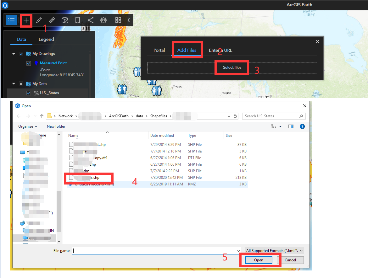
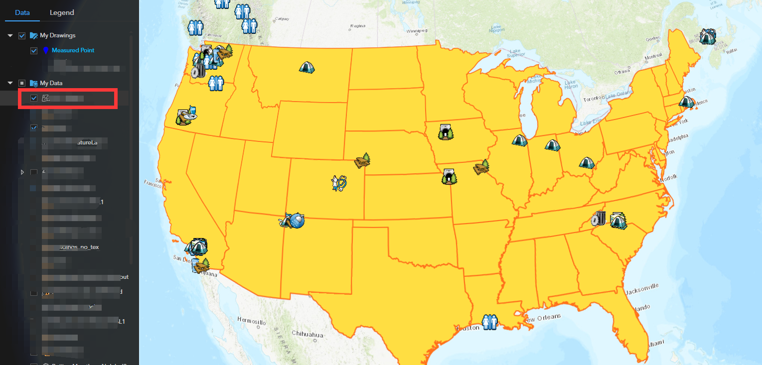
And then you can see the data. Also, tap the data and you will see the attributes of it.
Please feel free to let me know if you have any other questions. And you can send an email to ArcGISEarth_Feedback <[email protected]> to consult more.
Best,
Yujing