- Home
- :
- All Communities
- :
- Products
- :
- ArcGIS Reality
- :
- ArcGIS Drone2Map
- :
- ArcGIS Drone2Map Questions
- :
- Drone2map flight path change
- Subscribe to RSS Feed
- Mark Topic as New
- Mark Topic as Read
- Float this Topic for Current User
- Bookmark
- Subscribe
- Mute
- Printer Friendly Page
Drone2map flight path change
- Mark as New
- Bookmark
- Subscribe
- Mute
- Subscribe to RSS Feed
- Permalink
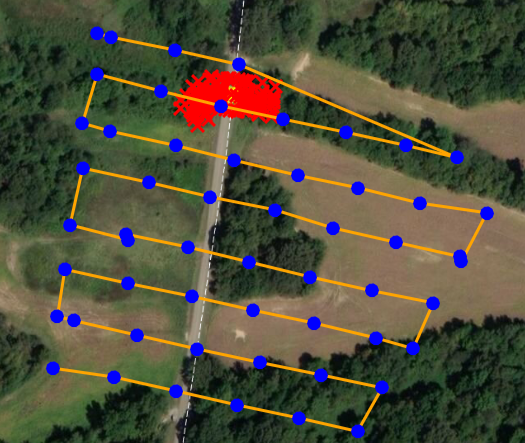
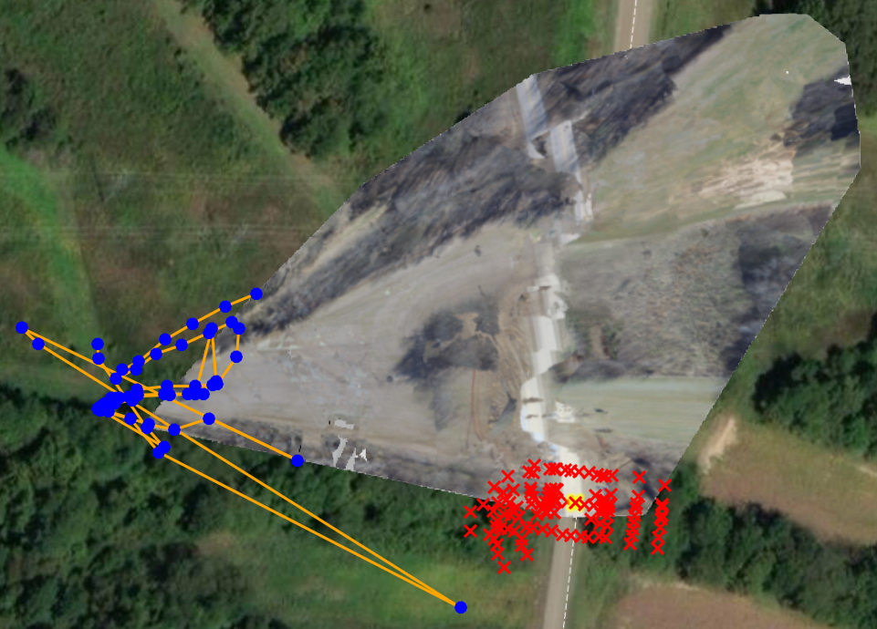
I have a small area that I'm trying to create 2D products for. My flight path is an aerial grid and I have 55 images.I added surveyed GCPs and linked 3 of the GCPs to ~14 images each. My overlap was 80% at 350 feet. I looked at the images before loading them into the project and they look good. When I start the project, everything looks fine, but after processing it's a mess. The grid flight path changes to a tangled mess and the orthomosaic image is also a jumbled mess. I am not sure what I am doing wrong, as I have followed the same workflow that I have in the past with success. I am attaching some before and after pictures. Please let me know if you have any idea as to why my output looks like this.
- Mark as New
- Bookmark
- Subscribe
- Mute
- Subscribe to RSS Feed
- Permalink
Michael
please look at your Z values, and verify if the images have good height values representing height above sea level (not height above ground).
If these images are from a DJI drone, especially a Mavic, please adjust the Z values before processing. I have seen problems with attempting to fix the Z values after an initial process has been run; Bad Z values will generate an erroneous focal length, so you may need to start a new project.
(Don't worry about having to re-measure all of your control points - you can *export* the control points from your existing project, and import them into the new project)
If you need more detail, let us know
Cody B.