- Home
- :
- All Communities
- :
- User Groups
- :
- ArcGIS Desktop Installation Support
- :
- Questions
- :
- ArcGIS 10.7.1 Custom Transformation Problem - Erro...
- Subscribe to RSS Feed
- Mark Topic as New
- Mark Topic as Read
- Float this Topic for Current User
- Bookmark
- Subscribe
- Mute
- Printer Friendly Page
ArcGIS 10.7.1 Custom Transformation Problem - Error 000365
- Mark as New
- Bookmark
- Subscribe
- Mute
- Subscribe to RSS Feed
- Permalink
I am using ArcGIS Desktop 10.7.1 and am encountering problems when I attempt to use custom geographic transformations.
I have a set of custom geographic transformation files (.gtf) which previously worked under ArcGIS 10.3.1. These .gtf files were located under C:\Users\<username>\AppData\Roaming\ESRI\Desktop10.3\ArcToolbox\CustomTransformations.
I migrated the same files to C:\Users\<username>\AppData\Roaming\ESRI\Desktop10.7\ArcToolbox\CustomTransformations.
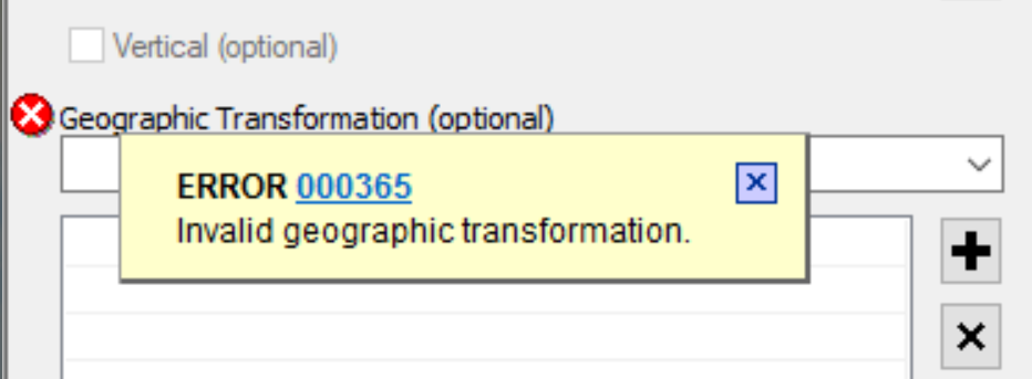
Whilst the transformations appear in the relevant dropdown list in the 'Project' geoprocessing tool, when I go to select a custom transformation I receive the following error:

I thought maybe the way 10.7.1 constructs the .gtf file might be different, so I constructed a new custom transformation within 10.7.1 from scratch, but alas I still have the same difficulties.
Is this a known bug in 10.7.1, or am I doing something wrong?
- Mark as New
- Bookmark
- Subscribe
- Mute
- Subscribe to RSS Feed
- Permalink
For anyone wondering, it seems 10.7 creates the .gtf file in a slightly different way to how it did in 10.3.
The order of input and output GEOGCS is inverted in 10.7.
E.g. in the .gtf file...
10.3:
Output GCS is listed first
Input GCS is listed second
10.7
Input GCS is listed first
Output GCS is listed second