- Home
- :
- All Communities
- :
- Products
- :
- ArcGIS Collector
- :
- ArcGIS Collector Questions
- :
- Has anyone used a Leica GS15 receiver with Collect...
- Subscribe to RSS Feed
- Mark Topic as New
- Mark Topic as Read
- Float this Topic for Current User
- Bookmark
- Subscribe
- Mute
- Printer Friendly Page
Has anyone used a Leica GS15 receiver with Collector?
- Mark as New
- Bookmark
- Subscribe
- Mute
- Subscribe to RSS Feed
- Permalink
I'm using an Android smartphone for Collector (Samsung Galaxy S5). The phone pairs via bluetooth just fine with my receiver but Collector is still showing my location to be about 15 feet off from where it is. Yes, I told Collector to use the receiver and not the internal/phone location GPS chip. TIA
- Mark as New
- Bookmark
- Subscribe
- Mute
- Subscribe to RSS Feed
- Permalink
Hi Alice. Are you using the same login credentials for your RTK reference network on both the receiver and the NTRIP app?
When I had the same issue as you, I had to get separate login credentials. One login for my GS15 receiver and another login for the NTRIP app.
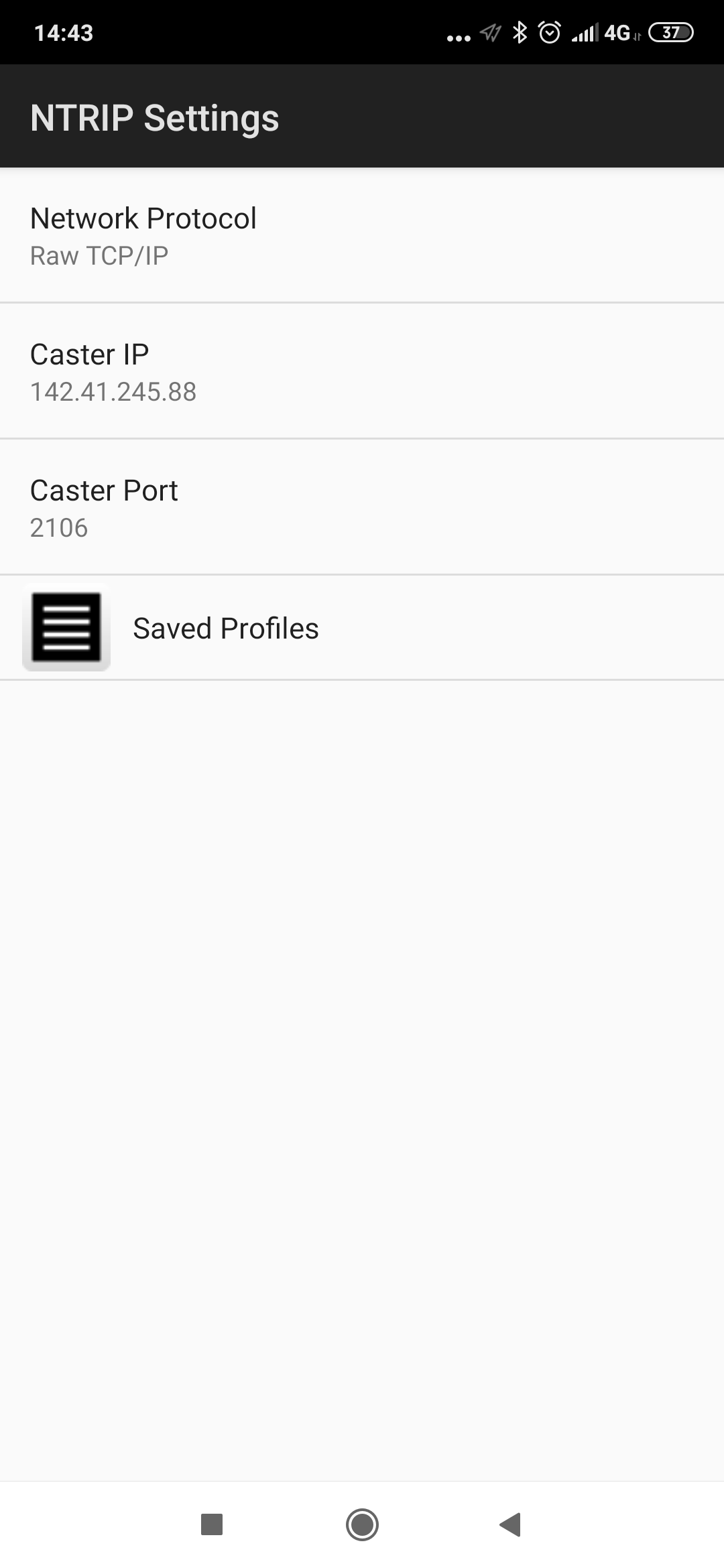
I’ve also included screenshots of my settings here for you. Hope this helps!
MTorres
- Mark as New
- Bookmark
- Subscribe
- Mute
- Subscribe to RSS Feed
- Permalink
Hi again!
Thank You for the prompt response and for the screenshots!
I thought the GS Receiver was getting its RTK reference from the Bluetooth connection with the smartphone/tablet but I am understanding is that it is not since you are using another login credential.
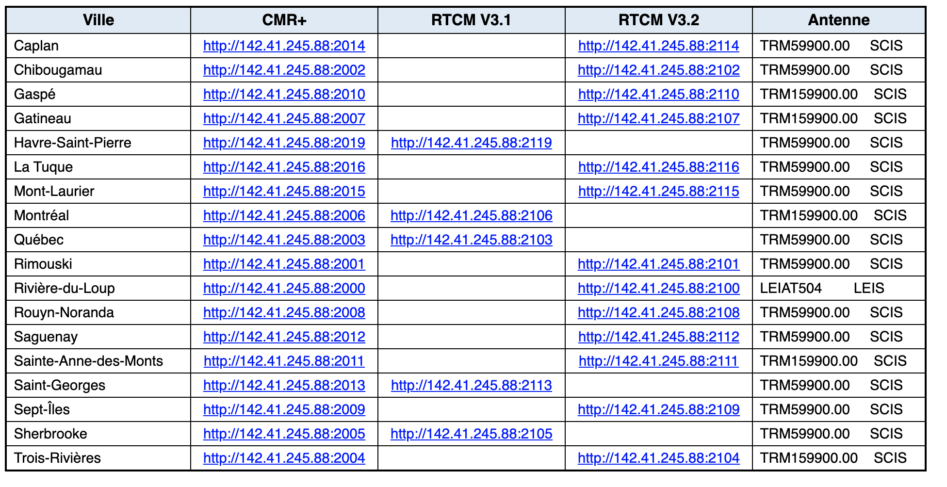
When I tested the connection, I used a Raw TCP/IP connection so I had no login credentials. I used the reference table below for the IP adresses/ports and selected the Data Stream format accordingly.
I will try using different login credentials to see if it fixes my issue. Thanks!


- Mark as New
- Bookmark
- Subscribe
- Mute
- Subscribe to RSS Feed
- Permalink
You're welcome Alice Breault-Germain. I used RTCM3_MAX for the Data Stream, but that may be my local setting. How did it work out for you using the two separate logins?
~MTorres
- Mark as New
- Bookmark
- Subscribe
- Mute
- Subscribe to RSS Feed
- Permalink
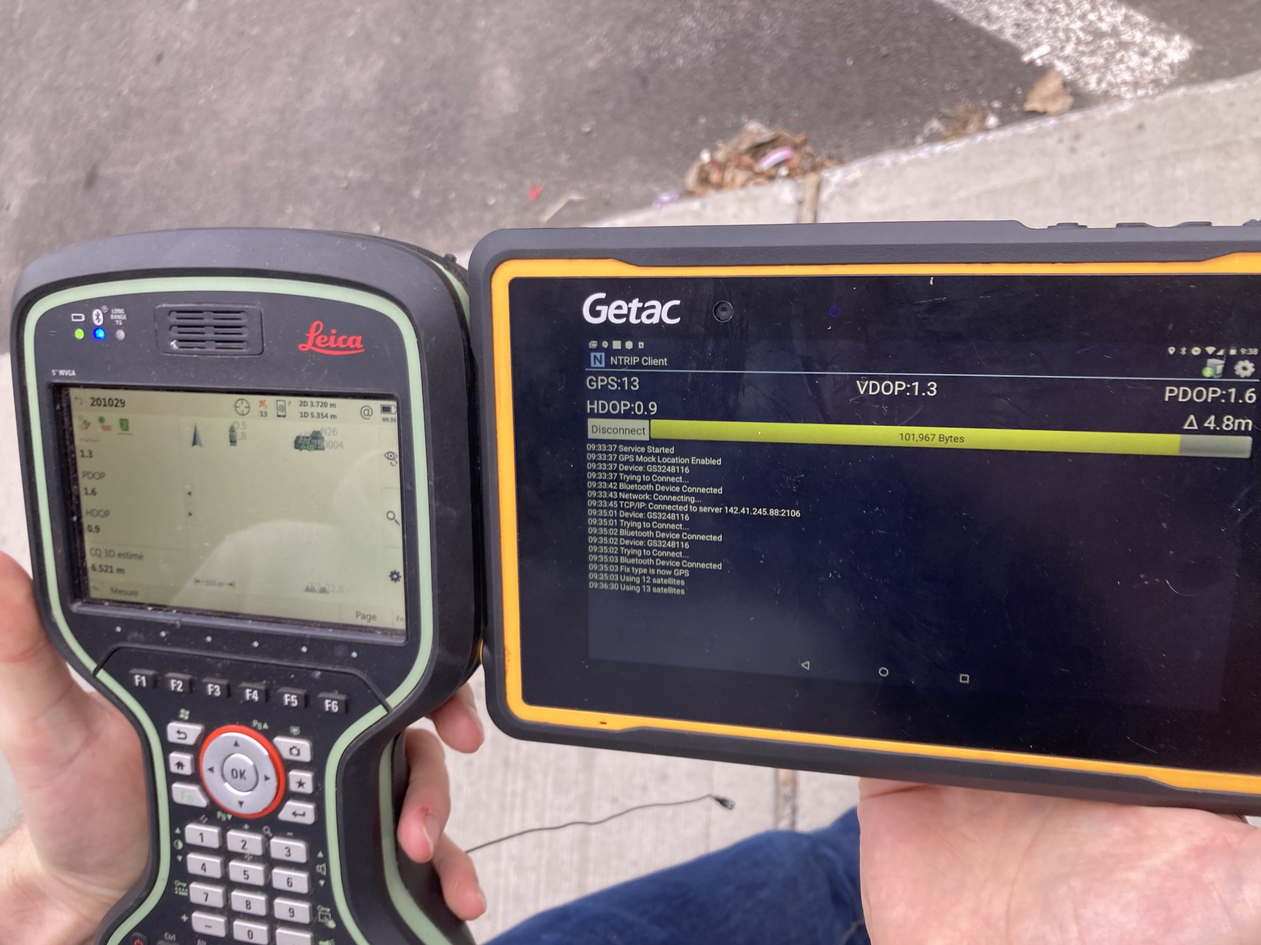
M Torres Good news! I am now receiving NMEA sentences when using a Raw TCP/IP connection for both the receiver and the NTRIP app. I can validate that the information on NTrip Client App by Lefebure is correct because I see the same data on the collector and the tablet (see attachment).

My goal is to collect high accuracy point with either ArcGIS Collector or Survey123 so I enabled 'Mock Up Locations' on my Android tablet so that the NTrip Client data can be used by those apps. However, I can not seem to access all the data from the NMEA sentences (vdop, pdop, hdop, etc).

Did you also face this issue?
- Mark as New
- Bookmark
- Subscribe
- Mute
- Subscribe to RSS Feed
- Permalink
Did you make sure you set up a location profile for the unit in your profile in Collector? This is a setting above where you select an external GNSS Unit. This is an important step so that the transformation from the NMEA stream translates your position into WGS84 web Mercator which is what the Esri basemaps use. It sounds like this may be what you are experiencing. Just something to be aware of.
- « Previous
-
- 1
- 2
- Next »
- « Previous
-
- 1
- 2
- Next »