Turn on suggestions
Auto-suggest helps you quickly narrow down your search results by suggesting possible matches as you type.
Cancel
- Home
- :
- All Communities
- :
- Products
- :
- ArcGIS CityEngine
- :
- ArcGIS CityEngine Questions
- :
- Sharing LIDAR Data in CityEngine
Options
- Subscribe to RSS Feed
- Mark Topic as New
- Mark Topic as Read
- Float this Topic for Current User
- Bookmark
- Subscribe
- Mute
- Printer Friendly Page
Sharing LIDAR Data in CityEngine
Subscribe
4535
2
12-20-2013 03:56 AM
12-20-2013
03:56 AM
- Mark as New
- Bookmark
- Subscribe
- Mute
- Subscribe to RSS Feed
- Permalink
Hi,
I'm wondering, Is anyone has tried to open or share LIDAR data using CityEngine?
I have tried lots of way but I couldn't succeed yet.
LAS Dataset converts to Multipoint but CityEngine can not import Multipoint Data.
I tried to convert from LAS Dataset to GDB, MDB, SHP but unfortunately I could not import Lidar points in CityEngine.
Multipoint feature class has a BLOB values like INTENSITY or COLOR fields.
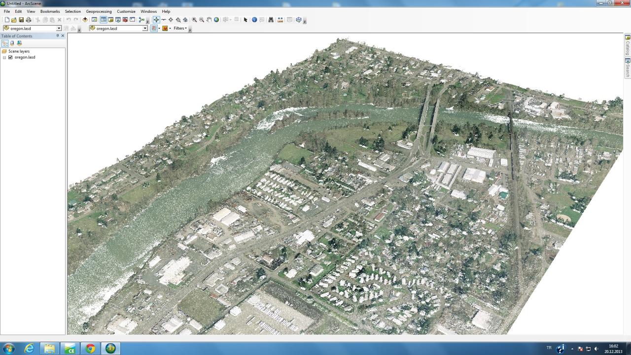
I want to publish lidar points with color values like this;
[ATTACH=CONFIG]30032[/ATTACH]
Is there any idea for this?
Thanks,
Güçlü
I'm wondering, Is anyone has tried to open or share LIDAR data using CityEngine?
I have tried lots of way but I couldn't succeed yet.
LAS Dataset converts to Multipoint but CityEngine can not import Multipoint Data.
I tried to convert from LAS Dataset to GDB, MDB, SHP but unfortunately I could not import Lidar points in CityEngine.
Multipoint feature class has a BLOB values like INTENSITY or COLOR fields.
I want to publish lidar points with color values like this;
[ATTACH=CONFIG]30032[/ATTACH]
Is there any idea for this?
Thanks,
Güçlü
2 Replies
01-03-2014
03:05 AM
- Mark as New
- Bookmark
- Subscribe
- Mute
- Subscribe to RSS Feed
- Permalink
Hi !
CityEngine does not support LIDAR data or pointcloud data in general.
What CE does when it gets point features, it converts them to little shapes, ready for use in CGA.
What you then can do is write a small CGA rule that e.g. inserts little cubes or spheres at these places and colorizes them. But the polycount will exlode with many points, so that's a no-go, especially for WebScenes.
matt
02-19-2014
12:44 AM
- Mark as New
- Bookmark
- Subscribe
- Mute
- Subscribe to RSS Feed
- Permalink
Like Matt wrote above, City Engine does not support LAS-Datasets or Point Clouds. A workaround to use LIDAR-Data as a terrain in City Engine could be to convert the LAS-Datesets to Raster and then import it in City Engine (Drag and drop from he Project-Folder to the Viewport). If you are using ArcGIS a usefull tool ist hat one: http://resources.arcgis.com/en/help/main/10.1/index.html#//001200000052000000
Good luck!
Sebastian
Good luck!
Sebastian