- Home
- :
- All Communities
- :
- Products
- :
- ArcGIS CityEngine
- :
- ArcGIS CityEngine Questions
- :
- Drone2Map and City Engine
- Subscribe to RSS Feed
- Mark Topic as New
- Mark Topic as Read
- Float this Topic for Current User
- Bookmark
- Subscribe
- Mute
- Printer Friendly Page
Drone2Map and City Engine
- Mark as New
- Bookmark
- Subscribe
- Mute
- Subscribe to RSS Feed
- Permalink
I have some imagery created in Drone2Map. Can I use those images in CityEngine? If so, how?
- Mark as New
- Bookmark
- Subscribe
- Mute
- Subscribe to RSS Feed
- Permalink
Hello April,
You have created a DSM with Drone2Map.
CityEngine does support import of image based terrain data.
Please follow the steps to create a Terrain Layer in CityEngine Help.
If you want to add 3D data from Drone2Map,
I suggest georeferencing the drone2map OBJs or FBXes in CityEngine.
1. use your DSM or "File > Get Map Data..." to download the surveyed area
2. import the drone2map export as static model (drag file into scene)
3. use the translation tool to fit the model into the map
CityEngine does not support import of SLPKs.
- Mark as New
- Bookmark
- Subscribe
- Mute
- Subscribe to RSS Feed
- Permalink
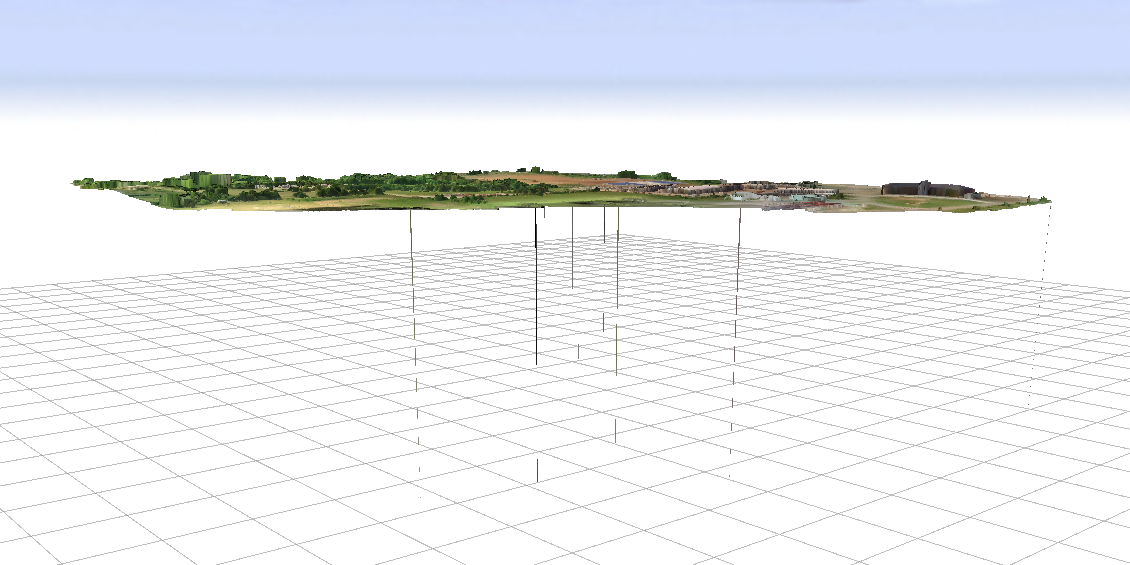
I have been able to get the two imported into CityEngine, but the Terrain and Texture keep appearing way above the grid in CityEngine. How do I move everything down to match?
- Mark as New
- Bookmark
- Subscribe
- Mute
- Subscribe to RSS Feed
- Permalink
The grid is at height 0, so if your terrain is higher, it's normal to be "up there". As for the streaks, turn off smoothing, somewhere in the image options.
- Mark as New
- Bookmark
- Subscribe
- Mute
- Subscribe to RSS Feed
- Permalink
Maybe LR is referring to turning off Value filtering in the Inspector as in these other posts:
Remove border issues on terrain
Value filtering is briefly described on this help page (in the table near the bottom):
Here is the description from the page:
The filtering applied to terrain height and sampling. Choice of either none (pixelated), or smooth (linear) filtering.