- Home
- :
- All Communities
- :
- Products
- :
- ArcGIS CityEngine
- :
- ArcGIS CityEngine Questions
- :
- Drawing a graph layer automatically raises terrain...
- Subscribe to RSS Feed
- Mark Topic as New
- Mark Topic as Read
- Float this Topic for Current User
- Bookmark
- Subscribe
- Mute
- Printer Friendly Page
Drawing a graph layer automatically raises terrain?
- Mark as New
- Bookmark
- Subscribe
- Mute
- Subscribe to RSS Feed
- Permalink
Hi folks,
I am trying to create a railroad graph layer and got the rail rule to work, however I am noticing that where the line crosses a bridge, it raises the DEM / terrain to the level of the railroad track.
Before:
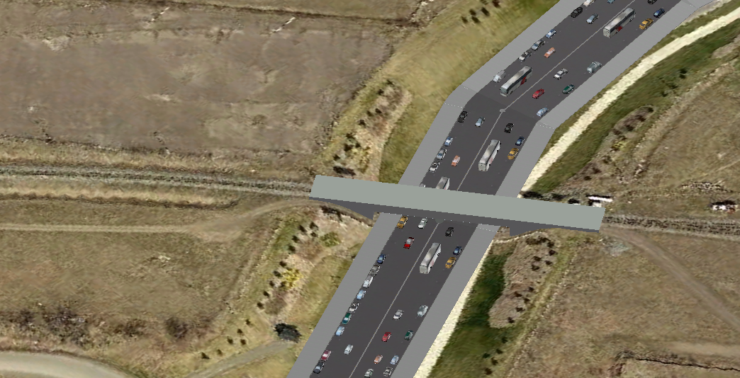
After:

Any way to easily disable this? I want the track to be elevated and go voer teh bridge, however I want the terrain to remain where it is...
Solved! Go to Solution.
Accepted Solutions
- Mark as New
- Bookmark
- Subscribe
- Mute
- Subscribe to RSS Feed
- Permalink
Hi André,
Thank you for this qestion.
In default graph drawing mode, one wants the terrain be smothed to align to the network graph.
But you are using a premodeled bridge as a base for the graph. This means the feature has to be deactivated.
Settings for new streets can be controlled by using the Street Creation Settings dialog.
To open the dialog, choose Graph → Street Creation Settings... from the main menu.
There you have to uncheck the "Align terrain" option.

For more details please refer the CityEngine Help on that topic:
Creating and Editing Street Networks Manually
Best regards
- Mark as New
- Bookmark
- Subscribe
- Mute
- Subscribe to RSS Feed
- Permalink
Hi André,
Thank you for this qestion.
In default graph drawing mode, one wants the terrain be smothed to align to the network graph.
But you are using a premodeled bridge as a base for the graph. This means the feature has to be deactivated.
Settings for new streets can be controlled by using the Street Creation Settings dialog.
To open the dialog, choose Graph → Street Creation Settings... from the main menu.
There you have to uncheck the "Align terrain" option.
For more details please refer the CityEngine Help on that topic:
Creating and Editing Street Networks Manually
Best regards
- Mark as New
- Bookmark
- Subscribe
- Mute
- Subscribe to RSS Feed
- Permalink
Thank you so much for your help! Much appreciated. If I run into other challenges modelling our downtown, I'll be sure to post questions to GeoNet for otehrs to refer to.