Turn on suggestions
Auto-suggest helps you quickly narrow down your search results by suggesting possible matches as you type.
Cancel
- Home
- :
- All Communities
- :
- Products
- :
- ArcGIS Aviation
- :
- ArcGIS Aviation Videos
- :
- Re: OIS Tools & Analysis (eTOD)
Options
- Subscribe to RSS Feed
- Mark Topic as New
- Mark Topic as Read
- Float this Topic for Current User
- Bookmark
- Subscribe
- Mute
- Printer Friendly Page
OIS Tools & Analysis (eTOD)
Subscribe
9569
1
12-14-2015 10:53 AM
12-14-2015
10:53 AM
- Mark as New
- Bookmark
- Subscribe
- Mute
- Subscribe to RSS Feed
- Permalink
Thank you for viewing this informational video about the Obstruction Identification Surface (OIS) functionality within Esri's ArcGIS for Aviation. This video is intended to provide a functional overview of the tools within ArcGIS for Aviation including examples using detailed step by step instructions.
If you have any further questions about Esri's ArcGIS for Aviation, please email us at [email protected].
1 Reply
12-16-2015
01:24 AM
- Mark as New
- Bookmark
- Subscribe
- Mute
- Subscribe to RSS Feed
- Permalink
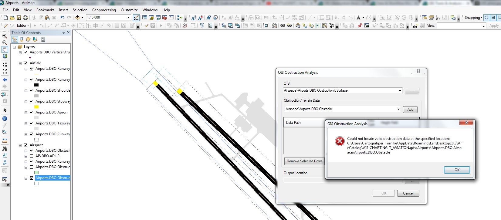
Thanks for video.
I have a problem when i use OIS Obstruction Analysis tool.
Can you tell me what's mean "valid obstruction data"?