- Home
- :
- All Communities
- :
- Products
- :
- ArcGIS AppStudio
- :
- ArcGIS AppStudio Questions
- :
- Sharing a WebMap as Public to access in AppStudio ...
- Subscribe to RSS Feed
- Mark Topic as New
- Mark Topic as Read
- Float this Topic for Current User
- Bookmark
- Subscribe
- Mute
- Printer Friendly Page
Sharing a WebMap as Public to access in AppStudio MapViewer template.
- Mark as New
- Bookmark
- Subscribe
- Mute
- Subscribe to RSS Feed
- Permalink
Hi,
I am trying to create an App from AppStudio using the Web Templates from AppStudio.arcgis.com
I started with the Mapviewer sample.
I selected required images in the AppInfo Settings
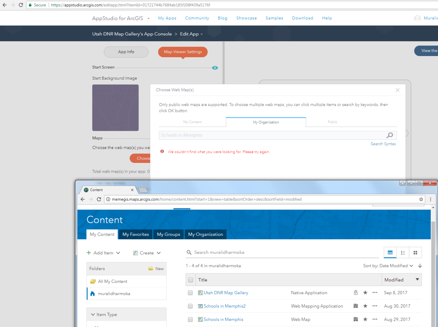
Then in MapViewer I try to select (Choose Web Maps(s) ) and in the Choose Web Map(s) tab,
I don't see the Web Map which I shared as Organization. if I share it as Public then only they are visible.
Also I see a message that I have to share it as Public. It is confusing because, I logged in with my portal account and then there is MyOrganization tab. Still it has to be shared as public? confused
Solved! Go to Solution.
Accepted Solutions
- Mark as New
- Bookmark
- Subscribe
- Mute
- Subscribe to RSS Feed
- Permalink
Please allow me to help you understand this
1) Only public webmaps are supported for MapViewer at this point (although this might change in the near future) which means the webmap has to be public
2) The three columns basically act as a filter for choosing webmap and they should be read as below
- My Content - Webmaps created or added by you to your org account but must be shared publically
-My Org- Webmaps created or added by other users in your org but must be shared publically
- Public - This is self explanatory, which means created by others and shared publically outside your org.
I hope this helps.
Nakul
- Mark as New
- Bookmark
- Subscribe
- Mute
- Subscribe to RSS Feed
- Permalink
Thanks Nakul.