- Home
- :
- All Communities
- :
- Developers
- :
- JavaScript Maps SDK
- :
- JavaScript Maps SDK Questions
- :
- Re: How to drop a pin from variables in JavaScript
- Subscribe to RSS Feed
- Mark Topic as New
- Mark Topic as Read
- Float this Topic for Current User
- Bookmark
- Subscribe
- Mute
- Printer Friendly Page
How to drop a pin from variables in JavaScript
- Mark as New
- Bookmark
- Subscribe
- Mute
- Subscribe to RSS Feed
- Permalink
Hi All
I want to drop a pin using data that is saved on to JavaScript Variables, x and y. How can I do that. Below is the code to drop a pin and get coordinates, is there a way I can change it so that I drop the pin using data that is saved on variables?
<!DOCTYPE html>
<html>
<head>
<meta charset="utf-8" />
<meta
name="viewport"
content="initial-scale=1,maximum-scale=1,user-scalable=no"
/>
<title>DEA GIS APPLICATION</title>
<link
rel="stylesheet"
href="https://js.arcgis.com/4.12/esri/themes/light/main.css"
/>
<script src="https://js.arcgis.com/4.12/"></script>
<style>
html,
body,
#viewDiv {
padding: 0;
margin: 0;
height: 100%;
width: 100%;
}
.esri-sketch__section.esri-sketch__tool-section:last-of-type {
display:none;
}
.esri-sketch__section.esri-sketch__tool-section:nth-child(2) {
border-right: none;
}
</style>
<script>
require([
"esri/widgets/Sketch",
"esri/Map",
"esri/layers/GraphicsLayer",
"esri/views/MapView"
], function(Sketch, Map, GraphicsLayer, MapView) {
const layer = new GraphicsLayer();
const map = new Map({
basemap: "streets",
layers: [layer]
});
const view = new MapView({
container: "viewDiv",
map: map,
zoom: 5,
center: [90, 45]
});
var symbol = {
type: "simple-marker", // autocasts as new SimpleMarkerSymbol()
style: "circle",
color: "blue",
size: "8px", // pixels
outline: { // autocasts as new SimpleLineSymbol()
color: [ 255, 255, 0 ],
width: 1 // points
}
};
const sketch = new Sketch({
layer: layer,
view: view,
symbol: symbol,
availableCreateTools: ["point"]
});
view.ui.add(sketch, "top-right");
sketch.on('create', function (evt) {
if (view.zoom >= 11) {
// check if the create event's state has changed to complete indicating
// the graphic create operation is completed.
let gra = evt.graphic.clone();
evt.graphic.layer.removeAll();
gra.symbol.color = "blue";
layer.add(gra);
console.log("X = ", gra.geometry.x);
console.log("Y = ", gra.geometry.y);
} else {
alert("please zoom in");
evt.graphic.layer.remove(evt.graphic);
}
});
});
</script>
</head>
<body>
<div id="viewDiv"></div>
</body>
</html>
Please assist.
Solved! Go to Solution.
Accepted Solutions
- Mark as New
- Bookmark
- Subscribe
- Mute
- Subscribe to RSS Feed
- Permalink
Hi Siyabonga Kubeka,
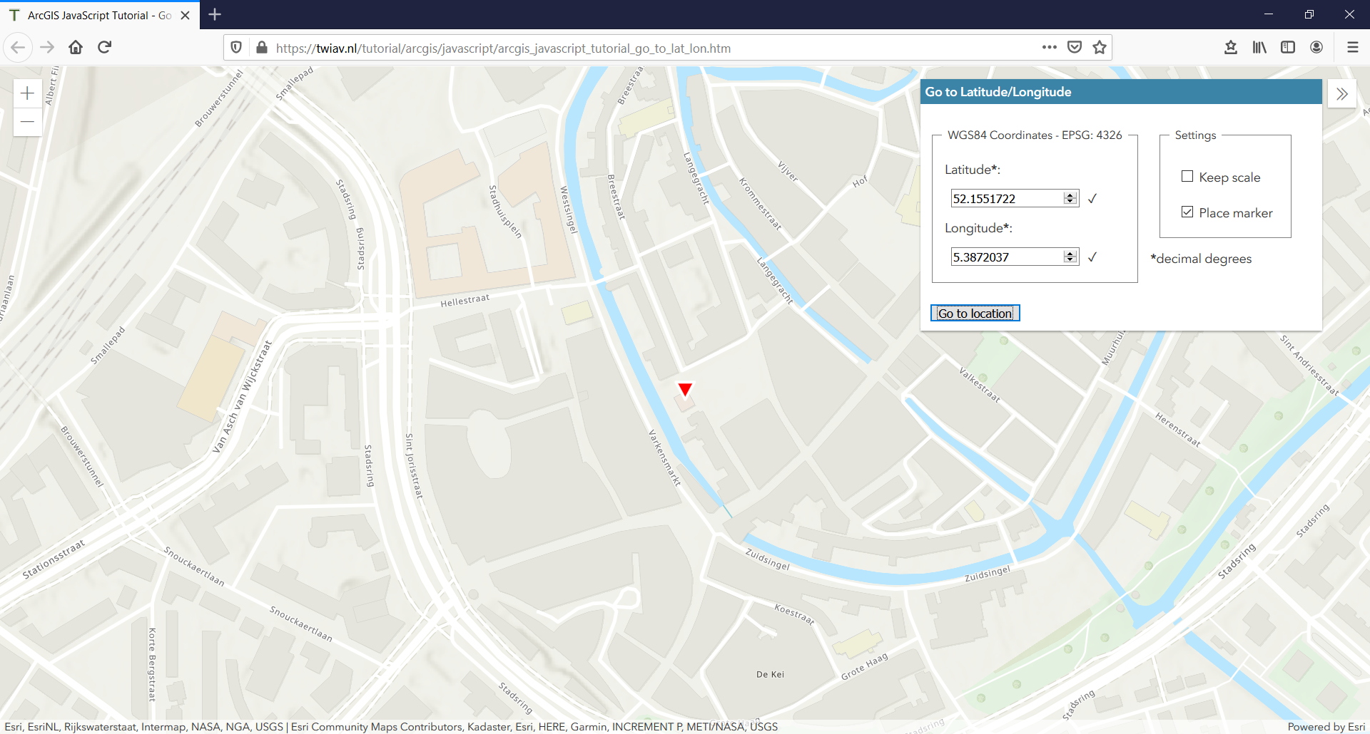
Recently, I did create a little app - with the ArcGIS API for JavaScript 4.x - with a custom tool to enter WGS84 Coordinates to zoom to a certain point, see screen capture attached.
These entries are used to create a new Graphic that is added to the MapView.
You can find (the source code of) the app here:
ArcGIS JavaScript Tutorial - Go to Latitude/Longitude
Is this useful to you?
Cheers,
Egge-Jan
- Mark as New
- Bookmark
- Subscribe
- Mute
- Subscribe to RSS Feed
- Permalink
Hi Siyabonga Kubeka,
Recently, I did create a little app - with the ArcGIS API for JavaScript 4.x - with a custom tool to enter WGS84 Coordinates to zoom to a certain point, see screen capture attached.
These entries are used to create a new Graphic that is added to the MapView.
You can find (the source code of) the app here:
ArcGIS JavaScript Tutorial - Go to Latitude/Longitude
Is this useful to you?
Cheers,
Egge-Jan
- Mark as New
- Bookmark
- Subscribe
- Mute
- Subscribe to RSS Feed
- Permalink
Hi Egge-Jan Polle
Thank you very much, let me try that.
- Mark as New
- Bookmark
- Subscribe
- Mute
- Subscribe to RSS Feed
- Permalink
Hi Egge-Jan Polle
Can I please the .htm file? Please email to siyakubeka@live.com
- Mark as New
- Bookmark
- Subscribe
- Mute
- Subscribe to RSS Feed
- Permalink
Hi Siyabonga Kubeka,
Yes, of course! You can view the source in your browser, and copy the full .htm file from there.
You can access the source - both in Firefox and Google Chrome - by hitting Ctrl+U with the page open --> the source will then be opened in a separate window.
Did you know this trick already?
Cheers,
Egge-Jan