- Home
- :
- All Communities
- :
- Industries
- :
- Natural Resources
- :
- Agriculture
- :
- Agriculture Questions
- :
- Re: Finding the amount of agriculture within 5km o...
- Subscribe to RSS Feed
- Mark Topic as New
- Mark Topic as Read
- Float this Topic for Current User
- Bookmark
- Subscribe
- Mute
- Printer Friendly Page
Finding the amount of agriculture within 5km of point
- Mark as New
- Bookmark
- Subscribe
- Mute
- Subscribe to RSS Feed
- Permalink
- Report Inappropriate Content
GOAL: I want to find out how much land is agricultural/forest/urban/water/sand within 5km of a point.
WORKFLOW: (SEE IMAGE ATTACHED)
- Download a satellite image from landsat8
- use image classification, maximum likelihood classification
- Now that I have classified what in the image is water, sand, forest, urban, and forest I created a point by creating a shape file and starting an edit session, during which I created the point.
- create a 5km buffer from the point i created, using the buffer tool
- I'M NOT SURE WHAT TO DO FROM HERE ON OUT.
- I tried using the intersect tool but the only input features are the point and buffer features, not MLCLASS_All_6 (which is what contains the data on agricultural/forest/urban/water/sand)
- I tried "extract by circle" to isolate the 5km area around the point but I don't know the X,Y coordinate of the point.
- I also tried entering another editing session in "MLClass_All_6" and creating a cricle that way but that didn't work either.
Any recommendations?
- Mark as New
- Bookmark
- Subscribe
- Mute
- Subscribe to RSS Feed
- Permalink
- Report Inappropriate Content
Hello Joel,
You can figure out the XY coordinates of the point in question by right clicking the point then hitting Identify. This will give you the coordinates of the point in whatever units were specified for the map. You can then enter these coordinates in the Extract by Circle tool to achieve the desired result.
Let me know how this goes for you,
Lukas
- Mark as New
- Bookmark
- Subscribe
- Mute
- Subscribe to RSS Feed
- Permalink
- Report Inappropriate Content
Thank you for showing me how to find the X,Y coordinates. I just tried the extract by circle tool - input raster "MLClass_All_6" and the X,Y coordinate of the point, and the radius as 5000, and I kept the extraction area inside. I ran the tool, and it runs successfully - but nothing shows up.
- Mark as New
- Bookmark
- Subscribe
- Mute
- Subscribe to RSS Feed
- Permalink
- Report Inappropriate Content
Hello Joel,
I tried using that tool just now and the output generated was empty as well. Not sure what's going on with that. I did however find an alternative method for achieving the desired result. Try utilizing the Clip (Data Management) tool. Simply input the raster, specify that 5km buffer as the Output Extent, and be sure to check the Use Input Features for Clipping Geometry option. Running this should produce the clipped layer you're looking for.
Cheers,
Lukas
- Mark as New
- Bookmark
- Subscribe
- Mute
- Subscribe to RSS Feed
- Permalink
- Report Inappropriate Content
It worked! Thank you!
- Mark as New
- Bookmark
- Subscribe
- Mute
- Subscribe to RSS Feed
- Permalink
- Report Inappropriate Content
One last issues to overcome! I need to calculate the area (in acres or some other form of area) of each category within the clip. I'm not sure how to convert the count in the attribute table (or if that is even what I should be doing) into area. I created a column for acres and when I right click it to use calculate geometry it is grayed out. 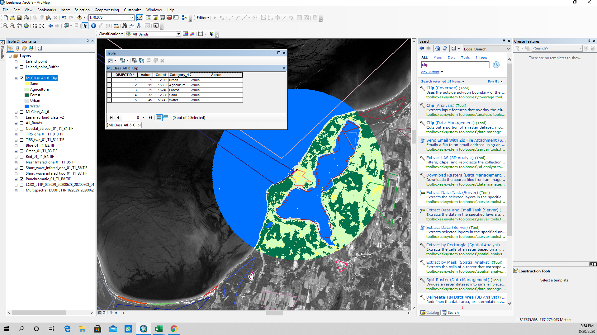
- Mark as New
- Bookmark
- Subscribe
- Mute
- Subscribe to RSS Feed
- Permalink
- Report Inappropriate Content
Never mind!! I figured it out! I just found the size of reach cell and multiplied that by the count and got meters squared. Then I converted meters squared into acres! Yes!