- Home
- :
- All Communities
- :
- Industries
- :
- Natural Resources
- :
- Agriculture
- :
- Agriculture Questions
- :
- Re: Attributing polygons based on the majority (ar...
- Subscribe to RSS Feed
- Mark Topic as New
- Mark Topic as Read
- Float this Topic for Current User
- Bookmark
- Subscribe
- Mute
- Printer Friendly Page
Attributing polygons based on the majority (area) class of smaller polygon within it
- Mark as New
- Bookmark
- Subscribe
- Mute
- Subscribe to RSS Feed
- Permalink
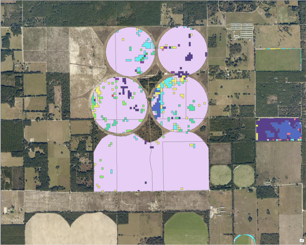
I have two shapefiles, one with unclassified polygons representing farms, and one with a smaller spatial scale that represents different crop types. I need to attribute the larger polygons based on the class within it with the greatest area.
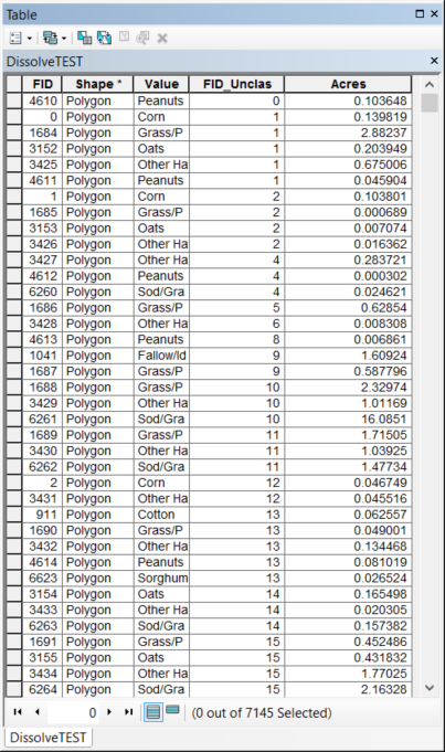
I've run an intersect between the two polygons and calculated the area of the resulting data. See below: FID_Unclass is an ID corresponding with every polygon I need classified. Acres is just that. I need to attribute each polygon represented in FID_Unclass with the crop type in "Value" based on the largest area
Any and all help is greatly appreciated!
Solved! Go to Solution.
Accepted Solutions
- Mark as New
- Bookmark
- Subscribe
- Mute
- Subscribe to RSS Feed
- Permalink
Can't you just summarize that table to get the max for the area field and the first in the Class field
- Mark as New
- Bookmark
- Subscribe
- Mute
- Subscribe to RSS Feed
- Permalink
Can't you just summarize that table to get the max for the area field and the first in the Class field
- Mark as New
- Bookmark
- Subscribe
- Mute
- Subscribe to RSS Feed
- Permalink
Awesome, worked perfectly. I knew it shouldn't be that hard, but I was getting stuck. Thanks a lot!