Turn on suggestions
Auto-suggest helps you quickly narrow down your search results by suggesting possible matches as you type.
Cancel
- Home
- :
- All Communities
- :
- Products
- :
- 3D
- :
- 3D Questions
- :
- LAS file into TIN failed
Options
- Subscribe to RSS Feed
- Mark Topic as New
- Mark Topic as Read
- Float this Topic for Current User
- Bookmark
- Subscribe
- Mute
- Printer Friendly Page
01-09-2016
10:45 AM
- Mark as New
- Bookmark
- Subscribe
- Mute
- Subscribe to RSS Feed
- Permalink
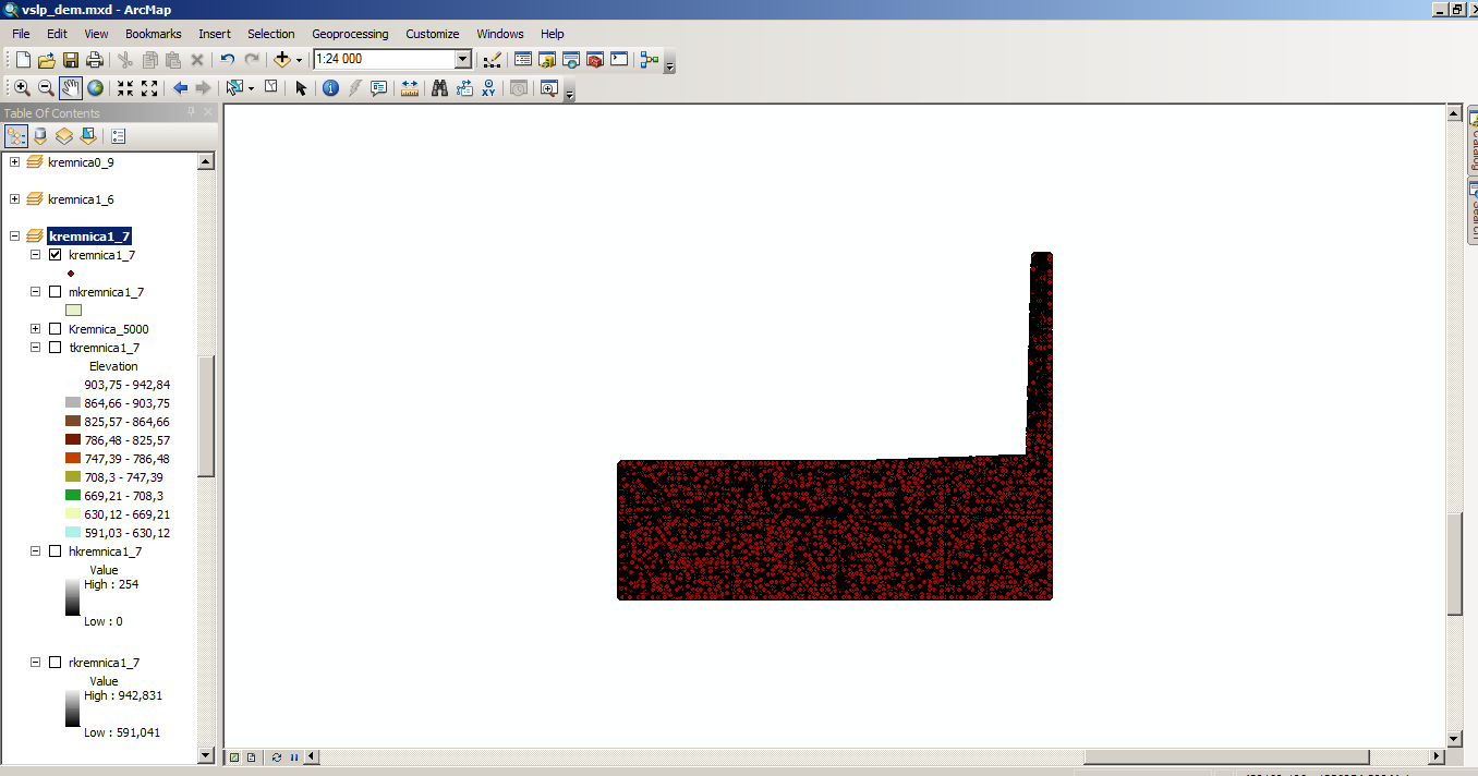
hello friends, i imported las file into arcgis - looks like this...

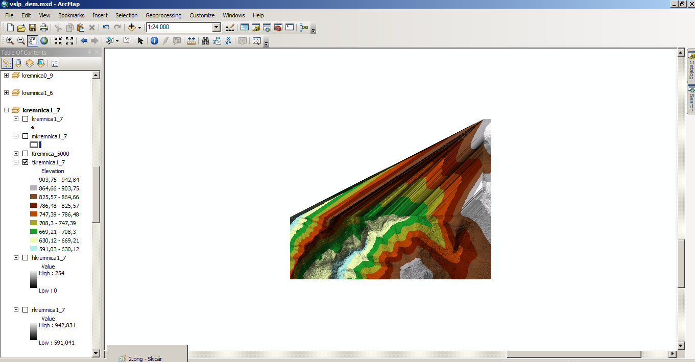
but when i used "create TIN" - it looks like this ..... 
can somebody help me with that please? ![]() thank you so much...
thank you so much... ![]()
Solved! Go to Solution.
1 Solution
Accepted Solutions
01-09-2016
11:17 AM
- Mark as New
- Bookmark
- Subscribe
- Mute
- Subscribe to RSS Feed
- Permalink
forgot about this one... Delineate TIN Data Area—Help | ArcGIS for Desktop
4 Replies
01-09-2016
10:53 AM
- Mark as New
- Bookmark
- Subscribe
- Mute
- Subscribe to RSS Feed
- Permalink
move to 3D this is the lounge GeoNet Community Structure and you will have a better chance in getting your question there
01-09-2016
10:57 AM
- Mark as New
- Bookmark
- Subscribe
- Mute
- Subscribe to RSS Feed
- Permalink
dump the points in the pointy section or window it, or mask it, otherwise the tin is the correct intpretation of the points LAS Dataset To TIN—Help | ArcGIS for Desktop
01-09-2016
11:17 AM
- Mark as New
- Bookmark
- Subscribe
- Mute
- Subscribe to RSS Feed
- Permalink
forgot about this one... Delineate TIN Data Area—Help | ArcGIS for Desktop
01-09-2016
11:57 AM
- Mark as New
- Bookmark
- Subscribe
- Mute
- Subscribe to RSS Feed
- Permalink
that´s wonderful! thank you so much ![]()
![]()