Turn on suggestions
Auto-suggest helps you quickly narrow down your search results by suggesting possible matches as you type.
Cancel
- Home
- :
- All Communities
- :
- Products
- :
- 3D
- :
- 3D Questions
- :
- Re: 'Extrude Between' tool?
Options
- Subscribe to RSS Feed
- Mark Topic as New
- Mark Topic as Read
- Float this Topic for Current User
- Bookmark
- Subscribe
- Mute
- Printer Friendly Page
01-24-2014
12:11 AM
- Mark as New
- Bookmark
- Subscribe
- Mute
- Subscribe to RSS Feed
- Permalink
I have a question regarding the 'Extrude Between' tool.
I have created a multipatch object showing a 3D layer of geology after working through one of ESRI's tutorials.
What I am wondering now is how you would go about calculating the volume of the multipatch that has been created so I can get some sort of measurment of the volume of material in the multipatch?
Thanks for any help
Solved! Go to Solution.
1 Solution
Accepted Solutions
02-03-2014
07:10 AM
- Mark as New
- Bookmark
- Subscribe
- Mute
- Subscribe to RSS Feed
- Permalink
Hi Mark,
It is possible that might cause an issue, but I'm not sure without seeing the data you're working with. The Enclose multipatch tool will use the lowest value z in the multipatch and then extrude the sides to that value so that could be the issue or the limitation with using it on your multipatch.
I would suggest to contact Esri Support and mention that you think you might be experiencing an issue related to Bug NIM-079796. Have the analyst take a look at the issue with the Tin and with it being extruded farther than you would expect as well. You may want to test creating a raster domain polygon of your DEM and then try using this as the input feature into the Extrude Between to see if you get the same non-closed results. It could be an issue with the input features used in the tool.
9 Replies
01-27-2014
07:02 AM
- Mark as New
- Bookmark
- Subscribe
- Mute
- Subscribe to RSS Feed
- Permalink
Hi Mark,
You could use the "Add Z information" tool or if you used the Extrude between tool this should have also given you the volume of the multipatch created within its attribute table using the same unit of measurement as x,y and z values.
Best Wishes,
You could use the "Add Z information" tool or if you used the Extrude between tool this should have also given you the volume of the multipatch created within its attribute table using the same unit of measurement as x,y and z values.
Best Wishes,
01-28-2014
12:17 AM
- Mark as New
- Bookmark
- Subscribe
- Mute
- Subscribe to RSS Feed
- Permalink
Hello Carrie. Thanks for getting back to me on this.
I created a multipatch after extruding between two TINs which I have converted from DEMS.
I just checked the attribute fields of the multipatch and I have the following fields:
OBJECTID_1 *
Shape *
OBJECTID
ID
gridcode
Shape_Leng
There's no volume attribute field unfortunately. Any idea why?
Thanks for you help! 🙂
01-28-2014
10:40 AM
- Mark as New
- Bookmark
- Subscribe
- Mute
- Subscribe to RSS Feed
- Permalink
Hi Mark,
What happens if you try using the "Add Z information" tool on your multipatch? Is the multipatch closed?
What happens if you try using the "Add Z information" tool on your multipatch? Is the multipatch closed?
01-29-2014
04:02 AM
- Mark as New
- Bookmark
- Subscribe
- Mute
- Subscribe to RSS Feed
- Permalink
Thanks Carrie. I've used the 'Add Z Information' tool on the multipatch.
I get results for:
Z_MIN
Z_MAX
Z_MEAN
SAREA
But get the following results for the other attribute fields
Volume = 0
Min_Slope = 0
Max_Slope = <Null>
Avg_Slope = <Null>
I get results for:
Z_MIN
Z_MAX
Z_MEAN
SAREA
But get the following results for the other attribute fields
Volume = 0
Min_Slope = 0
Max_Slope = <Null>
Avg_Slope = <Null>
01-29-2014
07:56 AM
- Mark as New
- Bookmark
- Subscribe
- Mute
- Subscribe to RSS Feed
- Permalink
Hi Mark,
Seems that the multipatch is not closed. Therefore it can't support a volume. You may be experiencing this bug, although this NIM does not occur in all cases. Would you share the link of the tutorial you are working with?
Bug NIM-079796
http://support.esri.com/en/bugs/nimbus/TklNMDc5Nzk2
There is a tool in the 3D toolbox that you can use to check if the multipatch is closed and a tool that will close a multipatch by extruding the sides down. You can also find the volume between two terrains or tins using the Surface Volume tool in the 3D Analyst toolbox.
Is Closed 3D tool documentation
http://resources.arcgis.com/en/help/main/10.2/index.html#//00q90000006p000000
Enclose Multipatch documentation
http://resources.arcgis.com/en/help/main/10.2/index.html#//00q9000000mn000000
01-30-2014
04:20 AM
- Mark as New
- Bookmark
- Subscribe
- Mute
- Subscribe to RSS Feed
- Permalink
Hello Carrie,
I've used the information from the ESRI 'Creating 3D Data Using ArcGIS' tutorial.
I followed this tutorial through then repeated it using my own data.
I used the 'Is Closed 3D' tool and you are right the multipatch was not closed.
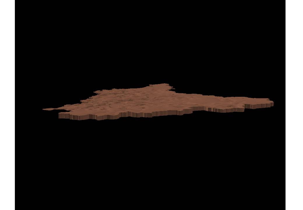
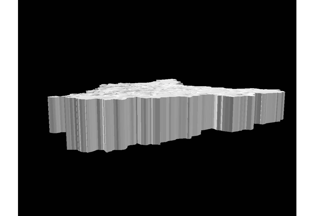
I then used the 'Enclose Multipatch' tool but something seems to have gone wrong somewhere!
The enclosed multipatch is several times deeper than my original multipatch.
I'm attached some images so you can see what i mean.
I've used the information from the ESRI 'Creating 3D Data Using ArcGIS' tutorial.
I followed this tutorial through then repeated it using my own data.
I used the 'Is Closed 3D' tool and you are right the multipatch was not closed.
I then used the 'Enclose Multipatch' tool but something seems to have gone wrong somewhere!
The enclosed multipatch is several times deeper than my original multipatch.
I'm attached some images so you can see what i mean.
01-31-2014
01:32 AM
- Mark as New
- Bookmark
- Subscribe
- Mute
- Subscribe to RSS Feed
- Permalink
Hello Carrie. I think I've figured out what the issue might be but I'd like to verfiy with you first.
One of the TINs used to create a multipatch is from a DEM.
The other TIN is a surface created using interpolation to map depths of soil from survey points.
What I have noticed is because part of the TIN is on a hill the soil depth layer actually extends out beyound part of the hill to there is some cross over between the TINs.
I'm thinking it might be this crossover that is causing the issue?
02-03-2014
07:10 AM
- Mark as New
- Bookmark
- Subscribe
- Mute
- Subscribe to RSS Feed
- Permalink
Hi Mark,
It is possible that might cause an issue, but I'm not sure without seeing the data you're working with. The Enclose multipatch tool will use the lowest value z in the multipatch and then extrude the sides to that value so that could be the issue or the limitation with using it on your multipatch.
I would suggest to contact Esri Support and mention that you think you might be experiencing an issue related to Bug NIM-079796. Have the analyst take a look at the issue with the Tin and with it being extruded farther than you would expect as well. You may want to test creating a raster domain polygon of your DEM and then try using this as the input feature into the Extrude Between to see if you get the same non-closed results. It could be an issue with the input features used in the tool.
It is possible that might cause an issue, but I'm not sure without seeing the data you're working with. The Enclose multipatch tool will use the lowest value z in the multipatch and then extrude the sides to that value so that could be the issue or the limitation with using it on your multipatch.
I would suggest to contact Esri Support and mention that you think you might be experiencing an issue related to Bug NIM-079796. Have the analyst take a look at the issue with the Tin and with it being extruded farther than you would expect as well. You may want to test creating a raster domain polygon of your DEM and then try using this as the input feature into the Extrude Between to see if you get the same non-closed results. It could be an issue with the input features used in the tool.
02-07-2014
01:38 AM
- Mark as New
- Bookmark
- Subscribe
- Mute
- Subscribe to RSS Feed
- Permalink
Great thanks for your help in this 🙂