- Home
- :
- All Communities
- :
- Products
- :
- 3D
- :
- 3D Questions
- :
- Adjusting a Digital Terrain Model in AGOL
- Subscribe to RSS Feed
- Mark Topic as New
- Mark Topic as Read
- Float this Topic for Current User
- Bookmark
- Subscribe
- Mute
- Printer Friendly Page
Adjusting a Digital Terrain Model in AGOL
- Mark as New
- Bookmark
- Subscribe
- Mute
- Subscribe to RSS Feed
- Permalink
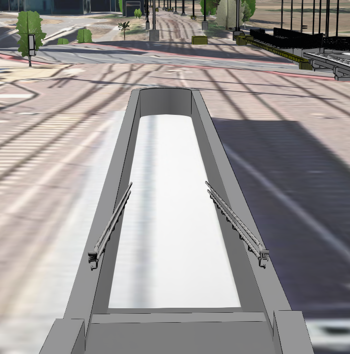
Hello, I need your help. I'm currently integrating BIM models (Revit) into my AGOL. However, I haven't been able to adjust the DEM so that it includes underpasses and structures that are located below the actual ground surface – in these areas, the DEM still appears (see screenshot). Does anyone have an idea on how I should proceed? Thank you and best regards.
- Mark as New
- Bookmark
- Subscribe
- Mute
- Subscribe to RSS Feed
- Permalink
Hello @offi24
The video shows the workflow to create the modified terrain on Pro. After the terrain has been created you can published to AGOL.
David
- Mark as New
- Bookmark
- Subscribe
- Mute
- Subscribe to RSS Feed
- Permalink
Hi David,
Thank you for your help. I try to automate this process with Python to work with multiple files. I could manage to automate the extraction of the Floors, the creation and the merging of the .tif's. But till now, I couldn't automate the step where we define the .tif as Elevation Layer and publish it to ArcGIS Online. Do you have an idea how this could work?
Best regards
Eric