- Home
- :
- All Communities
- :
- Products
- :
- 3D
- :
- 3D Questions
- :
- Add-In for Assigning measures based on XYZ coordin...
- Subscribe to RSS Feed
- Mark Topic as New
- Mark Topic as Read
- Float this Topic for Current User
- Bookmark
- Subscribe
- Mute
- Printer Friendly Page
Add-In for Assigning measures based on XYZ coordinates in a Projected layer
- Mark as New
- Bookmark
- Subscribe
- Mute
- Subscribe to RSS Feed
- Permalink
Since I cannot update the gallery I am posting the Add-In here. It is compiled for ArcGIS 10.1, and I do not know if it will work in 10.0 or 10.2.
Here are the basic installation instructions. After downloading the Add-In double click it to install it and make it available to ArcMap. In Desktop open the Customize | Extensions... menu dialog, check the extension called Measures to 3D/2D, and close the dialog. In Desktop open the Customize | Customize Mode... menu dialog and click on the Commands tab. In the list of Categories scroll down until you see a category named "Measures to 3D/2D Lengths" and click that category. In the commands list box you will see a tool named Measures to 3D/2D.... Click and drag this tool on to one of your toolbars and drop it onto the toolbar. Close the Customize dialog.
Now you should be able to click the Measures to 3D/2D Lengths tool button to open a panel for configuring and using the tool. If you have at least one projected polyline layer in your map that is M and Z aware, it should appear in the list of layers. The tool lets you specify a multiplier for unit conversions. A unit calculator detects your current XY projected units and can assist you to find the conversion factor you should input to achieve a particular measure unit conversion (for example to convert from US Feet to Meters the calculator displays a conversion factor of 0.304800609601219). You can optionally specify a Measure offset for your first measure, ignore or take into account measure gaps, make the measures go with or against the digitized direction, and respect or not respect a selection of routes to operate on.
If further explanation is needed post your questions or comments here.
- Mark as New
- Bookmark
- Subscribe
- Mute
- Subscribe to RSS Feed
- Permalink
- Mark as New
- Bookmark
- Subscribe
- Mute
- Subscribe to RSS Feed
- Permalink
If you have downloaded the Add-In contained in this thread and used it let me know if it successfully listed your Route features and updated the 3D measures or if you had any problems getting it to work.
Hello Richard,
It is working on my machine+ArcGIS 10.1! Superb..
Thanks so much
Amran
- Mark as New
- Bookmark
- Subscribe
- Mute
- Subscribe to RSS Feed
- Permalink
- Mark as New
- Bookmark
- Subscribe
- Mute
- Subscribe to RSS Feed
- Permalink
Hi Richard,
Thanks for sharing this useful tool!
I have a question, there is a version for ArcGIS 10.0?
Regards,
Gastón.
- Mark as New
- Bookmark
- Subscribe
- Mute
- Subscribe to RSS Feed
- Permalink
There probably could be a 10.0 version if I was able to compile it on a machine with ArcGIS 10.0 installed, However, no one has that version where I work now, and I don't have administrator rights to install it myself. I don't have a good case to ask IT to install if for me that relates to my work.
If you can upgrade to 10.1 or 10.2 I think it is very much worth it. Either of those versions is much more stable and has much better performance than 10.0.
- Mark as New
- Bookmark
- Subscribe
- Mute
- Subscribe to RSS Feed
- Permalink
Thank you very much for your answer. Yes, I need to upgrade my ArcGIS!
- Mark as New
- Bookmark
- Subscribe
- Mute
- Subscribe to RSS Feed
- Permalink
Is has this been updated for 10.3?

- Mark as New
- Bookmark
- Subscribe
- Mute
- Subscribe to RSS Feed
- Permalink
Hi Richard,
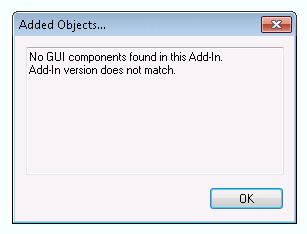
I am running 10.3.1 and every time I click on the icon to open the tool my arcmap crashes. Have you experienced this before? Any suggestions?
-Kevin