- Home
- :
- All Communities
- :
- Products
- :
- 3D
- :
- 3D Mapping Questions
- :
- Re: What does a red exclamation point on a layer i...
- Subscribe to RSS Feed
- Mark Topic as New
- Mark Topic as Read
- Float this Topic for Current User
- Bookmark
- Subscribe
- Mute
- Printer Friendly Page
What does a red exclamation point on a layer in ArcPRO mean?
- Mark as New
- Bookmark
- Subscribe
- Mute
- Subscribe to RSS Feed
- Permalink
The red exclamation point next to each layer indicates that the link to the data source is broken.
The data source can be broken if its references in a geodatabase have been moved, renamed, or deleted, or if they’re inaccessible for some other reason such as the inability to access a folder due to permissions. If, for example, a geodatabase has been moved or renamed, all the layers that rely on data in that geodatabase will have broken source indicators—the red exclamation points.
You can find more information on how to troubleshoot that here:
Five Tips for Fixing Broken Data Links in an ArcGIS Pro Project
Hope that helps.
Derrick
- Mark as New
- Bookmark
- Subscribe
- Mute
- Subscribe to RSS Feed
- Permalink
Thank you, you two,
I did receive an email saying that I exceeded my limit of credits for PRO. If I buy more credits, can the layer go back to normal and I can see my streets again in my map?
Justin
- Mark as New
- Bookmark
- Subscribe
- Mute
- Subscribe to RSS Feed
- Permalink
Hi Derrick,
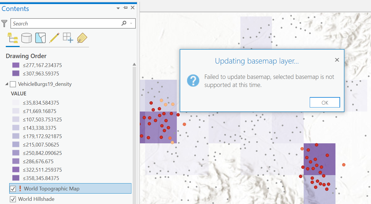
None of those five tips helped. There wasn't a data source I could change the layer to, and when I tried to update the basemap, it gave me this error message:

Do you think there could be something wrong in my application? Or my account? I received an email saying some of my account was suspended, though I could still add to the map.
Thank you,
Justin
- Mark as New
- Bookmark
- Subscribe
- Mute
- Subscribe to RSS Feed
- Permalink
Ah, it's a Esri base map you are adding. Can you mouse over the red exclamation mark and see what the tool tip error says?
Does this happen with another basemap?
- Mark as New
- Bookmark
- Subscribe
- Mute
- Subscribe to RSS Feed
- Permalink
There is a support article related to your issue, hope it helps: Error: Failed to update basemap, selected basemap is not supported at this time (esri.com)
Thanks,
Xuewen
- Mark as New
- Bookmark
- Subscribe
- Mute
- Subscribe to RSS Feed
- Permalink
Thank you, you two,
I did receive an email saying that I exceeded my limit of credits for PRO. If I buy more credits, can the layer go back to normal and I can see my streets again in my map?
Justin
- Mark as New
- Bookmark
- Subscribe
- Mute
- Subscribe to RSS Feed
- Permalink
Hi Justin,
I am having the same issue right now. Were you ever able to find a solution to the basemap layer error?
Thanks,
Chris
