- Home
- :
- All Communities
- :
- Products
- :
- 3D
- :
- 3D Mapping Questions
- :
- Lidar points disappear when zoomed in
- Subscribe to RSS Feed
- Mark Topic as New
- Mark Topic as Read
- Float this Topic for Current User
- Bookmark
- Subscribe
- Mute
- Printer Friendly Page
Lidar points disappear when zoomed in
- Mark as New
- Bookmark
- Subscribe
- Mute
- Subscribe to RSS Feed
- Permalink
When displaying lidar data, the further I zoom in, more and more points disappear, leaving random blank areas, even after the refresh button finishes spinning.
When zoomed out the full extent of all the tiles in the dataset are seen with no blank areas.
It doesn't matter whether I set "show layer at all distances" or set Point Thinning density to maximum and set display limit as high as it will let me, 100,000,000.
Any idea what I'm doing wrong?
- Mark as New
- Bookmark
- Subscribe
- Mute
- Subscribe to RSS Feed
- Permalink
You could try Recalculating the spatial index - works for me when layers don't display when zooming in and out regardless of max/min scale settings.

- Mark as New
- Bookmark
- Subscribe
- Mute
- Subscribe to RSS Feed
- Permalink
Thanks for the reply, I'm a newbie so I don't fully understand ArcGIS yet.
However, when I try to follow the help instructions to modify a spatial index, there is no Indexes tab under Properties.
- Mark as New
- Bookmark
- Subscribe
- Mute
- Subscribe to RSS Feed
- Permalink
Sorry - You are right. The index setting not available for .las. The only thing i would suggest for you to check are first the point thinning options under LAS Dataset layer

You could also try changing display options Go to Project > Options > Display Switch between DirectX and OpenGL (whichever is not selected). Try enabling "Dynamically adjust rendering quality" and disable antialiasing to reduce load.
Only my suggestions.. Someone from ESRI might have another idea.
- Mark as New
- Bookmark
- Subscribe
- Mute
- Subscribe to RSS Feed
- Permalink
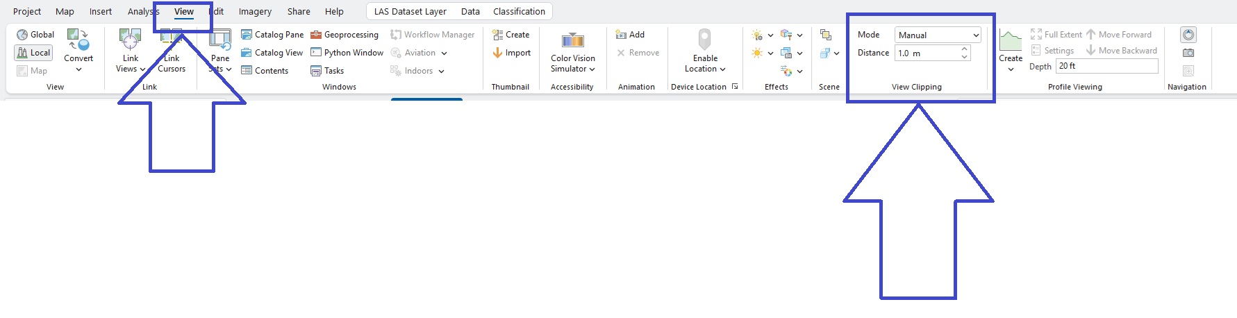
I just answered the same question in another thread. Here's a copy and paste of the same answer-
Are the points always in the foreground?
View tab -> "view clipping" ->change mode from automatic to manual and set the distance to something like 0.05m or 1m.

I assume that's what you need, but if that doesnt fix the issue:
Did you rebuild pyramids in ArcPro?
Did you regenerate LOD in ArcPro?