Turn on suggestions
Auto-suggest helps you quickly narrow down your search results by suggesting possible matches as you type.
Cancel
- Home
- :
- All Communities
- :
- Products
- :
- 3D
- :
- 3D Mapping Questions
- :
- ArcScene10 problem
Options
- Subscribe to RSS Feed
- Mark Topic as New
- Mark Topic as Read
- Float this Topic for Current User
- Bookmark
- Subscribe
- Mute
- Printer Friendly Page
ArcScene10 problem
Subscribe
2903
0
05-02-2015 06:57 AM
05-02-2015
06:57 AM
- Mark as New
- Bookmark
- Subscribe
- Mute
- Subscribe to RSS Feed
- Permalink
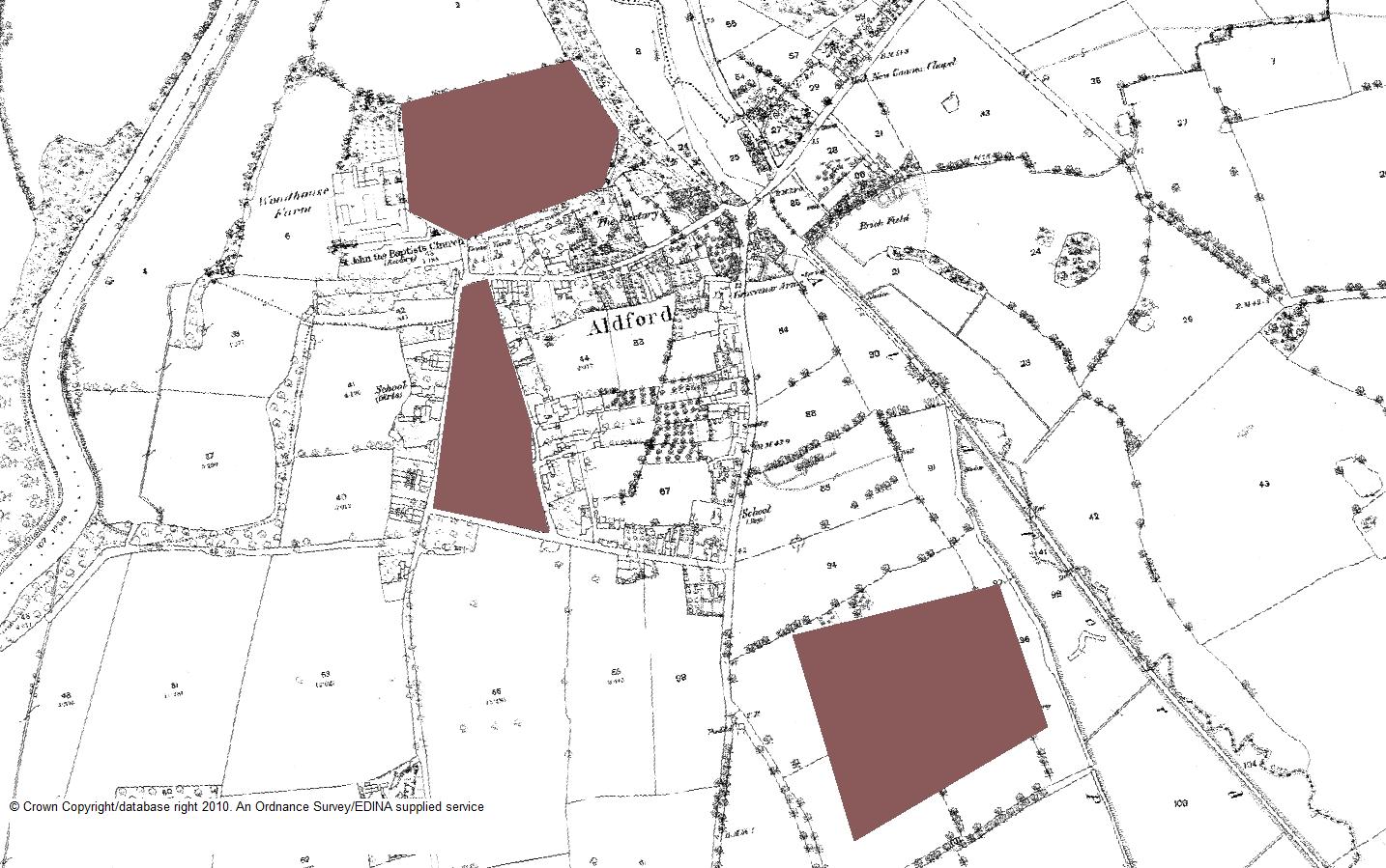
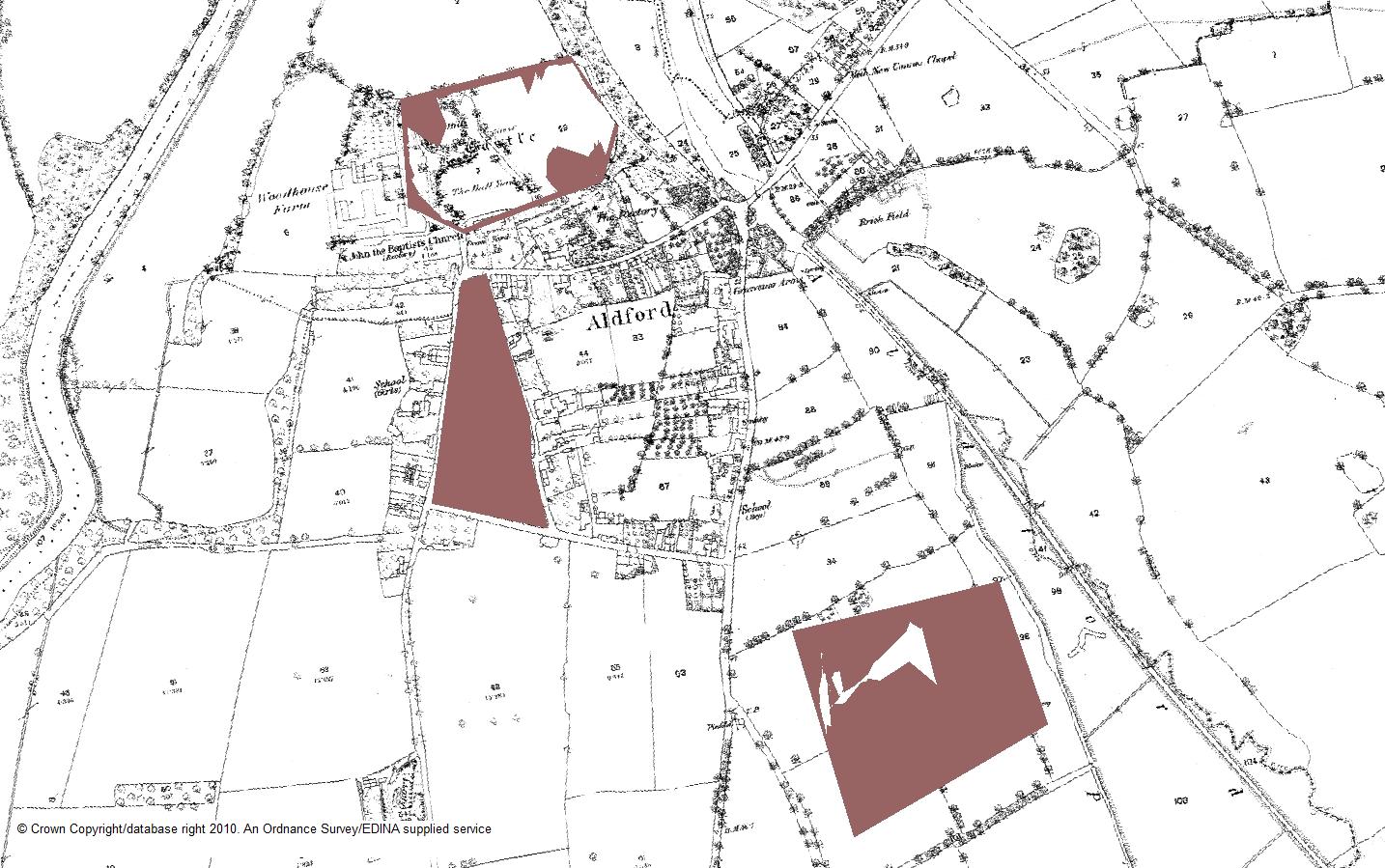
I ahve encountered a problem in ArcScene10. I am finding that where I have created a polygon shapefile and overlay it over an OS or LiDAR base map that the base map intrudes into the polygon so that only part of the polygon shows - see attacehd jpegs - the first shows the area with no vertical exaggeration, the second with X2 vertical exaggeration. Annoyingly I have looked through some jpegs I did years ago - in ArcScene9 I think - and this didn't happen whereas now it happens all the time! Has anyone found a similar problem and if so do they have a solution?
Thank you,
Mike
0 Replies