5 New Ways to View Transit
- Subscribe to RSS Feed
- Mark as New
- Mark as Read
- Bookmark
- Subscribe
- Printer Friendly Page
- Report Inappropriate Content
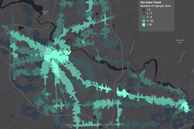
Who are the people served by your city's transit system? And who isn't, but should be? How does transit change throughout the day? And what is the best way to analyze service areas? These questions and more are answered in this compelling Map Journal of new ways to view public transportation. You'll learn helpful best practices through examples of public library access in Chicago, Illinois and transit availability in Ann Arbor, Michigan.
I created this Map Journal for Melinda Morang to present at the GIS in Transit conference this past month in D.C. and it was a hit! This Map Journal is also featured as an Esri blog.
You must be a registered user to add a comment. If you've already registered, sign in. Otherwise, register and sign in.