- Home
- :
- All Communities
- :
- Products
- :
- ArcGIS GeoStatistical Analyst
- :
- ArcGIS GeoStatistical Analyst Questions
- :
- Re: Exporting the cross validation file
- Subscribe to RSS Feed
- Mark Topic as New
- Mark Topic as Read
- Float this Topic for Current User
- Bookmark
- Subscribe
- Mute
- Printer Friendly Page
Exporting the cross validation file
- Mark as New
- Bookmark
- Subscribe
- Mute
- Subscribe to RSS Feed
- Permalink
- Report Inappropriate Content
Hi, Is there a way to export excel file for the cross validation process (indicated below in the image) only. Export option that is available at the bottom exports the interpolated values at the unsampled locations. However, I only need measured and predicted values at the sampled locations in order to calculate coefficient of determination (r2) for the kriged map.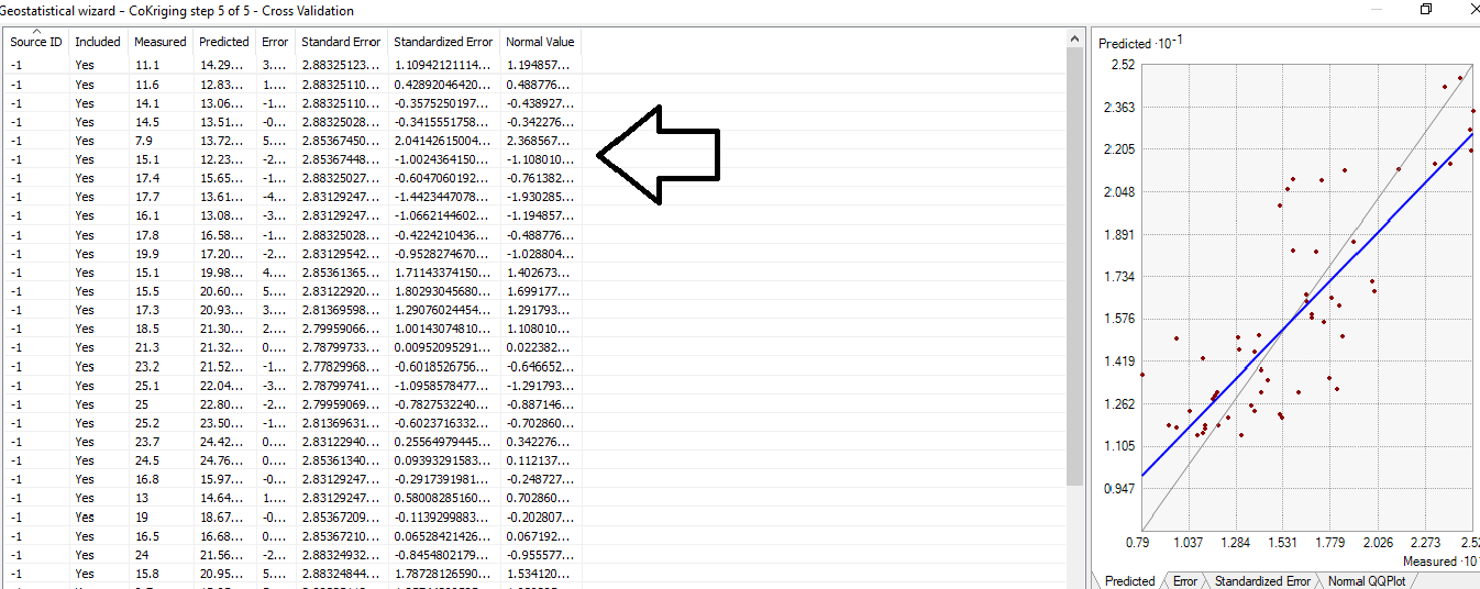
- Mark as New
- Bookmark
- Subscribe
- Mute
- Subscribe to RSS Feed
- Permalink
- Report Inappropriate Content
Attached is the screenshot of dataset from my 2nd site. It's the same as my 1st site, with exception of 56 sampled data points instead of 82. Number of terrain covariates is around 156000. However, I just notice that the number of records for both datasets is showing up as 56. So, maybe combining the two datasets is causing the issue.
- Mark as New
- Bookmark
- Subscribe
- Mute
- Subscribe to RSS Feed
- Permalink
- Report Inappropriate Content
Hi Musfira,
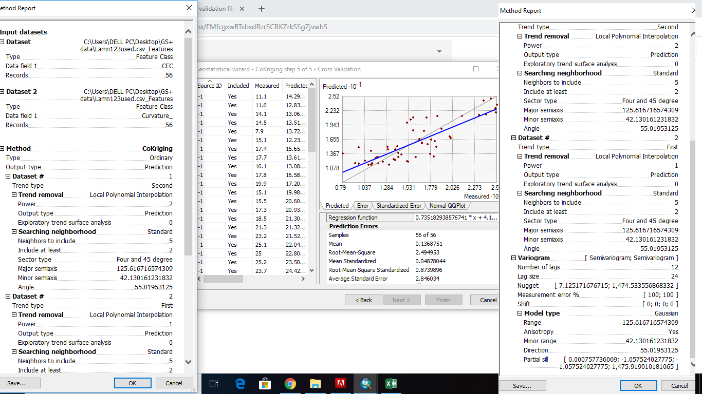
The number of points that come out of the Export Result button should be equal to the number of rows in the cross validation table in the Geostatistical Wizard. I don't know any reason they would be different. I can also see in your table that all Source ID values are -1, which is also strange.
As Steve asked, what format are the points that you used in the wizard? Shapefile, file geodatabase, something else?
Regardless, you should try clicking Finish then OK in the wizard to create a geostatistical layer in your map. Then use the Cross Validation geoprocessing tool with the layer. The optional feature class output from the tool produces the same feature class as the Export button in the Wizard. Using the geoprocessing tool instead of the Export button may give what you are expecting.
- Mark as New
- Bookmark
- Subscribe
- Mute
- Subscribe to RSS Feed
- Permalink
- Report Inappropriate Content
Hi Eric,
Thanks for the reply. That is exactly my understanding that the number of records in the exported excel file should be equal to the number of records in the cross validation file. However, it's not the case. Maybe combining both datasets into single csv file is causing the issue.
I think, I will input the two datasets as two csv files, instead of one. It might solve the exporting issue, as well as the source ID one.
- « Previous
-
- 1
- 2
- Next »
- « Previous
-
- 1
- 2
- Next »