- Home
- :
- All Communities
- :
- Products
- :
- ArcGIS CityEngine
- :
- ArcGIS CityEngine Questions
- :
- Re: How to perfectly align shapes to a street netw...
- Subscribe to RSS Feed
- Mark Topic as New
- Mark Topic as Read
- Float this Topic for Current User
- Bookmark
- Subscribe
- Mute
- Printer Friendly Page
How to perfectly align shapes to a street network on a basemap?
- Mark as New
- Bookmark
- Subscribe
- Mute
- Subscribe to RSS Feed
- Permalink
Hello,
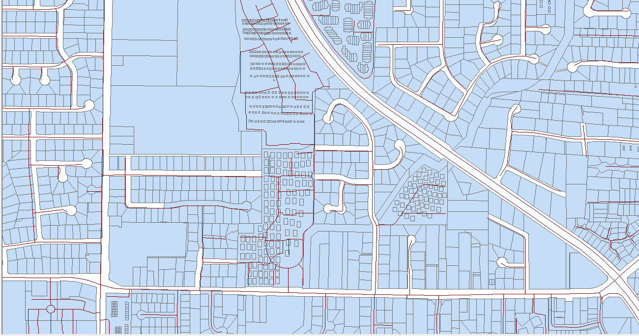
I'm working on creating my city in CityEngine using GIS data to be as accurate as possible. I have all the lots in the city that represent individual properties and land that looks like this:


As you can see, my shapes are missing the streets. What I have done is create a basemap and use OSM to create a street network shown here:

Which works just fine on it's own. However when I try to drag the lot shapes onto the basemap, I am always slightly off center, meaning I can't orient it perfectly.

For reference, this misalignment is what i'm referring to. Of course I can attempt to correct it but it will always mess up one other side of the city. This is as close to perfect as I can seem to get.
What is a better way to properly align the street network and the shapes? The trial-and-error method cannot get me close enough. Does anyone have any better ideas?
Thank you in advance.
Bonus question:
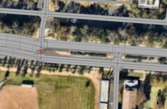
What is the easiest way to fix these crisscrosses in the roads you see in the last picture and here:

I have them in quite a lot of places and the "Cleanup Graph" tool doesn't help much.
- Mark as New
- Bookmark
- Subscribe
- Mute
- Subscribe to RSS Feed
- Permalink
So which data has the precision you desire? My guess is the parcel data, right? Sounds to me like you get to roll up you sleeves and adjust the alignment of the streets to your parcels. Welcome to wild wonderful world of GIS. Here's a snapshot of my streets with parcels:

Some areas are better than others. In my case the streets are the more precise data...
- Mark as New
- Bookmark
- Subscribe
- Mute
- Subscribe to RSS Feed
- Permalink
CityEngine does have a tool, to help with the task. However some manual cleanup work can't be avoided.
Use the Fit Street Widths to Shapes tool to correct the street width and offset.

For the bonus question:
Streets with lanes that are separated (e.g. a row of trees) are modeled as two one way streets. At intersections the nodes of these streets are too close together. If the option "Run Graph Cleanup Tool after Import" is activated in the OSM importer, the nodes are merged. This leads to the bended streets. The option needs be be turned off and the street and sidewalk width needs to be manually adjusted to enable the street shape creation.

Conflict on the left, resolved on the right
- Mark as New
- Bookmark
- Subscribe
- Mute
- Subscribe to RSS Feed
- Permalink
Sorry- I don't do City Engine... I'm just an old school, roll yer own kind of guy....
- Mark as New
- Bookmark
- Subscribe
- Mute
- Subscribe to RSS Feed
- Permalink
This was very helpful, thank you.
- Mark as New
- Bookmark
- Subscribe
- Mute
- Subscribe to RSS Feed
- Permalink
Thomas Fuchs, I'm facing a similar situation as Ethan's in that I will need to manually edit my imported streets to properly model them. However, I am currently only modeling a portion of my city (priorities/goals as much as available hardware resources). I've made some edits to my subset of streets to resolve intersections, alignment, etc. and have attempted to export the graph to a shapefile for use in other CE projects.
However, when I attempt to import that shapefile into another project it seems to destroy all of my hard work and time spent editing those intersections I only want to edit once! Do you have any strategies for effectively re-using features that have been painstakingly edited in other projects?
Perhaps I am using the wrong method of exporting (I exported selected Graph objects)? I don't mean to hijack this thread but I suspect Ethan may be faced with a similar situation in the future. Thanks.
- Mark as New
- Bookmark
- Subscribe
- Mute
- Subscribe to RSS Feed
- Permalink
Maybe your streets department can provide pavement polygons (yes polygons not lines), lip of gutter and face of curb feature classes to help with this task.