- Home
- :
- All Communities
- :
- Industries
- :
- State & Local Government
- :
- State & Local Government Questions
- :
- How to change projection in the Local Government M...
- Subscribe to RSS Feed
- Mark Topic as New
- Mark Topic as Read
- Float this Topic for Current User
- Bookmark
- Subscribe
- Mute
- Printer Friendly Page
How to change projection in the Local Government Model?
- Mark as New
- Bookmark
- Subscribe
- Mute
- Subscribe to RSS Feed
- Permalink
- Report Inappropriate Content
Trying to change the Illinois state plane projection in the local government model to represent the correct projection for our city. Seem like it should be rather straight forward but having a surprising amount of difficulty, thanks.
- Mark as New
- Bookmark
- Subscribe
- Mute
- Subscribe to RSS Feed
- Permalink
- Report Inappropriate Content
why don't you set the coordinate system of the data frame to match it? or do you have a mismash of data in different coordinate system? Normally the first file that you add to a dataframe, sets the coordinate system you want, then you can add other data. Alternately, rightclick on the data frame, select properties, then define it
- Mark as New
- Bookmark
- Subscribe
- Mute
- Subscribe to RSS Feed
- Permalink
- Report Inappropriate Content
These are the steps that I took when I converted my data to the LGIM:
All of this is done in ArcCatalog
- Create a new file gdb
- In the Xray add-in, select the local government gdb w/the schema you want. It should populate the Geodatabase filepath
- Create an XML from this gdb

- Select an existing feature class that is the correct coord. System. Note that the file path under Geodatabase changes.
- Verify the XML you created in step 3 is still populated in XRAY
- Select Options > Use Spatial Reference
- Select Save, to save the XML with the newly defined coord. system
- Select the gdb you created in step 1
- Select export XML to gdb


Once you have this, you have a blank local government schema gdb and you can import your data in to it. If you need help with this, go here.
Good luck
- Mark as New
- Bookmark
- Subscribe
- Mute
- Subscribe to RSS Feed
- Permalink
- Report Inappropriate Content
Perfect, thanks for the help
- Mark as New
- Bookmark
- Subscribe
- Mute
- Subscribe to RSS Feed
- Permalink
- Report Inappropriate Content
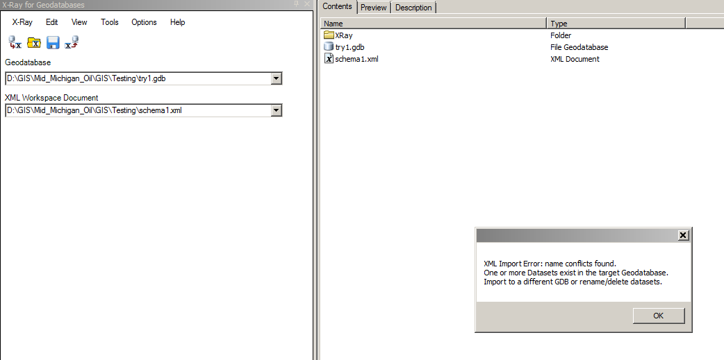
I am running ArcGIS 10.5.1 I have tried this workflow at least 7 times and it is not working for me. try1 is an empty gdb. Importing the xml to gdb works if you do not change the spatial reference. Changing the spatial reference as instructed consistently causes issues for me. Any thoughts?