- Home
- :
- All Communities
- :
- User Groups
- :
- Conservation GIS
- :
- Documents
- :
- Deborah Jewitt, South Africa
- Subscribe to RSS Feed
- Mark as New
- Mark as Read
- Bookmark
- Subscribe
- Printer Friendly Page
Deborah Jewitt, South Africa
Deborah Jewitt, South Africa


Deborah Jewitt, Ezemvelo KZN Wildlife (EKZNW), South Africa
x2019TTT x2014Trainer x2012Scholar xDrone xPark xSouthAfrica xAfrica
Linkedin Profile Researchgate Profile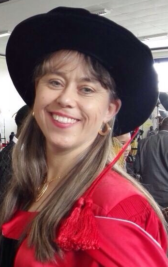
2019 Profile: Deborah is a participant in the first-ever SCGIS TTT Summit Meeting. Currently an ” Independent Researcher”,
Debbie works as a conservation scientist for Ezemvelo KZN Wildlife, and carries out research in Botany, Ecology, Conservation Planning, Climate Change, Land Cover Change, Connectivity, Gradients and Biodiversity. Debbie is also active in the SCGIS South Africa Chapter
2019 International Conference Presentation, session: VEGETATION & BOTANICAL CONSERVATION
2019 Map Gallery Interviewer on TEAM MAPITAS
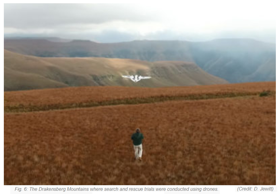
2018: Drones:
In 2018 she was an invited or keynote speaker at several conferences related to drones including the South African Wildlife Management Association, DroneCon 2018, Drones Conference 2018, the 2018 "Drones Africa Summit" and presented the following paper:
"Drones for Wildlife and Environment"
"Drones, or unmanned aerial vehicles (UAVs), are rapidly changing the face of the conservation industry. They have the potential to revolutionise conservation and spatial ecology. At the core of conservation is the monitoring of species populations and their habitats.
Traditional approaches to collecting species populations and habitats data may be resource intensive, potentially inaccurate, difficult to validate [1] and may pose a significant threat to human safety due to the presence of dangerous animals or environments. In fact, the leading cause of wildlife workers deaths in the US (66%) is due to manned aircraft crashes. The slow, low-level, manned flights required to collect biological data may lead to aerodynamic stalls, power-line collisions or crashes due to downdrafts [2].
UAVs provide the opportunity to obtain accurate data and high-resolution images in a better, faster, cheaper and safer manner [3, 4]. The use of drones in the conservation sector is not limited to only monitoring species and their habitats. Drones can be used for management purposes, technical services, eco-tourism marketing, law enforcement, anti-poaching and search-and-rescue efforts. We discuss a few of the potential drone applications and challenges faced in the conservation sector."

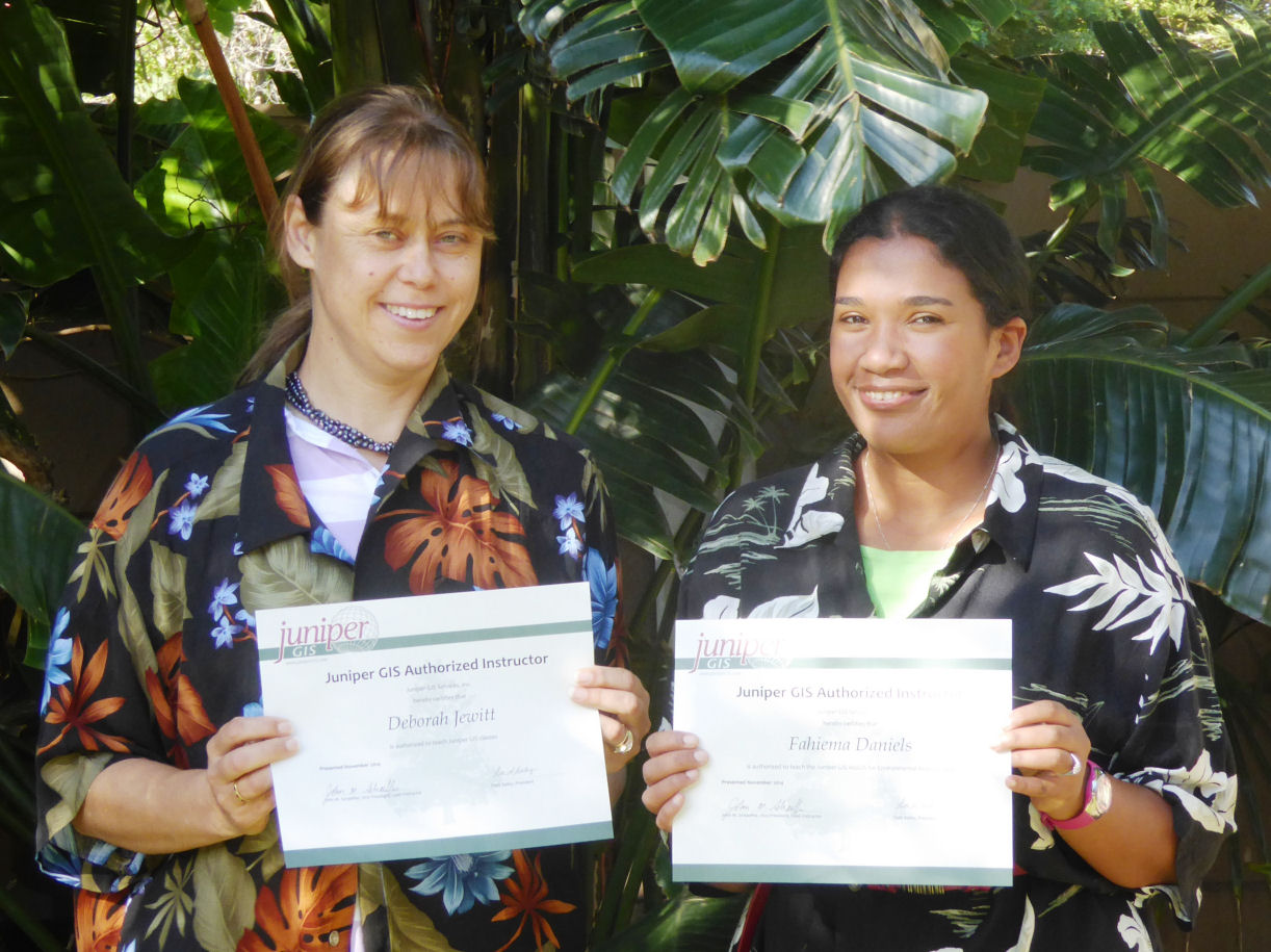
2014 TTT Profile: Deborah was accepted as TTT Candidate for the SCGIS 2014 Conservation GISTraining Program in South Africa. ArcGIS for Environmental Analysis and Advanced Topics for ArcGIS were taught in November at Kirstenbosch National Botanical Garden in Cape Town. There were 18 students in the first class and 14 in the second week. Most were from the South Africa National Biodiversity Institute SANBI), but there several from other environmental groups, plus a student from Nigeria and one from Tanzania. Fahiema Daniels, a 2013 Scholar from SANBI was the primary organizer, and Mervyn Lotter, a certified TTT Trainer, was brought in to teach workshops on ArcGIS Online. Funding came from an Esri-SCGIS International Grant.
(Photo below: Deborah (L) and Fahiema (R) receive their formal TTT Certifications)
2012 Scholar Profile:
"I would like to thank SCGIS for the opportunity to apply for this scholarship. A colleague from another provincial conservation organization in South Africa (Mervyn Lotter) had the privilege of receiving this scholarship last year and has spoken very highly of the programme and the opportunities it provides. As scientists from developing countries we are always grateful for initiatives such as these.
I work as an Ecosystem Ecologist for Ezemvelo KwaZulu-Natal Wildlife (EKZNW), which is a para-statal provincial conservation organization in South Africa. The organization is perhaps most well known for its pioneering work on rhino conservation and some of its protected areas open to tourists, such as the Hluhluwe-Imfolosi Park. My work involves the collection, synthesis and reporting of information pertaining to landscapes and ecosystems in the province, in particular their individual trend, prioritization for surveillance, monitoring and conservation action, the major threats to them, and to develop plans for and contribute to their long term conservation. I use GIS as one of the tools to achieve this mandate. Common projects I work on include vegetation mapping, setting conservation targets for vegetation types or ecosystems, determining the conservation status of vegetation types, contributing towards the systematic conservation plan, using land cover maps to identify changes in the landscape and the rates of change identifying threats to ecosystems and finding solutions for them e.g. climate change.
On a personal level I completed my PhD at the University of the Witwatersrand. I investigated the major threats of land cover change and climate change to grassland and savanna systems in KwaZulu-Natal and suggested solutions to maintain floristic diversity in the face of these global threats. GIS was a core tool in this work.
"Living in South Africa means that we basically live on the other side of the world, miles away from most developed countries! Our country is wonderful from a biodiversity perspective as we have such a vast array of diversity, and indeed our province of KZN is situated within the internationally recognized biodiversity hotspot known as the “Maputaland-Pondoland-Albany” hotspot. South Africa is a mix of first world and third world conditions which gives rise to some interesting situations. Our isolation, both geographically and socio-historically, and the lack of resources we have to conserve this awesome biodiversity means that South Africa’s researchers are in the position of having to do and be masters of several skills, instead of necessarily being master of a specific skill. So even our work has great diversity (which personally I think is fantastic!), however it is challenging to know everything one needs to know in order to be able to do ones work effectively.
Please describe the history of your personal work in conservation and GIS:
My history in conservation has been a bit convoluted. I had always wanted to be involved in conservation from a young age and was probably inspired by holidaying in wonderful game reserves such as the Kruger National Park. After school my parents encouraged me to get a university degree instead of a diploma from a technicon. This wise advice has stood me in good stead in progressing my career. However at that time there was not a direct university degree in nature conservation so I studied agriculture with a major in grassland science and veld management. My Masters degree at the University of Cape Town enabled me to finally study conservation biology which was most enjoyable. I was the only female in my class and after qualifying battled to get a job in the conservation world because the conservation world was still very male-dominated at the time. Thankfully that has all changed now but it did take me a while to get into my ideal conservation career. I have been working with EKZNW for 17 years and have learned so much about biodiversity conservation.
The first game reserve in KZN was proclaimed in 1895. EKZNW was formed in the late 1990’s as a result of the political change in South Africa at the time, but was formed by combining of the two previous conservation organizations in KZN: the former Natal Parks Board and the KwaZulu homelands conservation body KwaZulu Department of Nature Conservation, both of which had long standing and good conservation records. The former Natal Parks Board and now EKZNW are well known for their pioneering work on rhino conservation.
Please describe how you work in your local conservation and GIS community:
As mentioned above, I am the Ecosystem Ecologist for the organization. As such my work involves the collection, synthesis and reporting of information pertaining to landscapes and ecosystems in the province, in particular their individual trend, prioritization for surveillance, monitoring and conservation action, the major threats to them, and to develop plans for and contribute to their long term conservation. I use GIS as one of the tools to achieve this mandate. Common projects I work on include vegetation mapping, setting conservation targets for vegetation types or ecosystems, determining the conservation status of vegetation types, contributing towards the conservation plan, using land cover maps to identify changes in the landscape and the rates of change identifying threats to ecosystems and finding solutions for them e.g. climate change.
Our organization has a provincial mandate but works closely with other provincial conservation organizations, NGO’s (non-government organizations), stakeholders and national bodies such as SANBI (South African National Biodiversity Institute), municipalities and the like. As our division develops the conservation plan and map for the province and this is widely used by stakeholders, other government departments, researchers and consultants. We work with other provinces and national departments such as SANBI and the Department of Environmental Affairs (DEA) to help identify threatened ecosystems, to develop national and provincial policy, contributing towards EIA (Environmental Impact Assessments) assessments and guidelines, identifying where critical biodiversity areas are in the province and mapping these and working on both provincial and national protected area expansion strategies and plans. I have also been involved in mapping habitat types in the province and placing an economic value on the ecosystem goods and services in the province. We also work with private land owners and communities to get Stewardship agreements to benefit biodiversity conservation on their lands via our Stewardship programme.
At a local level my husband and I have been involved in the formation of a trust (Preservation of the Mkhondeni Mpushini Biodiversity Trust), with other community members, to ensure sustainable development in the neighbourhood where we live. I assist them with information and maps, and provided the information they needed to have an assessment done to value ecosystem goods and services in the valley based on mapped habitat variables.
Please describe what is the most unique and the most challenging about the conservation/GIS work that you do:
As specialist scientists in our organization we tend to have to work on our own e.g. there are only one animal scientist, invertebrate scientist, plant scientist, aquatic scientist and ecosystem scientist and we work at the provincial level. Whilst we can help each other with common problems much of the other work needs to be figured out on ones own. This includes doing technicians work and data capture as these posts have not been filled for several years now for various reasons. This can be quite challenging at times.
Our province falls into a biodiversity hotspot and we are facing major threats in terms of landscape transformation e.g. urbanization, agriculture, timber plantations and mining. These limited resources make it challenging to properly conserve our unique biodiversity and its many endemic species. We work both within Protected Areas and outside of them.
The title of the paper I presented at the SCGIS conference was: Macro-ecological corridors in KwaZulu-Natal, South Africa.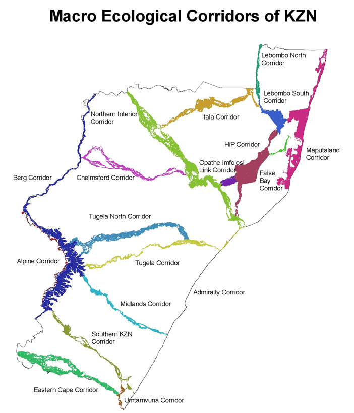
Abstract: Global change, especially land use and climate change, is a major threat to biodiversity the world over. Currently 50% of KwaZulu-Natal (KZN), a province of South Africa, has already been irreversibly transformed (as determined by the 2005 KZN land cover map), mainly by urban expansion, agriculture and timber plantations. KZN is a biologically diverse province due in part to a large altitudinal gradient (0-3000m), varied topography and geology and the convergence of tropical and temperate elements from the north and south respectively. KZN falls within the internationally recognized biodiversity hotspot known as the Maputaland-Pondoland-Albany hotspot. Given the predicted climate change scenarios for the province, a system of macro-ecological corridors were developed for the province based on least cost pathways, to facilitate altitudinal and latitudinal (evolutionary) movements of species. This is seen as the most cost-effective mechanism to mitigate against climate change impacts for species. The method used for the development of this product are highlighted and well as the way in which the corridors are incorporated into our planning products and strategies.
-
 Anonymous User