- Home
- :
- All Communities
- :
- User Groups
- :
- Conservation GIS
- :
- Documents
- :
- Aaria Dobson-Waitere, New Zealand
- Subscribe to RSS Feed
- Mark as New
- Mark as Read
- Bookmark
- Subscribe
- Printer Friendly Page
Aaria Dobson-Waitere, New Zealand
Aaria Dobson-Waitere, New Zealand
Taranaki Whānui ki Te Upoko o Te Ika / Port Nicholson Block Settlement Trust NEW ZEALAND
xTTT2018-2019 x2019TTT x2018Talk xScholar2017 x2017Talk xIndigenous Knowledge xLand Acknowledgement xEducation xPark xAotearoa xNew Zealand
2019 Profile: Aaria is a participant in the first-ever SCGIS TTT Summit Meeting.
2019 Paper Title: Ko au te awa, ko te awa ko au: I am the river, the river is me. SESSION: INDIGENOUS KNOWLEDGE & SOVEREIGNTY
2019 Abstract: Indigenous knowledge is intertwined with people, their history, culture, and ecosystems. In this presentation we will travel to Aotearoa/New Zealand where a Kaitiaki Freshwater Monitoring project is being developed as a way of reconnecting people with their environment. The implementation of such monitoring frameworks will support indigenous peoples of Aotearoa to collate their knowledge and traditional practices pertaining to freshwater management for the benefit of the waterways and future generations.
2018 Profile & Films: Aaria returned in 2018 as that year's Train-the-Trainer Candidate, teaching and supporting the 2018 SCGIS Scholarship Program. She was kind enough to describe the path to becoming a trainer and what the experience meant for her and her colleagues in the following video interviews.
FILM: 2018 Scgis UC Davis Introduction (below left)
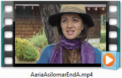
FILM: Aaria Ripeka Dobson-Waitere on the traditional origins of her conservation values (below right)

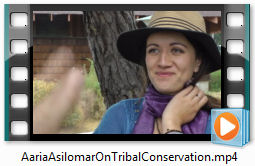
FILM: Aaria Ripeka Dobson-Waitere on SCGIS & Maori Values for teaching Conservation (below left)
FILM: Aaria Ripeka Dobson-Waitere on Climate Change in Traditional Communities (below right)
2017 Profile: Aaria's first year with SCGIS was in 2017, when she joined the scholarship program and presented a paper on Traditional Ecological Knowledge. (Aaria belongs to the Taranaki Whānui, descended from a group of iwi (tribes) from the Taranaki region of the North Island, living in and conducting the rights and duties of mana whenua -traditional guardians- of the Wellington Harbor area and associated lands. The Port Nicholson Block Settlement Trust takes it's name from the 2008 settlement acknowledging the 1840 Treaty of Waitangi and was established to receive and manage the settlement package for the Taranaki Whānui.)
SCGIS 2017 TALK TITLE: "Using the Past to inform the Present: the benefits of cultural restoration for environmental resource management: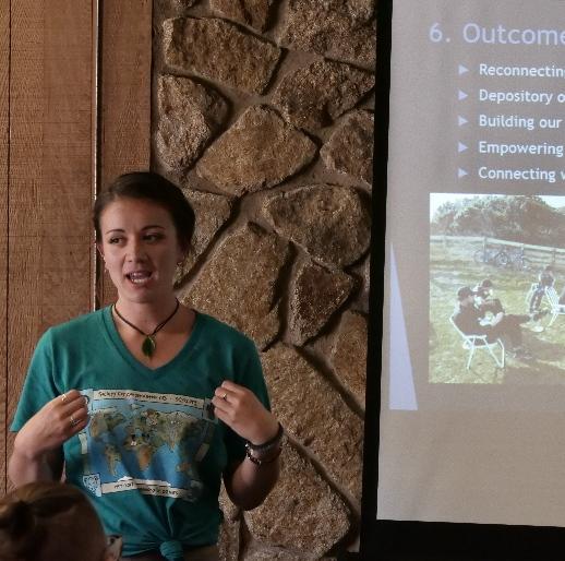
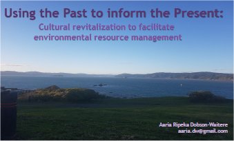
SCGIS 2017 ABSTRACT :"Kaitiakitanga (guardianship) and tikanga (cultural practices) were the traditional methods of managing resources used by Māori ancestors. These practices continue to be of value and relevant in application today. We not only have a responsibility to look after our resources but also the knowledge associated with these resources so it is available to be passed on to future generations. The environment is a place of connection between us and our tupuna/ancestors and one that is essential for us to connect the younger generations with, also for maintaining kaitiakitanga/guardianship into the future. The project will utilise the latest GIS technology to record, map and transmit traditional knowledge. With the aid of GIS technology, the stories and place names that record Taranaki Whanui history in Te Whanganui-a-Tara (Wellington), Aotearoa (New Zealand), will begin to be mapped onto a virtual landscape for future generations to come."
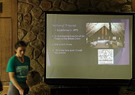
Live Map App created as part of the 2017 Esri-SCGIS Scholars Program Web GIS Training:
2017 SCGIS SCHOLAR PROFILE:
*-Organization name: Taranaki Whānui ki Te Upoko o Te Ika / PortNicholson Block Settlement Trust
*-Organization street address : 1-3 Thorndon Quay, Wellington, 6144
*-Organization mailing address, if different: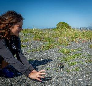
*-Country: Aotearoa / New Zealand
*-Work phone with country and area code: +64 4 472 3872
*-Work fax with country and area code: +64 4 472 3874
*-Main email: [email protected]
*-Scholar Email: [email protected], [email protected]
*-Organization Web site URL if any: https://www.pnbst.maori.nz/
(PHOTO right, Aaria releases a Tuturiwhatu chick)
*-ORGANIZATION’S WORK: The Port Nicholson Block Settlement Trust was established in August 2008 to receive and manage the Treaty settlement package for Taranaki Whānui ki Te Upoko o Te Ika. Our vision statement is: Ki te whakahou whakapakari me te whakanikoniko i te ahurea papori, rangatiratanga o Taranaki Whanui ki Te Upoko o Te Ika which translates as: To restore, renew, and revitalize the social, cultural, environmental and economic well-being of Taranaki Whānui ki Te Upoko o Te Ika.
*-ROLE IN THE ORGANIZATION: I began working part-time at Taranaki Whānui ki te Upoko o Te Ika / Port Nicholson Block Settlement Trust as the Kaiawhina Taiao / Environmental Assistant on the 1st April, 2016. In this position I am responsible for assisting the Kaiwhakahaere Taiao in their role to lead and fulfil our mana whenua (territorial rights) responsibility for the environment and to support the iwi (tribes) natural resource interests within the rohe (region). I am also responsible for ensuring tribal members and the wider community are  knowledgeable and informed about the mana whenua (territorial rights) of Taranaki Whānui ki Te Upoko o Te Ika. I also have a role to further develop GIS layers that details cultural/environmental/resource-related assets and interests of Taranaki Whānui ki Te Upoko o Te Ika.
As I soon discovered, working for any iwi (tribe) organization means you often take on a few extra roles other than what is outlined in your job description. As an example of some of the GIS/conservation projects I am involved with, following is a brief overview of associated projects:
- Ongoing processing of resource consents, permits and concessions, and archaeological authorities from respective organizations (Councils, government departments)
- Matiu Island Project.
The focus is to reconnect our members to Matiu Island, located in the middle of Wellington Harbour. I have been tasked with collating maps and data pertaining to Matiu Island and other sites of significance across the rohe of Taranaki Whānui. My work to date has consisted of collecting existing GIS layers, several meetings with LINZ around GIS support as well as collecting historical survey plans, gaining a subscription to ArchSite (a database of New Zealand’s archaeology sites), and learning how to navigate Mukurtu (online database storage).
From the information I have gathered thus far, I have identified 4 key maps that are able to be created utilising these different sources:
1. Te Heke o Taranaki – a map showing the migration of iwi (tribe) from Taranaki into the Wellington Region
2. Settlement Timeline – showing the complex history of settlement within Te Whanganui-a-Tara which will identify various iwi (tribes) and their associated sites of significance (pā (fortress), kainga (home), urupa (burial grounds))
3. Changing Landscapes – a timelapse showing Matiu Island over 4 time periods (pre-human, Māori, post-settlement, Today)
4. Māhere Taonga (Chart/Map of Property, Treasures) – based around the idea of a treasure map, I will create a user friendly map that highlights different features (flora and fauna, archaeological sites) on Matiu that provides Taranaki Whānui specific information.
All of these projects are currently under varying levels of development.
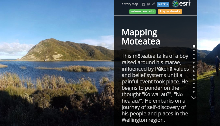
As part of the bigger project I envision that other interactive maps will be able to be developed in the future utilising other collated information, for example, the interviews can be used within a medium such as tourbuilder which is an online resource that can create tours on a landscape utilising images, videos and other kōrero

(PHOTO: TW Planting Day )
- Papakainga (housing development). 
Creating an opportunity for first home buyers within our membership, with a focus first on kaumatua housing / housing for elders. Priority will be given to building 8 kaumatua houses with 15 whanau / family houses to follow. I have been heavily involved with developing the landscape designs which I have based around restoration of native flora and fauna, and rongoaa Māori (Māori medicine).
I have also been provided with a training opportunity to be involved with developing a resource consent for this development alongside Cuttriss Consultants.
In addition to these projects I am involved with translocations, iwi (tribe) development strategies, various council projects, dotterel monitoring, bird banding, pest control and the list goes on. So no two days are the same, but I enjoy the wide variety of work that I have the opportunity to be involved with. I look forward to when our environmental team of two is able to expand as it is my desire to spend more of my time in developing an effective GIS system to support the various projects that we are involved with.
History of your personal work in conservation and GIS: Since 2008 I have been involved in a local community group in Te Whanganui a Tara / Wellington, at Te Papakainga o Ngā Hau e Whā o Paparārangi (NHEWOP). Initially I was involved with the rangatahi Kapa Haka (youth Māori performance group), which has led on to me becoming a rangatahi (youth representative) on the NHEWOP Committee. We have developed a restoration project where I am involved with contributing to implementing a vision to restore mātauranga Māori (Māori knowledge) system based practices in the community within the context of a 20 year planting plan focused on raranga / weaving, rongoā / medicine and māra kai (food cultivation). Within this project I have had the opportunity to develop skills using current scientific technology such as GIS. More specifically, I have been mentored in GIS skills by Catrina O’Neill while she was at her role at the Department of Conservation (NZ SCGIS volunteer), we have also received ongoing support from Parker Jones (Chair NZ SCGIS) in regards to design input and GIS project development planning.
Following on from this, I took an introductory course to GIS in 2015 as part of my undergraduate degree in Ecology and Biodiversity, and Māori Resource Management. I am currently completing my final semester of a Masters in Conservation Biology. Once completed, I will take on a full-time contract with Taranaki Whanui.
Your connection to the local SCGIS chapter: I was first introduced to my local SCGIS chapter through the volunteer work that I am involved with at Ngā Hau e Whā o Paparārangi (NHEWOP) through the ongoing support from both Catrina O’Neill (NZ SCGIS volunteer) and Parker Jones (Chair NZ SCGIS). Since this time, I have had the opportunity to meet with others involved in inspiring GIS projects within New Zealand through networking opportunities provided by workshops focused towards supporting Maori (first nation) in GIS work. As I continue to develop my own GIS skills and when time allows, it is one of my future aspirations to become a NZ SCGIS volunteer.
What is most challenging about the conservation/GIS  work that you do:. The challenge that I identify is to maintain and not compromise the essential factor of sustainable practices in consideration of the goals of productivity and profitability. My suggestion is that a commitment to a holistic overview is critical in recognising the interconnections of land, water, forest and people, therefore ensuring that all decision making considers how this delicate balance is protected.
Why are you interested in SCGIS? My degree gives me the confidence to walk in two worlds; the modern scientific world and Te Ao Māori. I can be a voice for the Māori community in political decision making, while also bringing my science knowledge to iwi (tribe) decision making. I see the SCGIS training as a great opportunity to build upon the GIS skills I have already begun to develop over the years, while also providing an opportunity to network with other indigenous communities from all over the world. I am passionate about contributing to kaitiakitanga (guardianship) of the environment as the basis for our collective wellbeing and have seen examples of how GIS data can provide support for achieving this. Being involved with my local community group (NHEWOP) has continued to provide me with fantastic opportunities that I wouldn’t otherwise have been exposed to.
*-Title of the paper you will present: Using the Past to inform the Present: the benefits of cultural restoration for environmental resource management
*-Abstract/summary of the paper you will present: Kaitiakitanga (guardianship ) and tikanga (cultural practices) were the traditional methods of managing resources used by Māori ancestors. These practices continue to be of value and relevant in application today. We not only have a responsibility to look after our resources but also the knowledge associated with these resources so it is available to be passed on to future generations. The environment is a place of connection between us and our tupuna/ancestors and one that is essential for us to connect the younger generations with, also for maintaining kaitiakitanga/guardianship into the future. The project will utilise the latest GIS technology to record, map and transmit traditional knowledge. With the aid of GIS technology, the stories and place names that record Taranaki Whanui history in Te Whanganui-a-Tara (Wellington), Aotearoa (New Zealand), will begin to be mapped onto a virtual landscape for future generations to come.
-
 Anonymous User