- Home
- :
- All Communities
- :
- User Groups
- :
- Conservation GIS
- :
- Documents
- :
- Khalid Mwakoba, Tanzania
- Subscribe to RSS Feed
- Mark as New
- Mark as Read
- Bookmark
- Subscribe
- Printer Friendly Page
Khalid Mwakoba, Tanzania
Khalid Mwakoba, Tanzania
Navigation: 2018 Scholar Project ReferenceProject CommunitiesPage ConservationGIS Scgis.org
Khalid Mwakoba, Frankfurt Zoological Society
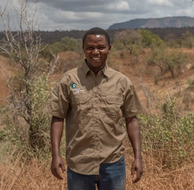
Khalid Mwakoba is a technical advisor for Frankfurt Zoological Society on GIS for anti-poaching and ecological monitoring in Selous Game Reserve (SGR), Tanzania. His major roles include advising the SGR management on anti-poaching and ecological issues based on GIS analyses results that he regularly performs. As well as building and maintaining GIS infrastructures for data availability he also conducts routines GIS trainings to SGR rangers. Working inside the reserve he can relate well the needs for spatial awareness in relationship to when things happen and why for advising. Currently, meanwhile, he has just joined a PhD program researching on the impacts of climate change and ecosystem-based adaptation-community based wildlife conservation on Selous Game Reserve Ecosystem.
2018 Scholar Profile
KHALID MWAKOBA
Technical advisor-GIS for anti-poaching and ecological monitoring, Frankfurt Zoological Society (FZS), Tanzania.
Selous Game Reserve, Morogoro, Tanzania
https://fzs.org/en/projects/selous-conservation-project/
Email: [email protected]
Phone & WhatsApp: +255787520579
ORGANIZATION’S WORK
FZS is an international conservation organization based in Frankfurt in Germany with a number of projects across the globe. Founded by Prof. Bernhard Grzimek, FZS is committed to preserving wildlands and biological diversity in the last remaining wilderness areas on the planet. FZS Africa program has several projects in four different countries, Tanzania being the headquarters of the program.
In Tanzania FZS has four projects namely Serengeti conservation project, Serengeti ecosystem management, Mahale conservation project and Selous conservation project.
Serengeti conservation project
Provision of critical support and know-how for resource protection, monitoring, and park management.
Serengeti ecosystem management
Empowering local communities in the Serengeti ecosystem to engage in conservation while promoting conservation-compatible livelihoods
Mahale conservation project
Preserving tropical rainforest biodiversity and strengthening environmental security for local communities.
Selous conservation project
Protection of one of the largest remaining wilderness areas and a UNESCO World Heritage Site in Africa. Anti-poaching and ecological monitoring are the major areas of support under this project.
ROLE IN THE ORGANIZATION
I’m the technical advisor on GIS for conservation under FZS Selous Game Reserve Conservation Project. This is almost my fourth year now with the organization in this role with the same project. My duties includes training rangers on data collection tools and methods, and basic GIS methods. I’m also responsible for processing and analyzing ground and aerial anti-poaching patrol data for evaluation and planning. Furthermore, as part of my GIS work I do mapping of different themes such as land cover/use (change detection) and tourism. Finally, I supervise the use of digital VHF radio system and lead the efforts to integrate it with GIS. Such a wide work portfolio has helped me promote the use of GIS within my organization and to our partner Selous Game Reserve (SGR).
As a consequence of my initiative, efforts and guidance on geospatial matters, as FZS project we have been able to remap land use/cover change of SGR dating back to the last thirty years ago by using ArcGIS and Landsat imageries. We have also been able to install GIS infrastructures and apply different GIS methods and workflows in relation to anti-poaching and the general conservation. Through fishnet analysis, buffer zones and density mapping we can now get reliable estimates of the area covered by both ground and aerial patrols. This is a new metric we have introduced in SGR for performance evaluation and planning. Again, we have led mapping of different types of infrastructures for tourism development in SGR. Again, for the first time several rangers (5) have been able to get trained basic GIS skills and so many other rangers (250) have vastly improved their capacity on using GPS units. Of this number, several of them for the first time learnt how to use a GPS unit as a tool for data collection for feeding into GIS works.
Finally, my role within FZS is evolving and expanding. I now advice Tanzania Wildlife Management Authority the body which is responsible for the management of game reserves (protected areas where sports hunting is done) on GIS infrastructures building and applications. This is a huge but rewarding work considering that there are at least forty (40) game reserves in Tanzania of different size the largest being Selous Game Reserve which has an area size of around 50, 000 km sq. that I’m now assisting with my GIS technical expertise.
HISTORY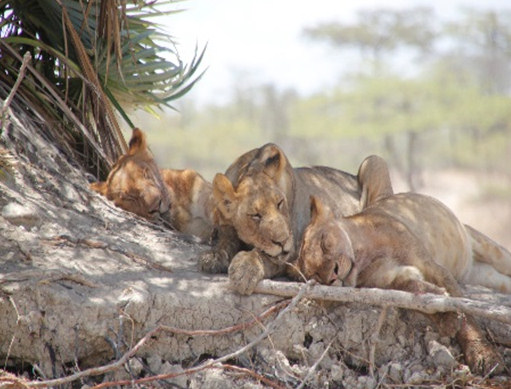
I grew up in a family which used to hunt in the buffer zones of the country’s largest national parks and game reserves. Hunting for holiday seasons and national holidays was a routine. Then, Geography became my favorite from elementary school. The combination of my family hunting background and Geography introduced me to the importance of conservation for local and national economy. I pursued Geography and related disciplines (e.g. environmental studies) all the way to the university level where I was introduced to the concept of GIS. The introduction to GIS applications was always vague especially when I heard or read that it is useful in so many different disciplines like conservation, forestry, agriculture and so on. I was amazed and interested to know more about the software and its capabilities.
Fortunately, later I got a scholarship to study an online master’s degree in GIS at Lund University. Currently, I’m finalizing it by writing my master’s thesis project on the role of ecological adaptation (community-based wildlife conservation) in enhancing the resilience of Selous ecosystem to climate change. At first, I was a bit disappointed to learn that in order to become highly successfully in GIS, it was equally necessary that I improve my computer skills as well as. But because of my passion and determination to succeed in GIS I would say I improved quite a lot on computer, installation, networking and troubleshooting issues which I never knew before.
Therefore, in part because of such a family and academic background when I started working on GIS as a private consultant, I preferred conservation consultancies more to other fields. Whenever GIS job or consultancy for conservation became available, I was always there for that.
ROLE IN THE LOCAL SCGIS CHAPTER
Unfortunately, there is no local SCGIS chapter in my country. But there is a GIS users’ community as an email list for the members. It is the platform for the member to share GIS technical ideas, provide GIS news, and share the data. Besides that, I’m a member of some social media international GIS groups where the members get to share GIS tricks, read regular GIS articles, ask questions, download the data and such.

TEACHING & LEADERSHIP
I have formally trained GIS to Selous rangers and I still do that whenever there is a need to do so. Driven by the objective of the training my class is small, usually it consists an average of 5 rangers. The experience of training people who have never heard much about GIS before but are also amazed by what it can do it is encouraging. The trainees are not only curious to get to know the process and the end result of the geospatial task at hand but also the data capture tools and mechanism involved and its link to GIS. Because of this the trainees are usually attentive, composed in their thinking and work hard because I normally tell them that GIS has lots of logic and for beginners like them it also needs constant practices in order to succeed. On the other hand, because of the thinking and time involved some think GIS is hard to comprehend. To reinforce their learning process, I have created a whatups group for this class to help them with questions they normally have, and for tracking their progress on their GIS projects in their respective areas of work.
LEARNING GIS
I did teach myself before I got enrolled for an online GIS master program which I’m about to graduate from. As well as being part of GIS professional groups for learning and exchanging technical tricks and tips, I have been following extra free online courses offered by ESRI on ArcGIS Pro and ArcGIS Online.
MY CURRENT GIS CAPABILITY/EXPERTISE
Except on most of GIS programming languages of which I’m not familiar with very much I’m an advanced GIS user. I have been using ArcGIS since when it was called ArcView and currently, I’m adapting to ArcGIS Pro.
The nature of my work requires various skills to meet different specifics needs. Data collection, creation (e.g. digitization and geo-referencing) and cleaning, data conversions between formats (e.g. vector to raster and vice versa, shapefile to geodatabase etc.), building and managing geodatabase, spatial analyses (e.g. density mapping and surface analyses), land use/cover mapping, map production of different themes, and applying ModelBuilder to mention just a few methods and workflows that I constant apply in my routine GIS portfolio.
Apart from ArcGIS desktop and Pro I’m also experienced in web GIS technologies specifically ArcGIS online. Whenever I’m on Pro I use ArcGIS online subscription service as a source of real time data, hard-to-get-data and for sharing maps with other people within the organization. I get annual licenses under ESRI conservation grant which has assured me of continuous use of ArcGIS desktop, ArcGIS Pro and ArcGIS online.
xPark xAntipoaching xEducation xEnforcement x2018Scholar x2018Talk xScholar xTalk xTanzania xPOC xAfrica xArcGISPro xArcGISOnline xModelBuilder
-
 Anonymous User