- Home
- :
- All Communities
- :
- Industries
- :
- Science
- :
- Ocean Science
- :
- Ocean Science Blog
- :
- New Multidimensions in ArcMap
New Multidimensions in ArcMap
- Subscribe to RSS Feed
- Mark as New
- Mark as Read
- Bookmark
- Subscribe
- Printer Friendly Page
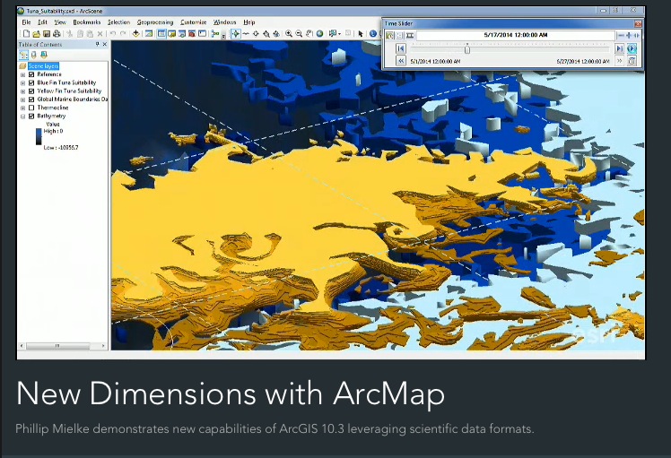
As was shown at this year's Esri User Conference, ArcMap now incorporates multidimensional data into GIS workflows to further the advancement of science (see Philip Mielke's excellent plenary presentation). This is a very important concept that we at Esri would like re-emphasize. With all the attention and focus on ArcGIS Pro, it is imperative that we do not forget that ArcGIS Pro will not do everything that Desktop can do, and that we continue to improve and enhance Desktop as well. ArcGIS for Desktop is still being enhanced and remains one of our most powerful GIS products (i.e., bigger than an app), providing much of the capability to fuel the ArcGIS platform. Our goal is to ensure a long term commitment to Desktop. ArcGIS Pro is just a complementary application to what our users already know about Desktop. While there are a number of enhancements to Desktop at 10.3, the multidimensional improvements are very important as we seek to advance science, and to position ArcGIS to always focus on advancing geographic information science in particular. Key messages from Philip's demo:
- In addition to lightweight apps, enhancements abound in the more powerful and comprehensive ArcGIS desktop. Earlier in the morning plenary, the audience saw the new ArcGIS Pro app. But this demo represents a highlight of the powerful ArcMap with ArcGIS for Desktop.
- Advancing science.
- Users can consume scientific multidimensional datasets. Users can symbolize them with Vector Field Symbology.
- The Python Adapter Function gives users the ability to use Python to model their data.
- Users can animate Time-enabled data in ArcSceneTwo.
You must be a registered user to add a comment. If you've already registered, sign in. Otherwise, register and sign in.