- Home
- :
- All Communities
- :
- Products
- :
- ArcGIS QuickCapture
- :
- ArcGIS QuickCapture Blog
- :
- Get Started with ArcGIS QuickCapture Live Training...
Get Started with ArcGIS QuickCapture Live Training Seminar
- Subscribe to RSS Feed
- Mark as New
- Mark as Read
- Bookmark
- Subscribe
- Printer Friendly Page
- Report Inappropriate Content
What a day today! Danielle Hopkins and I delivered our Get Started with ArcGIS QuickCapture Live Training Seminar three times. Below is a compilation of the most common questions we got and a link to the recording as well.

 Listen to the recording here
(You will need to login with your Esri account to see the Watch optio...
What are the most common use cases for QuickCapture? We originally productized ArcGIS QuickCapture with field data capture workflows for the transportation industry in mind. Think night retroreflectivity inspections, road hazard monitoring, road-kill surveys, at-speed road asset inventories, snow-plow monitoring, etc. Since we launch in July 2019, however, we have seen the use of QuickCapture expand into many, many other use cases: wildlife aerial surveys, right of way patrols, documentation of code violations, weed abatement programs, trail mapping, street-light patrols, quick sign inventories, utility locator, quick damage assessments, sidewalk and pavement condition surveys, etc.
We have documented a handful of use cases recently:
Can ArcGIS QuickCapture work while disconnected from the network? Yes!. This was by far the most common question throughout the Live Training Seminar. In short: Once a QuickCapture project has been downloaded into your device, you can use it while offline. All captured data will remain in your device and once you get back online again, it will be sent to ArcGIS. There is nothing special you need to do to get this going, other than simply downloading your project into your device.
What mobile platforms are supported? Android, iOS and Windows. You can download the mobile app from the corresponding app stores or from our download page. Details about the operating system versions supported can be found at Requirements—QuickCapture | Documentation
For ArcGIS QuickCapture to work, your must configure your device to allow QuickCapture to access your location.
Does ArcGIS QuickCapture work with an ArcGIS Enterprise portal? Yes, as long as the version of your portal is 10.7.1 or newer. Your data can configure it against a multi-user enterprise geodatabase or the ArcGIS Data Store.
If you have an older version of ArcGIS Server, or do not have a portal installed, you can register your ArcGIS Server feature services as items in ArcGIS Online and have your QuickCapture projects work against them. In this hybrid approach, your data lives in ArcGIS Server, but end users will be authenticated against your ArcGIS Online organization.
Does QuickCapture work with external GNSS receivers? Yes. You can choose to connect your QuickCapture app to an external GNSS receiver to improve the location accuracy of your data and associate location quality GNSS metadata with your records. The list of supported GNSS receivers is available at Use a high-accuracy receiver—QuickCapture | Documentation If the particular receiver you want to use is not supported yet, feel free to propose support for it throughArcGIS Ideas.
What type of ArcGIS account I need to use ArcGIS QuickCapture? It depends. If you want to create new QuickCapture projects, you will need a Creator (or GIS Professional) user type with privileges to create new content. If you simply want to use the mobile app to collect data, you will need a Field Worker (or Creator, or GIS Professional) user type with privileges to add records into feature layers. Alternatively, the mobile app can also be used with an Editor user type, as long as you buy an add-on license for the QuickCapture mobile app.
Please note that Free ArcGIS Public Accounts are not supported with ArcGIS QuickCapture.
I want to use ArcGIS QuickCapture for a crowd-sourcing project. Is that possible? At this moment in time, end users of the mobile app need an ArcGIS account. Using the ArcGIS Hub | Community Engagement Software you can get ArcGIS accounts for everyone of your volunteers.
In a future release, we have plans to allow ArcGIS Hub Premium customers to share QuickCapture projects publicly. This will open up the use of the QuickCapture mobile app, even to users without an ArcGIS account.
Can I bring up a window after a button is pushed so the end user can add some extra information? Yes. This is done through User Input windows, which you can configure to capture free text, numeric values or a selection from a list. To learn more about configuring User Inputs, check our https://community.esri.com/community/arcgis-quickcapture/blog/2019/10/06/understanding-user-inputs-i... blog post.
Can I capture a point observation while a line button is active? Yes. You can in fact capture multiple lines at the same time and while they are active, you can capture additional points. This is known as nested field data capture. Say for example you want to map the condition of pedestrian trails within a park as well as park furniture. You can activate the Trail in Good Condition button to capture a line as you walk, and capture benches and other park furniture as you go.
Is it possible for an end-user to create new buttons on the fly? No. Only the author of the QuickCapture project can create and organize data capture buttons. If you want to accommodate your project to the possibility of new feature category types, I would consider adding a new button for a generic 'Other' category. You can use a User Input to let end users type some free text to describe the new category. You can later look at entries in the category 'Other' and decide if more buttons should be added to the project.
Can multiple feature layers be added to a QuickCapture project? Yes. You can combine layers of different geometry types for example. You can also have a mix of layers coming from ArcGIS Online and Enterprise if you like. You can also build multiple QuickCapture projects on top of a single feature layer, and even build Survey123 and Collector projects against the same layers you are using with QuickCapture.
I am a University professor and want to cover field data collection tools. Should I teach QuickCapture, Survey123 or Collector? I would say that an important lesson for your students is to learn that not one single tool is going to serve all possible field data collection workflows. The three apps you mention are all about capturing georeferenced data in the field: they all let you capture points, lines and polygons; they all can be combined with external GNSS receivers, they all let you capture photos, etc. Now, the way they let you capture data is radically different. Choosing the right user experience to meet the way field users work is critical for success.
- QuickCapture is ideal for rapid and at-speed data collection workflows. It delivers a minimalist user experience where end users can capture observations with minimum distraction and with minimum training. Think aerial patrols, quick reporting of issues and violations, at-speed road asset inventories, etc.
- Survey123 delivers a form-centric approach to data capture. This is for use cases where you need people to spend a bit more time completing a form to capture multiple aspects of something. Think routine asset inspections, formal damage assessments, documenting code violations, etc. If people are used to do their work completing a paper form... chances are you in front of a candidate for Survey123.
- Collector is great when you want the data capture experience driven from a map. This is the way to go when working with multiple GIS layers is needed to provide context to your own editing workflows, or where you want to map assets across multiple layers of a map.
In practice, you will find some workflows where any of the options above could do the job. There are other use cases where one app will be the a best fit. Choosing wisely between the different options often comes after full understanding of the pros and cons of each in relation to your specific workflow. Your seasoned students will be able to make the right call with experience. Finally, in some cases it makes sense to combine apps as well.
Can I use QuickCapture to update existing features? No. With QuickCapture you can only submit new records. Survey123 and Collector would be a better fit.
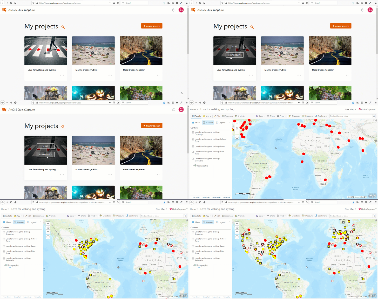
How can I visualize all data captured from QuickCapture in a map? Simply bring your QuickCapture feature layers into a web map. You can optionally set a refresh rate on your web map layers so new data will appear automatically as it gets submitted to ArcGIS. Even better, once you have your web map ready, bring it over into an Operations Dashboard or Web AppBuilder web application to deliver the best experience.
The animation below shows how you can bring your QuickCapture feature layers into a web map to get started.

Can ArcGIS QuickCapture be customized as a white labeled product? Absolutely. The source code of the ArcGIS QuickCapture mobile app is available to AppStudio for ArcGIS developers. You can build your own version of the mobile app, change it look and feel and functionality, and upload it to the store under your own branding.
You must be a registered user to add a comment. If you've already registered, sign in. Otherwise, register and sign in.