- Home
- :
- All Communities
- :
- Products
- :
- ArcGIS Pro
- :
- ArcGIS Pro Questions
- :
- Re: POI suggestions when associated address entere...
- Subscribe to RSS Feed
- Mark Topic as New
- Mark Topic as Read
- Float this Topic for Current User
- Bookmark
- Subscribe
- Mute
- Printer Friendly Page
POI suggestions when associated address entered
- Mark as New
- Bookmark
- Subscribe
- Mute
- Subscribe to RSS Feed
- Permalink
- Report Inappropriate Content
Is there a way to build a locator with Create Locator to where a POI will also show as a suggestion when the associated address is entered? For my specific need, this would be most useful via the GeocodeServer REST endpoint.
Example : A user types in 123 MAIN ST the following suggestions would show if applicable:
123 MAIN ST, City, Zip
McDonald's, 123 MAIN ST, City, Zip
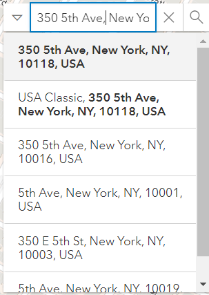
I'm not seeing this as a functionality with the World Geocoding service, so I'm guessing it is not possible, but wanted to check before I throw it up as an enhancement idea. The attached photos show a search for The Empire State Building and then for it's associated address and it does not show up.
Solved! Go to Solution.
Accepted Solutions
- Mark as New
- Bookmark
- Subscribe
- Mute
- Subscribe to RSS Feed
- Permalink
- Report Inappropriate Content
@ScottFedak2085 The information that I provided shows what is supported for POI roles and unfortunately, searching for only the address of the POI will not return the POI name for a locator created with the Create Locator tool or the ArcGIS World Geocoding Service.
- Mark as New
- Bookmark
- Subscribe
- Mute
- Subscribe to RSS Feed
- Permalink
- Report Inappropriate Content
Hello Scott,
I would venture to say that in order for this to be possible, you would have to set up a point of interest layer for bot the address and the location you would like returned in your results. Then use this to create a locator and then a service if so desired.
- Mark as New
- Bookmark
- Subscribe
- Mute
- Subscribe to RSS Feed
- Permalink
- Report Inappropriate Content
Thanks Amanda. I feel like I would lose things like subaddress functionality using addresses points outside of it's intended role. Having address data in both roles would also seem like it would pull in redundant results, but I'll try and give it a shot if I get a chance. I currently don't have address data separated out with the POI data, it just references a field with the Full Street Name, so that may be my a next step too.
However, not seeing it as a functionality in the ArcGIS World Geocoding Service suggestions makes me hesitant to think it is a functionality I'm going to be able to find some work-around to tease out. Google will show you an associated POI after you type an address and hit enter, but not as a suggestion while using the geocoding service. Bing was actually the only commercial geocoding service I've found to date that will show a POI as you're entering an address into the geocoding service.
- Mark as New
- Bookmark
- Subscribe
- Mute
- Subscribe to RSS Feed
- Permalink
- Report Inappropriate Content
In one of my previous projects, we had a similar issue where the search would not work as we had expected. Unfortunately, due to time crunch we ended up using the Elastic Search which gave us much more desired results. You can read up on that if you wish.
While we were trying to resolve the issue at the time, we did learn that the World Geocode service is a Composite Address Locator service which is basically a combination of many Address locators at the backend.
Additionally, we did look up at quite a few options that ArcGIS provide that would surely enhance and enrich the user experience. Few of the parameters would include Address Locator Style, Reference tables & Alternate Tables, Match Score and Suggest.
In our case we were building a custom address locator and I would say we met up to 80% of the client requirement with just playing around with these options.
You may refer to the links below which might be helpful.
- Tips for improving geocoding performance
- Tips for improving geocoding quality
- Additional tuning options
- Composite locator tuning tips
~Shan
- Mark as New
- Bookmark
- Subscribe
- Mute
- Subscribe to RSS Feed
- Permalink
- Report Inappropriate Content
@shan_sarkar Thank you. I feel like I've been in and out of those links a million times for the past months, and will continue to do so 🙂
The Create Locator GP tool and locator output is easy to build, versatile in the use of roles, and overall I'm fairly happy with the output; but like you said, if often times only gets 80% of the way there or has competing configuration needs. I've been trying to configure some locators for Public Safety / CAD purposes, and it doesn't always meet the needs for such a high demand and stressful environment. In addition, there are too many black boxes, especially with suggestions, on how the locators are running behind the scenes, which often requires a lot of data manipulation and test building to figure out.
It almost feels to me like ESRI locators were built with a more global scale in mind, where there is lots of data, potentially lots of duplicate attribute but spatially different data, and there is a need to streamline the underlying reference data. I think this approach may miss some of the nuances and configuration that may be needed on a more local level.
Unfortunately, I don't think switching products will be an option. There may be other build options, more work-around options, more "under the hood" options to look into, but that is all just adding more complexity into an already complex system that I'd like to avoid.
- Mark as New
- Bookmark
- Subscribe
- Mute
- Subscribe to RSS Feed
- Permalink
- Report Inappropriate Content
@shan_sarkar and @ABishop
I finally got around to doing a quick test today and I verified that you can tack the address of a POI onto the end of the name and it will show up as a suggestion when searching for the address. For example, the mapped Name field when building a locator with a POI role (Create Locator) would look something like the following (Dash not needed):
Art Museum - 123 Main St, Milwaukee, WI, 53202
The above would show up as a suggestion if 123 Main St is searched for. This muddies up the output fields and potentially presents issues with FindAddressCandidate results but it is a version of a workaround.
- Mark as New
- Bookmark
- Subscribe
- Mute
- Subscribe to RSS Feed
- Permalink
- Report Inappropriate Content
@ScottFedak2085 The following help topic section describes the POI role and gives illustrations of the types of searches that are supported and what the result would look like in ArcGIS Pro, https://pro.arcgis.com/en/pro-app/2.9/help/data/geocoding/introduction-to-locator-roles.htm#ESRI_SEC.... More details about POI searches using REST can be found below. I would say that using the REST endpoint is for development and testing purposes and when using it you should include the location parameter as part of the requests since there is not map that location can be determined from like in ArcGIS Pro or the Map Viewer.
- https://developers.arcgis.com/rest/services-reference/enterprise/suggest.htm#ESRI_SECTION2_824C2C37C... (see example 'Get suggestions using location' and 'Use proximity with suggestions' section)
- If you have included your own categories for the POIs you can search based on the category, https://developers.arcgis.com/rest/services-reference/enterprise/suggest.htm#ESRI_SECTION2_F6AA0E35A...
- Mark as New
- Bookmark
- Subscribe
- Mute
- Subscribe to RSS Feed
- Permalink
- Report Inappropriate Content
Thank you @ShanaBritt!! I scanned through those links and will look at them in more detail when I get a chance. Hopefully I can uncover a better workaround for getting POI's to show when it's associated address is entered.
- Mark as New
- Bookmark
- Subscribe
- Mute
- Subscribe to RSS Feed
- Permalink
- Report Inappropriate Content
@ScottFedak2085 The information that I provided shows what is supported for POI roles and unfortunately, searching for only the address of the POI will not return the POI name for a locator created with the Create Locator tool or the ArcGIS World Geocoding Service.
- Mark as New
- Bookmark
- Subscribe
- Mute
- Subscribe to RSS Feed
- Permalink
- Report Inappropriate Content
Have there been any enhancements made over the last year that now allow this as a possibility?