Hello ESRI Help Forum users,
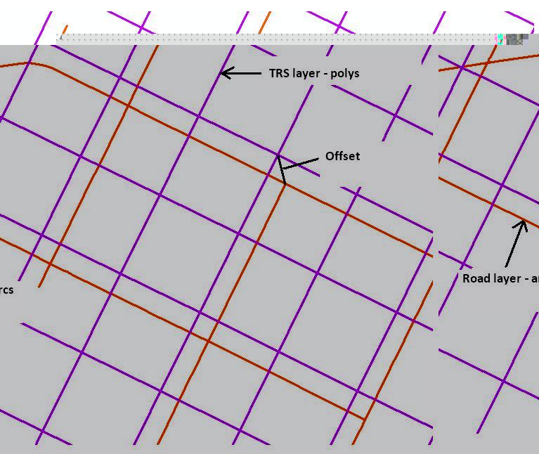
I am trying to generate minimum, maximum and average offset statistics between two datasets. The first dataset is made up of polygons that represent Townships, Ranges and Sections (TRS - based on the Dominion Land Survey), the second dataset is road arcs.
There is an offset between the two datasets that varies across the full extent. The road arcs are GPS compliant, the TRS are a mathematical construct. Any ideas how to proceed?
Here's a picture to show the offset.
[ATTACH=CONFIG]15921[/ATTACH]
Thanks in advance for any input you may provide.
G Parent