Turn on suggestions
Auto-suggest helps you quickly narrow down your search results by suggesting possible matches as you type.
Cancel
- Home
- :
- All Communities
- :
- Products
- :
- Spatial Data Science
- :
- Spatial Data Science Questions
- :
- Help simplifying a buffer output
Options
- Subscribe to RSS Feed
- Mark Topic as New
- Mark Topic as Read
- Float this Topic for Current User
- Bookmark
- Subscribe
- Mute
- Printer Friendly Page
Help simplifying a buffer output
Subscribe
1499
3
05-25-2018 08:48 PM
05-25-2018
08:48 PM
- Mark as New
- Bookmark
- Subscribe
- Mute
- Subscribe to RSS Feed
- Permalink
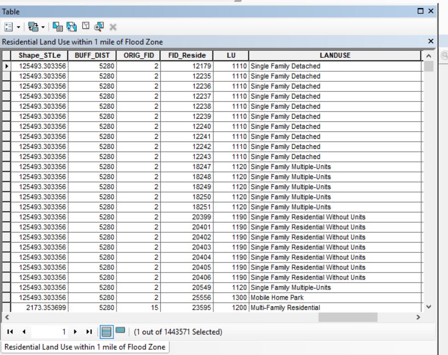
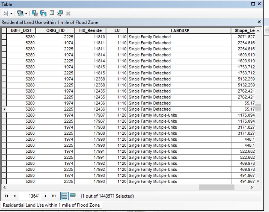
I'm taking an intro GIS course where we had to make a final map project. I ran a buffer of flood zones to see what residential parcels are within a 1 mile radius. The output has duplicated some of the zones. How can I simplify my data so the parcels are only listed once. I want to make a graph to show what percent of all residential parcels are at risk for flooding.
3 Replies
05-25-2018
11:39 PM
- Mark as New
- Bookmark
- Subscribe
- Mute
- Subscribe to RSS Feed
- Permalink
When you buffered, did you dissolve the overlaps?
05-26-2018
08:58 AM
- Mark as New
- Bookmark
- Subscribe
- Mute
- Subscribe to RSS Feed
- Permalink
I think I did. I tried running it without dissolving and I couldn't figure out which parcels were selected. 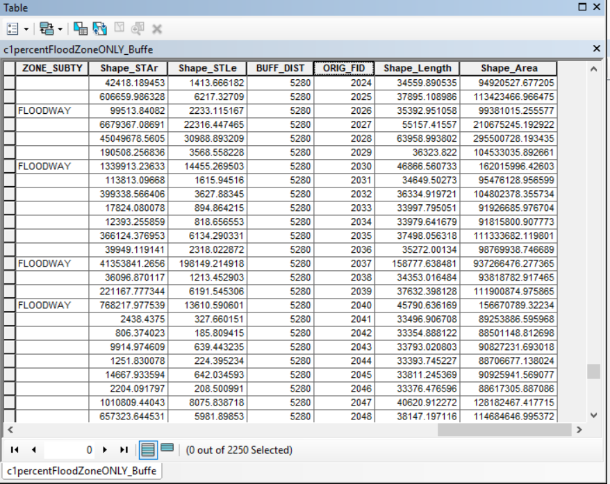
It didn't give me an FID_Res so I could identify which parcels were selected.
05-26-2018
09:47 AM
- Mark as New
- Bookmark
- Subscribe
- Mute
- Subscribe to RSS Feed
- Permalink
well 2250 is way better than 1.4+ million records