- Home
- :
- All Communities
- :
- Developers
- :
- Python
- :
- Python Questions
- :
- Raster Processing - ExecuteError: ERROR 010092: In...
- Subscribe to RSS Feed
- Mark Topic as New
- Mark Topic as Read
- Float this Topic for Current User
- Bookmark
- Subscribe
- Mute
- Printer Friendly Page
Raster Processing - ExecuteError: ERROR 010092: Invalid output extent?
- Mark as New
- Bookmark
- Subscribe
- Mute
- Subscribe to RSS Feed
- Permalink
I have been trying to run both the Line Density and Euclidean Distance processes within a script and am being given the same error in both cases. Both processes will use the same layer as input. The coordinate system for the input appears to be fine. Any thoughts?
****EDIT****
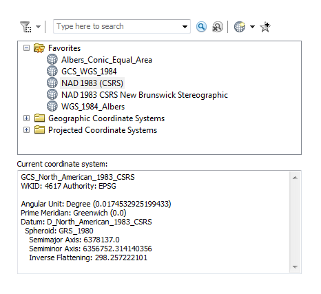
I have included the coordinate system info. below.
Solved! Go to Solution.
Accepted Solutions
- Mark as New
- Bookmark
- Subscribe
- Mute
- Subscribe to RSS Feed
- Permalink
those are geographic coordinates... project your data before you do any planar calculations (ie Euclidean). if you are in NB, project it to one of NB's provincial scale coordinate systems, and/or an appropriate UTM zone for your area...
- Mark as New
- Bookmark
- Subscribe
- Mute
- Subscribe to RSS Feed
- Permalink
Yikes, suppose sometimes you just need another set of eyes and another perspective. Thanks Dan Patterson
- Mark as New
- Bookmark
- Subscribe
- Mute
- Subscribe to RSS Feed
- Permalink
Glad it worked out Tyler