- Home
- :
- All Communities
- :
- Industries
- :
- Public Safety
- :
- Public Safety Questions
- :
- Is anyone building a USNG Geocode widget for WebAp...
- Subscribe to RSS Feed
- Mark Topic as New
- Mark Topic as Read
- Float this Topic for Current User
- Bookmark
- Subscribe
- Mute
- Printer Friendly Page
Is anyone building a USNG Geocode widget for WebApp Builder?
- Mark as New
- Bookmark
- Subscribe
- Mute
- Subscribe to RSS Feed
- Permalink
It seems there is no way to provide a web map or web mapping application where someone can simply type in US National Grid coordinates and zoom to that location on the map.
Has anyone built this yet or is it in the pipeline at Esri?
I am hoping there will be a geocoding service stood up or a custom widget built so we can provide this service to map users.
Solved! Go to Solution.
Accepted Solutions
- Mark as New
- Bookmark
- Subscribe
- Mute
- Subscribe to RSS Feed
- Permalink
*IMPORTANT* See my note below about using a USNG Geocoder as a Utility across your entire ArcGIS Online Account.
Configure utility services—ArcGIS Online Help | ArcGIS
Ok some options.
If you have the option to create custom deployment (host-your-own)
- Use Tim's widget it is awesome. Location Widget
If you are using the hosted WebApp Builder only
- You can use the Search widget with a USNG / MGRS geocoding service eg MGRS (GeocodeServer)
- Don't forget the Coordinate widget can be configured with USNG display and reverse geocoder
- The NGA_US_National_Grid (MapServer) map service does an OK job of displaying USNG on the map, but it should be used in conjunction with spatially explicit tools like the ones listed above.
Please keep the discussion going and if anyone has other ideas add to this thread.
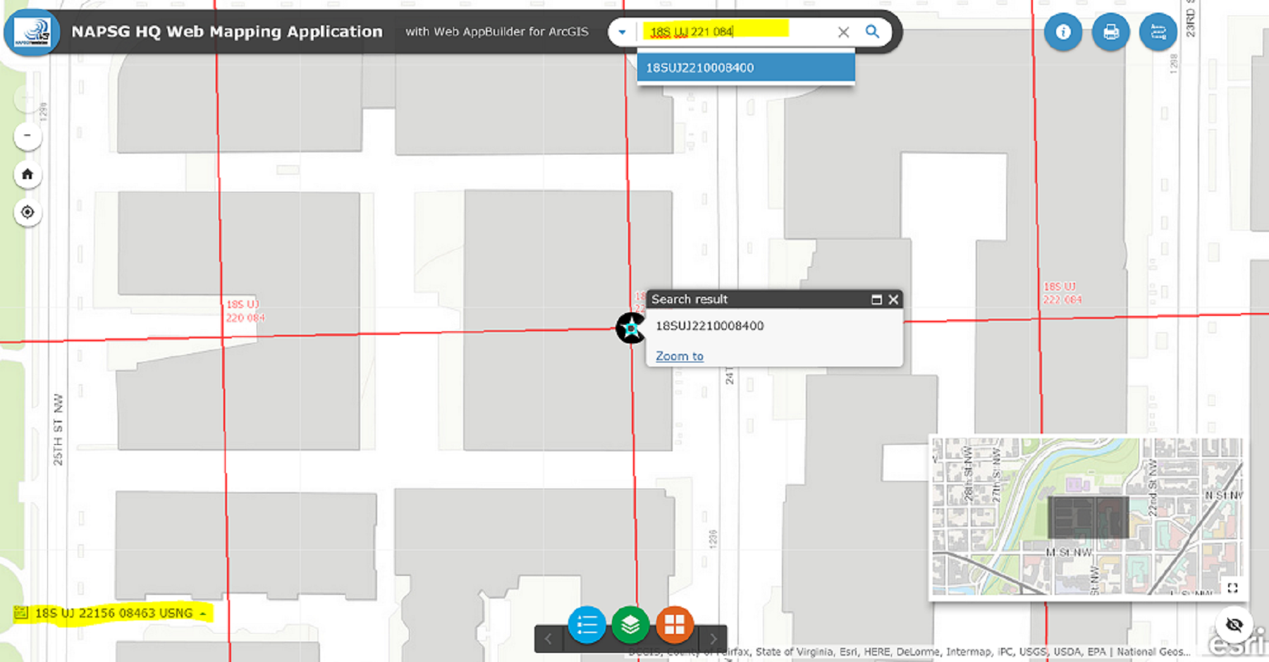
See my screenshot of the hosted WebApp Builder I configured using these options, link: ArcGIS Web Application
- Mark as New
- Bookmark
- Subscribe
- Mute
- Subscribe to RSS Feed
- Permalink
Hey Paul,
check out my Location Widget here: Location Widget
Here is the live version: ArcGIS Web Application
Tim
- Mark as New
- Bookmark
- Subscribe
- Mute
- Subscribe to RSS Feed
- Permalink
Thanks Tim Witt - nice simple interface.
I was also able to add USNG to the Search widget using this geocoding service
But this may just be a sample service and I am not sure of the source.
- Mark as New
- Bookmark
- Subscribe
- Mute
- Subscribe to RSS Feed
- Permalink
It works really well!
- Mark as New
- Bookmark
- Subscribe
- Mute
- Subscribe to RSS Feed
- Permalink
*IMPORTANT* See my note below about using a USNG Geocoder as a Utility across your entire ArcGIS Online Account.
Configure utility services—ArcGIS Online Help | ArcGIS
Ok some options.
If you have the option to create custom deployment (host-your-own)
- Use Tim's widget it is awesome. Location Widget
If you are using the hosted WebApp Builder only
- You can use the Search widget with a USNG / MGRS geocoding service eg MGRS (GeocodeServer)
- Don't forget the Coordinate widget can be configured with USNG display and reverse geocoder
- The NGA_US_National_Grid (MapServer) map service does an OK job of displaying USNG on the map, but it should be used in conjunction with spatially explicit tools like the ones listed above.
Please keep the discussion going and if anyone has other ideas add to this thread.
See my screenshot of the hosted WebApp Builder I configured using these options, link: ArcGIS Web Application
- Mark as New
- Bookmark
- Subscribe
- Mute
- Subscribe to RSS Feed
- Permalink
Paul,
do you know of any feature service that includes 10m or is 100m as close as it can get at this moment?
Tim
- Mark as New
- Bookmark
- Subscribe
- Mute
- Subscribe to RSS Feed
- Permalink
Tim -
I do not know of any that are public. But there are 100m layer packages available on ArcGIS online and in a pinch I have published these as feature services.
Let me know if you find any.
- Paul
- Mark as New
- Bookmark
- Subscribe
- Mute
- Subscribe to RSS Feed
- Permalink
For an all-javascript solution that converts between USNG and latlng, see the work by Larry Moore. Others worked on the code before Larry and they are credited in the js file.
Start here: USNG
Go to Larry's app and look at the source.
usng.js is near the bottom of the source listing.
I am using that code for point conversions in my Gmap4.
Here is a 100m USNG grid with the map centered near the Seattle space needle.
http://www.mappingsupport.com/p/gmap4.php?usng=10T_ET_4886_7428&tilt=off&z=17&t=h
Joseph Elfelt
Redmond, WA
- Mark as New
- Bookmark
- Subscribe
- Mute
- Subscribe to RSS Feed
- Permalink
UPDATE - The FEMA Geocoder seems to be disabled or secured. For now I am going to use this URL MGRS (GeocodeServer).
Also, if you have administrator privileges I suggest simply adding a USNG Geocoder as a Utility Service.
My Organization --> scroll down to Utility Services --> Geocoding --> ADD GEOCODER
Then all of your web maps and apps will have this as an option.
