Turn on suggestions
Auto-suggest helps you quickly narrow down your search results by suggesting possible matches as you type.
Cancel
- Home
- :
- All Communities
- :
- Products
- :
- ModelBuilder
- :
- ModelBuilder Questions
- :
- Automating County-Level DEM Downloads and Merging ...
Options
- Subscribe to RSS Feed
- Mark Topic as New
- Mark Topic as Read
- Float this Topic for Current User
- Bookmark
- Printer Friendly Page
Automating County-Level DEM Downloads and Merging with Model Builder
753
0
11-27-2024 09:57 AM

11-27-2024
09:57 AM
- Mark as New
- Bookmark
- Subscribe to RSS Feed
- Permalink
Hello Esri Community,
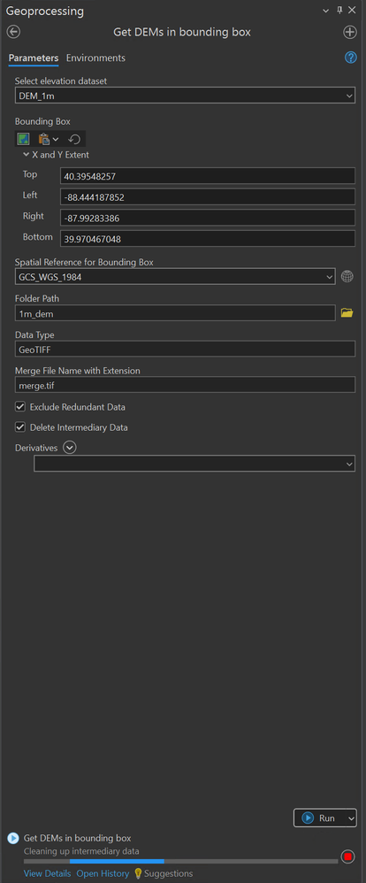
I’m currently working on downloading and merging 1-meter DEMs for multiple counties in Illinois using the USGS DEM Getter (Get DEMs in Bounding Box tool) and used geographic coordinate system WGS 1984. For a single county, I set the following parameters:
- Bounding Box Extent: Adjusted to match the extent of the county boundary (e.g., Cook County).
- Data Type: GeoTIFF.
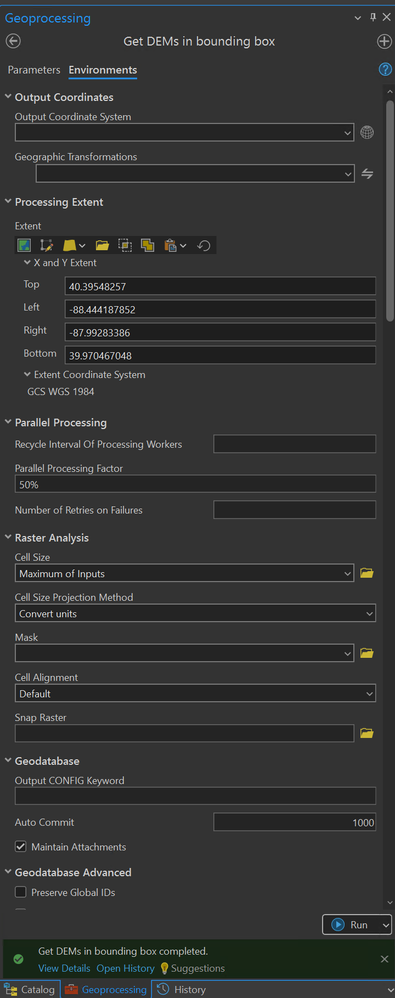
- Environment Settings:
- Processing Extent: Set to the county layer extent.
- Parallel Processing: 50%.
This approach works well for one county. However, I need to automate the process for all counties in Illinois. My goal is to use ModelBuilder to:
- Loop through each county boundary.
- Dynamically set the bounding box extent and processing extent (environment) for each county.
- Download and Merge the DEMs for all counties.
I’m seeking guidance on:
- Best practices for automating this workflow in ModelBuilder.
- Setting up a dynamic loop for county boundaries.
- Ensuring proper merging of DEMs after downloads.
If anyone has experience with similar workflows or advice on using the USGS DEM Getter tool in an automated setting, your input would be greatly appreciated!
Thank you!
Anna
0 Replies
