- Home
- :
- Community Resources
- :
- Member Introductions
- :
- Re: Introduce Yourself!
- Subscribe to RSS Feed
- Mark Topic as New
- Mark Topic as Read
- Float this Topic for Current User
- Bookmark
- Subscribe
- Mute
- Printer Friendly Page
Introduce Yourself!
- Mark as New
- Bookmark
- Subscribe
- Mute
- Subscribe to RSS Feed
- Permalink

Welcome to GeoNet!
We are a community that collaborates, learns and shares together. To help you connect with other members, we started this introduction thread. Think of this as your intro to GeoNet networking and a chance to get to know each other as we begin our GeoNet journey.
Please introduce yourself to the rest of the community by sharing your answers to the questions in the comments section below.
- Where do you work and what is your role?
- What GIS success have you had this year and what product did you use? (big or small - no win is out of bounds)
- What is your expertise (GIS related or not), and how can that help the community?
Bonus Round! Post the coordinates to your favorite place on earth.
note: this post has been archived, and is available in read only mode. To create a new introduction, please visit the new GeoNet Member Introductions space. Thank you!
Manager, Community Experience & Programs
- Mark as New
- Bookmark
- Subscribe
- Mute
- Subscribe to RSS Feed
- Permalink
Dominic Regli, Welcome to GeoNet! I hope you find everything you need. Everyone is really helpful, so don't hesitate to ask questions! To get started, use the main navigation to find Product Communities, Industry Communities or Developer Communities.
Cheers,
Michelle
Manager, Community Experience & Programs
- Mark as New
- Bookmark
- Subscribe
- Mute
- Subscribe to RSS Feed
- Permalink
Hello,
I’m unable to find your reply in GeoNet. Any suggestions on how I could do this? Also, I may be going to the GIS convention in July, Will you be going?
Happy Friday &,
Shalom,
Sue
- Mark as New
- Bookmark
- Subscribe
- Mute
- Subscribe to RSS Feed
- Permalink
Where do you work and what is your role?
Hi, my name is David Forbuss and I'm a GIS Technician at Rogue Valley Sewer Services in Central Point, OR. I also assist the Network Administrator with various IT activities.
What GIS success have you had this year and what product did you use?
We have recently migrated our organization to fully cloud based GIS using ArcGIS Enterprise/Portal, and the plethora of apps and software available (Collector, Workforce, Survey123 etc..). The response from our staff has been very positive, and new ideas of how to implement the apps are arising every day.
What is your expertise (GIS related or not), and how can that help the community?
My expertise is relating to the needs of the end user (because I used to be one!). This has been a tremendous help when developing new uses for Collector by our field crews.
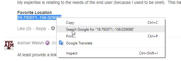
Favorite Location
19.792071,-156.029088
- Mark as New
- Bookmark
- Subscribe
- Mute
- Subscribe to RSS Feed
- Permalink
At least provide a link if I'm going to have to guess where this might be! 
- Mark as New
- Bookmark
- Subscribe
- Mute
- Subscribe to RSS Feed
- Permalink
Cool link, but you can do this just as easily:
- Mark as New
- Bookmark
- Subscribe
- Mute
- Subscribe to RSS Feed
- Permalink
- Where do you work and what is your role?
Hello All, I'm Mani Prathap Gopaluni, Happy to join here in Geonet Community.
I am Having 16+ years of Experience in GIS Industry along with Land & property management.
Currently I am associated with Sri City an integrated Smart City ( Sricity Private Limited as a developer)
as a GIS & Land planner.
- What GIS success have you had this year and what product did you use? (big or small - no win is out of bounds)
Since This organization is related to Infrastructure , majority of the data format will be in CAD, where I am trying to build GIS Database and GIS Systems implementation for the City operations. I am collecting all the related information for building a data model , where this community support expecting.
- What is your expertise (GIS related or not), and how can that help the community?
Arc GIS - 16+ years
- Mark as New
- Bookmark
- Subscribe
- Mute
- Subscribe to RSS Feed
- Permalink
Welcome Mani!
Can you share your Job location....
- Mark as New
- Bookmark
- Subscribe
- Mute
- Subscribe to RSS Feed
- Permalink
- Where do you work and what is your role?
- Hello, this is Hugo Mora. I live in Chile and I am a CRM/BI consultant, beginning my own company
 for "customer insights" processes. I work with Microsoft solutions, including Dynamics 365 and Power BI and I am learning to use the "ArcGIS Maps for Power BI" visual.
- Hello, this is Hugo Mora. I live in Chile and I am a CRM/BI consultant, beginning my own company
- What GIS success have you had this year and what product did you use? (big or small - no win is out of bounds)
- 2018 was my first year I began to work with GIS systems. And this new 2019 I have the objetive to incorporate GEO info for my "customer insights" solutions.
- What is your expertise (GIS related or not), and how can that help the community?
- Little for GIS: I have experience with Spatial Data on SQL Server and Exasol (geometries with SQL language) and calculating some elements as distance and intersections, but not real experience with GIS systems. Hope to learn a lot in this community and hopefully share my learning with you.
- A lot for Customer Relationship Management Systems. Really hope to engage with anybody who wants to create solutions for customers (patients, citizens, etc.) that need to use GIS info.
Favorite location? MANY but for Sun, Sand and Peace, I recommend "Cabo Polonio" in Uruguay: -34,402963, -53,782149
Happy 2019 to everybody!
Hugo.
- Mark as New
- Bookmark
- Subscribe
- Mute
- Subscribe to RSS Feed
- Permalink
Hi Hugo! Cabo Polonio looks beautiful! Are there really extreme tides there? I noticed the fishing boats are way up out of the water.
- Mark as New
- Bookmark
- Subscribe
- Mute
- Subscribe to RSS Feed
- Permalink
- Where do you work and what is your role?
Hello all, my name is Mark A Morales. I'm an aspiring Geographer with a BA in Physical Geography (1996) from Buffalo State College, and an MA in GIS (2009) from SUNY Buffalo, home of the NCGIA (National Center for Geographic Information and Analysis). I've come along way really, but have yet to find employment in GIS due to some health setbacks that are proving more formidable than any of the academic challenges that I've had to date. Oh, did I mention that as an aspiring Geographer, I was awarded the prestigious Barry M. Goldwater Scholarship in 1994, while pursuing my first BA degree. Mind you, this scholarship is usually awarded to aspiring scientists principally in Math and Engineering. So, for me, a former High School dropout, it was in the words of the Dean of Natural Sciences "a real feather in my cap".
- What GIS success have you had this year and what product did you use?
Since I haven't been employed full time in two decades, its put a big pinch on my wallet. I've been doing small personal projects on an Open Source GIS that have used some of the tools that were developed in graduate school while a student at SUNY Buffalo. My interests are in Spatial Analysis, which is what brought me to this site today. I'm interested in ESRI's products like ArcGIS, Spatial Analyst, etc. And ESRI Education is a new one for me. My MA degree's subject was the Geostatistical Analysis of Nitrate Deposition to the Niwot Saddle in Colorado. I had hoped that the tool set in ArcGIS would have been the acceptable method of analysis, but alas even though Ordinary Kriging was apropos, there was some conflict with what was known as a "moving window" statistic, and non-stationarity. So, the ArcGIS tool though useful wasn't the proper tool for the job.
In graduate school I was so glad though to see that ArcGIS had incorporated such a dynamic set of statistical tools in their product suite.
- What is your expertise (GIS related or not), and how can that help the community?
Having just an MA in GIS, I'd hardly qualify as an expert. I'd really like to work on the Developer's side of GIS, and would probably benefit on seeing what's behind the .shp shapefile format. I've tried my had to some degree at Google Earth's programming, and some very basic concepts related to the Google Maps API. Its there where my world stopped turning. I don't really know how to program computers, with only having taken two courses in Pascal during my undergraduate years (1992-1996), and I don't really have the language to adequately describe my dilemma, except to say, I want to engage in GIS Development, and I have some ideas, but I just don't know where to start. I've thought of doing remedial work and starting a second bachelor's degree in CIS, but that doesn't seem feasible at this point.
If I can help in other ways, I'm more than glad to.
Favorite Location:
Its a small park in the City of Tonawanda, NY, called Clinton Park. The public gazebo, surrounded by a couple 100+ years old maple trees and some oaks, is quite relaxing to me.
43° 1'3.80"N, 78°52'53.63"W