Turn on suggestions
Auto-suggest helps you quickly narrow down your search results by suggesting possible matches as you type.
Cancel
- Home
- :
- All Communities
- :
- Products
- :
- Mapping
- :
- Mapping Questions
- :
- Huge symbology sizing
Options
- Subscribe to RSS Feed
- Mark Topic as New
- Mark Topic as Read
- Float this Topic for Current User
- Bookmark
- Subscribe
- Mute
- Printer Friendly Page
Huge symbology sizing
Subscribe
735
2
06-03-2019 01:47 PM
06-03-2019
01:47 PM
- Mark as New
- Bookmark
- Subscribe
- Mute
- Subscribe to RSS Feed
- Permalink
I'm having a weird issue with symbology in ArcMap. I need to size lines and points to 200 - 300 pts minimum just to see it on my map. Anyone have any clue what's going on?
I'm relatively new to ArcMap, but I'm working from a file someone else started.
Thanks!
2 Replies
06-03-2019
02:48 PM
- Mark as New
- Bookmark
- Subscribe
- Mute
- Subscribe to RSS Feed
- Permalink
Can you provide screenshots of original size of the lines and points that were hard to see and larger sized lines and points that are easier to see?
06-03-2019
04:01 PM
- Mark as New
- Bookmark
- Subscribe
- Mute
- Subscribe to RSS Feed
- Permalink
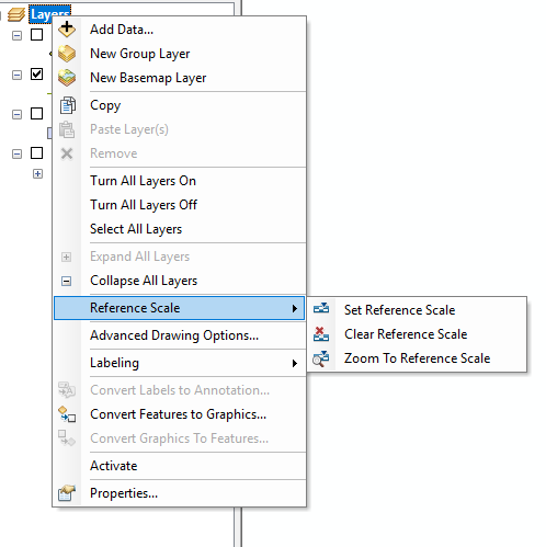
Is there a reference scale set on the data frame?
