- Home
- :
- All Communities
- :
- Products
- :
- Mapping
- :
- Mapping Questions
- :
- Data Driven Page - Map Extent Issue
- Subscribe to RSS Feed
- Mark Topic as New
- Mark Topic as Read
- Float this Topic for Current User
- Bookmark
- Subscribe
- Mute
- Printer Friendly Page
Data Driven Page - Map Extent Issue
- Mark as New
- Bookmark
- Subscribe
- Mute
- Subscribe to RSS Feed
- Permalink
hi all,
I am wondering why the map extent is acting strange for my current Data Driven Page setup.
If you look at the below screenshot, I have set the Best fit to be 4cm, so I would like 4cm of clearance around my land parcel before the edge of the map. It looks fine.
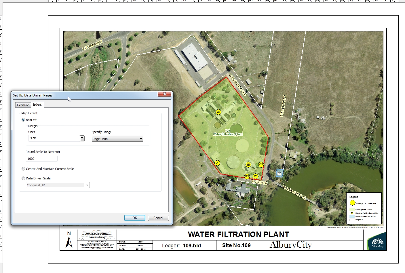 scale automatically zooms to 1:2000
I would like to lessen this margine as I would like to see more detail of my parcel of land, so I change the margin to be 3cm or even 2cm, but then the map scale rounds DOWN to be 1:1000, which actually chops part of my parcel off. Is this normal? I would have thought that ArcMap would have realised this and changed it so as it had to round up to the next available scale which is 1:2000.
Is this a bug? Or should the map be clipping part of my parcel in focus out of the map?
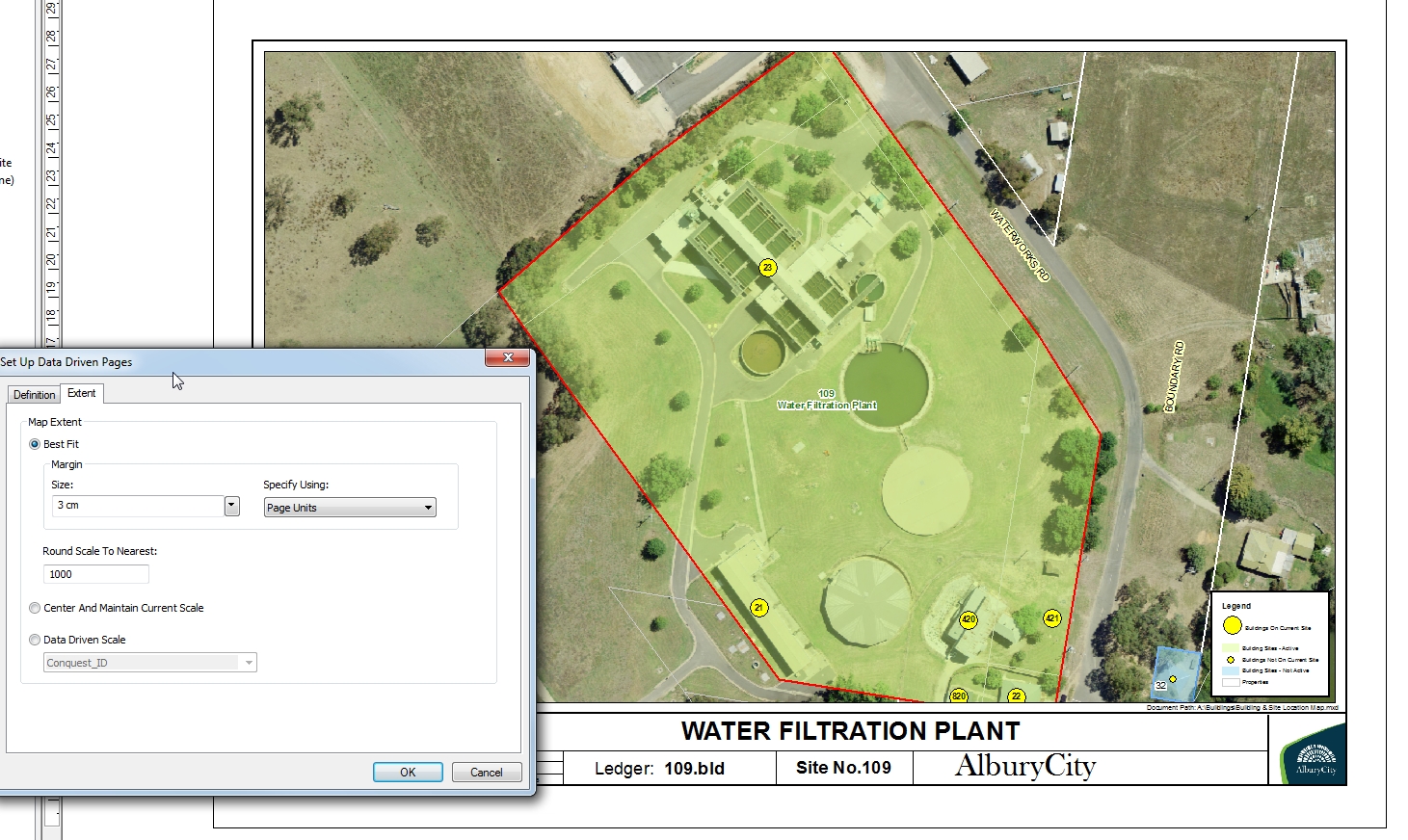 scale is automatically changed to 1:1000
Thanks
- Mark as New
- Bookmark
- Subscribe
- Mute
- Subscribe to RSS Feed
- Permalink
In the Data Driven Pages Set up dialog, on the Extent tab, what is "Round Scale To Nearest" set to?
- Mark as New
- Bookmark
- Subscribe
- Mute
- Subscribe to RSS Feed
- Permalink
Hi David, as per the screenshots i have it set to round to nearest 1000 scale, but I am perplexed as to why it would round down and cut parts of the data driven polygon out of the data frame...
cheers
- Mark as New
- Bookmark
- Subscribe
- Mute
- Subscribe to RSS Feed
- Permalink
It's rounding to "nearest" value, which means it can round up or down. Maybe there should be an option to only round up, or maybe it should do that by default. You might consider submitting an idea to the ideas website at http://ideas.arcgis.com/
- Mark as New
- Bookmark
- Subscribe
- Mute
- Subscribe to RSS Feed
- Permalink
ah excellent, you have stated the obvious which I had made an incorrect assumption.
I interpreted that to be round up only, I didn't think ArcMap would round down and cut the map off, thanks for your assistance.