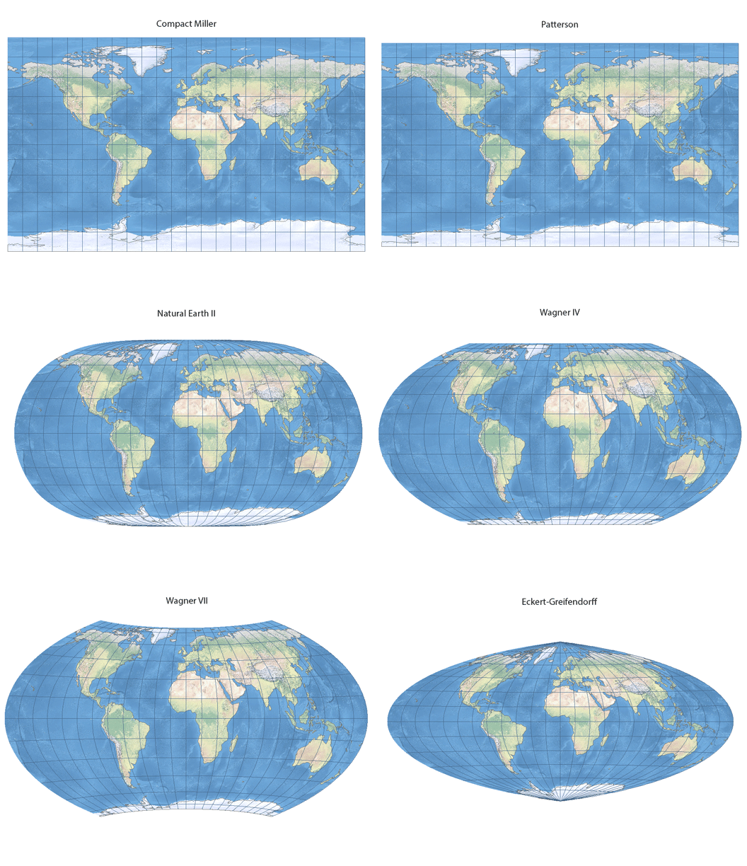
ArcGIS 10.4 now supports eight small-scale map projections displayed in an animated gif:
Compact Miller
Patterson
Natural Earth
Natural Earth II
Wagner IV
Wagner V
Wagner VII
Eckert-Greifendorff
The Eckert-Greifendorff, Wagner IV and Wagner VII are equal-area projections; the remaining five are compromise projections that try to minimize overall distortion. Sample definitions for the first seven projections are available in the Projected Coordinate Systems\World and Projected Coordinate Systems\World(Sphere-based) folders.
The Eckert-Greifendorff, Wagner IV and Wagner VII also support ellipsoidal equations. Gnomonic, quartic authalic and Hammer projections are now available in ellipsoidal forms too.
With Eckert-Greifendorff, Hammer ellipsoidal, quartic authalic ellipsoidal, Wagner IV, and Wagner VII, one can select a custom central latitude and create oblique aspects of the projections.
ArcGIS 10.4 includes three variants of polar stereographic projection (variant A, B and C – EPSG codes 9810, 9829 and 9830 respectively) and two new variants of Mercator projection (variant A and C – EPSG codes 9804 and 1044 respectively). Mercator variant B (EPSG code 9805) was already included before as Mercator projection.
Mercator variants A and B have origin of northings / Y values at the equator. Variant A uses a scale factor at the equator to reduce overall scale distortion and effectively defines two standard parallels that are symmetric around the equator. Variant B takes a standard parallel and effectively forces the scale factor at the equator to be less than one. Variant C is similar to variant B, but with the addition of a latitude of origin. The origin of northings / Y values occurs at the latitude of origin.
The polar stereographic variant A is centered at a pole. The longitude of origin defines which longitude will be going straight “down” from the North Pole or “up” from the “South Pole” towards the middle of the map. A scale factor reduces the overall scale distortion and effectively defines a standard parallel. The variant B is similar to variant A, only that it takes a standard parallel to reduce the overall scale distortion of the projection and results in a scale factor at the pole of less than one. Variant C is similar to variant B, but with the addition of a latitude of origin. The origin of northings / Y values occurs at the intersection of the latitude of origin and the longitude of origin.

