- Home
- :
- All Communities
- :
- Products
- :
- Mapping
- :
- Map Projections Questions
- :
- Display X,Y data comes in a line
- Subscribe to RSS Feed
- Mark Topic as New
- Mark Topic as Read
- Float this Topic for Current User
- Bookmark
- Subscribe
- Mute
- Printer Friendly Page
- Mark as New
- Bookmark
- Subscribe
- Mute
- Subscribe to RSS Feed
- Permalink
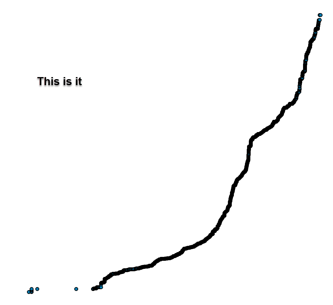
OK so I have found old posts about this from 10 years ago but nothing recent. I have a spreadsheet originally in excel, I have added new fields (longitude, latitude) as double, even saved as CSV yet data still comes in a line? I have used the excel to table tool still did not help. I have added to a blank arcmap without projection and to an arcmap with projection. When I display X,Y I have tried WGS 84 and many others.I have tried numerous coordinate and projections, yet still wrong. Any Ideas.

Solved! Go to Solution.
Accepted Solutions
- Mark as New
- Bookmark
- Subscribe
- Mute
- Subscribe to RSS Feed
- Permalink
You might as well close this out and report back when you get it resolved
- Mark as New
- Bookmark
- Subscribe
- Mute
- Subscribe to RSS Feed
- Permalink
Longitude is X, Latitude is Y. You have a whole load of duplicates
Define it as a Geographic Coordinate system WGS84
Save it to a geodatabase featureclass.
You will have to figure out what to do with the duplicates... they seem to be the centroids of some geocoding or something
- Mark as New
- Bookmark
- Subscribe
- Mute
- Subscribe to RSS Feed
- Permalink
Yes, duplicates needed, still comes in a line?
- Mark as New
- Bookmark
- Subscribe
- Mute
- Subscribe to RSS Feed
- Permalink
The data are what they are... they are points all squished together. If the pattern isn't what you expected, then the problem is with how it was acquired or processed. Sorry but....

- Mark as New
- Bookmark
- Subscribe
- Mute
- Subscribe to RSS Feed
- Permalink
if I geocode it I get the random distribution, yes it has to be something with the lat/lon originally
- Mark as New
- Bookmark
- Subscribe
- Mute
- Subscribe to RSS Feed
- Permalink
You might as well close this out and report back when you get it resolved