- Home
- :
- All Communities
- :
- User Groups
- :
- Local Government Solutions Users
- :
- Questions
- :
- clipping raster data
- Subscribe to RSS Feed
- Mark Topic as New
- Mark Topic as Read
- Float this Topic for Current User
- Bookmark
- Subscribe
- Mute
- Printer Friendly Page
clipping raster data
- Mark as New
- Bookmark
- Subscribe
- Mute
- Subscribe to RSS Feed
- Permalink
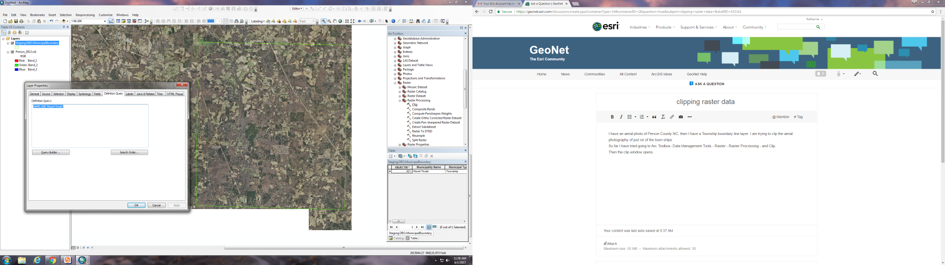
I have an aerial photo of Person County NC, then I have a Township boundary line layer. I am trying to clip the aerial photography of just on of the town ships.
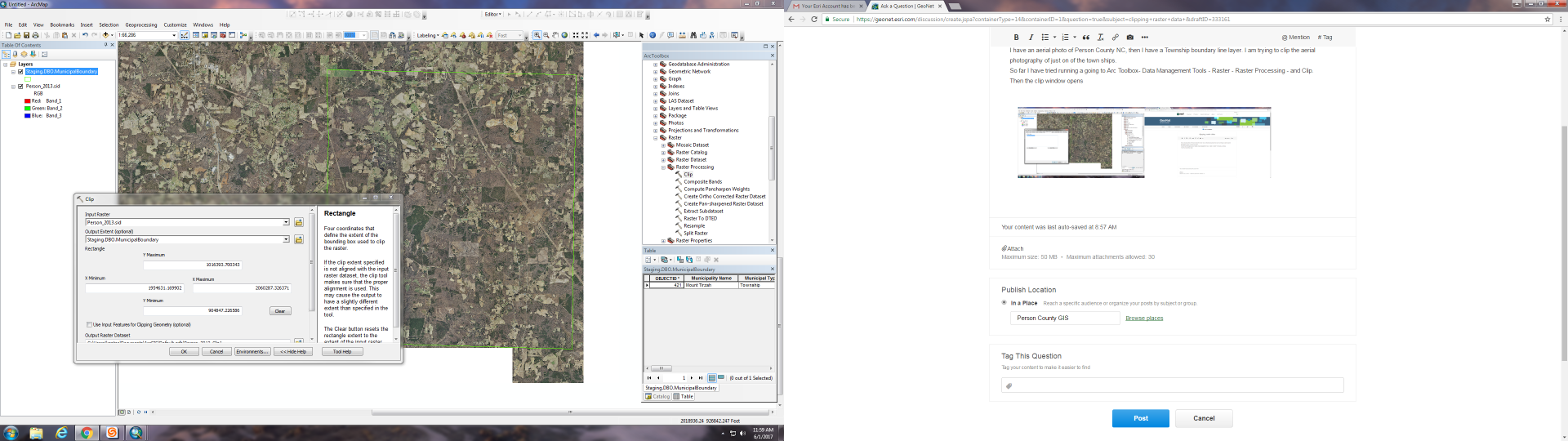
So far I have tried running a definition query to only show desired township then I went to Arc Toolbox- Data Management Tools - Raster - Raster Processing - and Clip.
Then the clip window opens I select the raster aerial photo as the Input Raster and The township boundary as the Output Extent.
When I run the Clip nothing seems to happen.
Please help.
Thanks,
Katherine Gates
Person County GIS Intern
- Mark as New
- Bookmark
- Subscribe
- Mute
- Subscribe to RSS Feed
- Permalink
Check the box "Use Input Features for Clipping Geometry" in Clip tool.
Think Location
- Mark as New
- Bookmark
- Subscribe
- Mute
- Subscribe to RSS Feed
- Permalink
I tried that once before and it did not work but this time it has been
clipping for almost 30 mins.
- Mark as New
- Bookmark
- Subscribe
- Mute
- Subscribe to RSS Feed
- Permalink
That's not unexpected - it can take quite a while to clip an aerial if it is a large size. Though if it takes more than several hours, then one may have to decide whether the program crashed or not....
Chris Donohue, GISP
- Mark as New
- Bookmark
- Subscribe
- Mute
- Subscribe to RSS Feed
- Permalink
Okay, the system has never taken this long so hopefully that is good news.
Thank you,
Katherine Gates.
- Mark as New
- Bookmark
- Subscribe
- Mute
- Subscribe to RSS Feed
- Permalink
Also keep Background Processing (Geoprocessing Options) Disabled. Sometimes, it may cause delays/failures.
Think Location
- Mark as New
- Bookmark
- Subscribe
- Mute
- Subscribe to RSS Feed
- Permalink
Hi Katherine,
What is the uncompressed size of the SID you are attempting to clip? You can check by right-clicking on the raster > Properties > Source tab. Another option is to create a mosaic dataset from the SID image and apply a Clip function. This takes less than a second to perform a clip compared to the Clip geoprocessing tool.