Turn on suggestions
Auto-suggest helps you quickly narrow down your search results by suggesting possible matches as you type.
Cancel
- Home
- :
- All Communities
- :
- User Groups
- :
- Land Use / Land Cover / Forest Cover Mapping
- :
- Questions
- :
- Automate dataframe fitting to grid
Options
- Subscribe to RSS Feed
- Mark Topic as New
- Mark Topic as Read
- Float this Topic for Current User
- Bookmark
- Subscribe
- Mute
- Printer Friendly Page
Automate dataframe fitting to grid
Subscribe
743
0
10-02-2017 10:48 AM
Labels (8)
Labels
10-02-2017
10:48 AM
- Mark as New
- Bookmark
- Subscribe
- Mute
- Subscribe to RSS Feed
- Permalink
I am using Arcgis 10.2.2 and preparing some data for printing and im stacked with something. I want to autorotate the dataframe on the grid (which grid after grid it gets rotated by some degree) cause i am using data driven for printing content inside a grid.
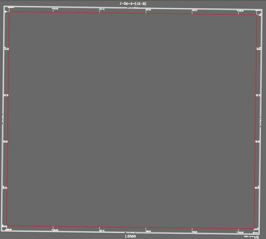
The red rectangle is the limit of the grid where the data should be visible, only inside red rectangle data should be visible, and i want that the red rectangle rotates automatically with the grid and with them also the white part, which where they are some dynamic text that shows the coordinate.
0 Replies