GeoMentors Case Study: Lisa H.
- Subscribe to RSS Feed
- Mark as New
- Mark as Read
- Bookmark
- Subscribe
- Printer Friendly Page
To both document program activity and learn from the efforts of our volunteers, we invite our GeoMentors to submit their experiences as program case studies through this online form.
City/State of School, School District, or Group: Conway, South Carolina
Grade level of students you or your educator collaborator work/worked with: Coaching educators of 6th-12th grade students
Subject/topic of class/group you assisted your collaborator with: Subjects which can be taught through a GIS curriculum (including history, geometry, health, social studies, science, and marine science)
Approximately how many students were engaged in GIS activities through this collaboration: 18 educators in attendance.
How did you connect with your collaborator?
Approximately one year ago, a representative of Workforce Development within the SC Department of Commerce, reached out to me about becoming a speaker at the annual Career Day event at a middle school. This began a series of conversations about how GIS can be taught in schools and the benefit it would provide to students and teachers. The Work-Based Learning Specialist with the school district was contacted, and thus began the partnership between the City of Myrtle Beach GIS and Horry County Schools.
Describe your collaboration process.
We held several telephone conversations and met a couple of times over the course of a 4-month period. I was able to speak with the school district superintendent and with the technology teachers within the school district. We decided that it would be best to conduct a special GIS workshop for educators based on the encouraging responses received.
Describe the tasks you assisted your collaborator with.
An “Educators in GIS” workshop was held on October 22, 2015, focusing on the ArcGIS Online platform. The workshop was conducted at Horry-Georgetown Technical College and was very well-received. There were a total of 18 attendees, including not only instructors, but also school district staff, the Information Technology Director for Horry-Georgetown Technical College, a representative from a private GIS firm, the Workforce Development representative, and members of Florence County, SC GIS. There are plans in the works to offer more workshops in the future in Georgetown County and in the Columbia, SC area. The objectives of the workshop were to explore the meaning of GIS; to view real world GIS applications; to comprehend how GIS is used in education and other industries; and to examine the options for implementing GIS in the classroom.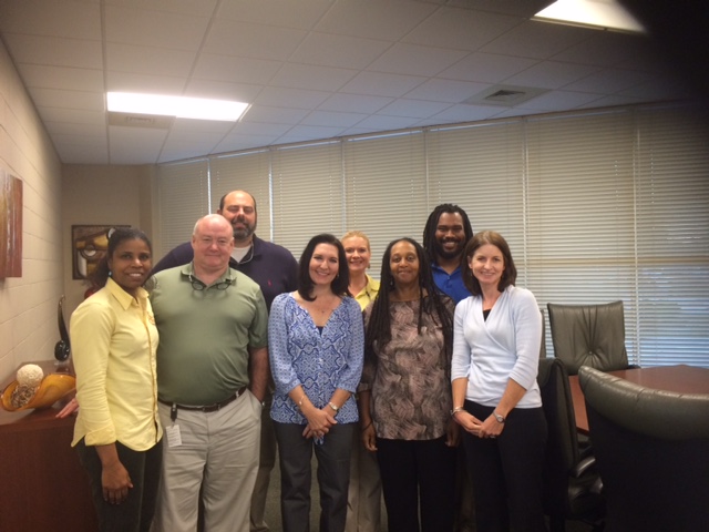
What available resources, if any, did you use or help your collaborator use to implement GIS in K-12 education?
Spatial thinking was certainly one of the main topics of discussion, which the attendees seemed to understand and accept as a new way of engaging students. The participants agreed that today's students are far more educated by the time they reach middle school than we were as students! GIS provides a different, fun, and innovative way to explore and learn various subjects. The workshop contained numerous websites which showed how GIS is used in everyday applications, such as weather (local TV station), real estate (www.zillow.com), E-911 (discussion of how GIS data is uploaded to the E-911 CAD system), and Google and Bing maps.
The attendees were also provided with the following sites to investigate:
http://www.arcgis.com/apps/MapSeries/?appid=c369c6d9bb6d4232bb3ad066cd5b9280
https://www.whitehouse.gov/issues/technology/techhire
http://storymaps.esri.com/stories/2015/presidential-colleges/
City of Myrtle Beach Aerial Imagery: https://pol.pictometry.com/en-us/app/login.php
Did you develop any new educational material or GIS activities through your collaboration?
Workshop participants brought their laptops and mobile devices for a hands on tutorial on how to make a map in ArcGIS Online. They were also taught how to make story maps. Later discussion following the workshop led to the probability of introducing Story Map Making as an event at the Technology Student Association (TSA) national competition.
What did you gain from the experience? What do you think your educator collaborator and/or the students gained?
The experience was definitely a win-win. I learned more about the inner workings of the schools and how they are thirsting to be innovative. Horry County Schools has come a long way over the years to become one of the top school districts in the state of SC. Just this year, three (3) Horry County Schools were designated National Blue Ribbon Schools. The attendees were thrilled to explore a new way of teaching, and were a little surprised at the ease of using ArcGIS Online. They were grateful for the free school accounts available, and look forward to creating GIS-based lesson plans.
Any additional comments about your experience?
Educators are certainly embracing the technology as evidenced in the many e-mails and phone calls I have received in regards to speaking about GIS at more schools, which I am more than happy to oblige! In addition to various speaking engagements at the middle and high school levels, I will be spending GIS Day 2015 with the marine science students at Carolina Forest High School. The Academy for the Arts, Science, and Technology (AAST) will be piloting the first GIS curriculum in Horry County Schools by spring 2016 or fall 2016. I will be acting as a GeoMentor for this endeavor and will be glad to provide an update when the time comes. The next goal will be to work with the local technical schools to implement a GIS curriculum as either a certificate program or as an Associate’s Degree. This will provide a bridge for high school students to further their education. A preliminary meeting was held on November 13, 2015 with an Information Technology staff member from Horry-Georgetown Technical College to discuss how a GIS curriculum may be introduced, possibly by Fall 2016. I am encouraged by the enthusiastic response of the college, thus far. I look forward to many more GeoMentoring opportunities!
Do you have a GeoMentoring experience you would like to share as a program case study?
Submit yours today through this online form.
You must be a registered user to add a comment. If you've already registered, sign in. Otherwise, register and sign in.