- Home
- :
- All Communities
- :
- Products
- :
- Data Pipelines
- :
- Data Pipelines Ideas
- :
- map point locations from addresses or coordinates ...
- Subscribe to RSS Feed
- Mark as New
- Mark as Read
- Bookmark
- Follow this Idea
- Printer Friendly Page
map point locations from addresses or coordinates in output feature layer
- Mark as New
- Bookmark
- Subscribe
- Mute
- Subscribe to RSS Feed
- Permalink
It'd be great if under Outputs > Feature Layer, it would map locations from coordinates and/or addresses from a connected table brought in and cleaned up/filtered from another source -- in this case, a CSV published from a Google sheet. That would really streamline our ability to work with non-GIS users to update locations in community resource maps by adding them to a Google sheet.
Hi @necurri_VC_SSO ,
Thank you for reaching out and sharing your feedback with us!
We will consider this enhancement for streamlining workflows.
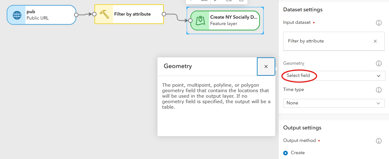
Data Pipelines currently does not support geocoding (enabling location from addresses). However, in the meantime you can use the tool Create geometry to enable geometry using coordinates.
Here is the doc for the Create geometry tool: https://doc.arcgis.com/en/data-pipelines/latest/process/create-geometry.htm
And here is an example of how the tool looks when populated using Long/Lat coordinates from field values:

Please let me know if you have any questions.
Thanks again for sharing your feedback with us.
Bethany
Thanks. We ended up using the capability to create and update a feature layer from a Google Sheet for this particular application.
You must be a registered user to add a comment. If you've already registered, sign in. Otherwise, register and sign in.