Turn on suggestions
Auto-suggest helps you quickly narrow down your search results by suggesting possible matches as you type.
Cancel
- Home
- :
- All Communities
- :
- Products
- :
- Data Management
- :
- Data Management Questions
- :
- Using a CAD file in ArcMap, missing attribute data
Options
- Subscribe to RSS Feed
- Mark Topic as New
- Mark Topic as Read
- Float this Topic for Current User
- Bookmark
- Subscribe
- Mute
- Printer Friendly Page
Using a CAD file in ArcMap, missing attribute data
Subscribe
6677
10
11-16-2010 08:25 AM
11-16-2010
08:25 AM
- Mark as New
- Bookmark
- Subscribe
- Mute
- Subscribe to RSS Feed
- Permalink
I'm trying to convert a CAD file to an ESRI shapefile. It is a file of water meter locations with attributes (condition, manufacture, etc). The points come through correctly, but none of the attributes are there. The field columns show up in the attribute table but they are empty. This is also the case when I just open the CAD file in ArcMap without any conversions. So ArcMap knows the fields are there, but can't seem to read the content. This is with AutoCAD Map 2011 and ArcMap 10. Any suggestions? Thanks.
10 Replies
11-16-2010
12:25 PM
- Mark as New
- Bookmark
- Subscribe
- Mute
- Subscribe to RSS Feed
- Permalink
I'm trying to convert a CAD file to an ESRI shapefile. It is a file of water meter locations with attributes (condition, manufacture, etc). The points come through correctly, but none of the attributes are there. The field columns show up in the attribute table but they are empty. This is also the case when I just open the CAD file in ArcMap without any conversions. So ArcMap knows the fields are there, but can't seem to read the content. This is with AutoCAD Map 2011 and ArcMap 10. Any suggestions? Thanks.
Hi Trish,
Can you please attach the data? Also, are the attributes represented as Object Data in AutoCAD Map?
11-19-2010
08:30 AM
- Mark as New
- Bookmark
- Subscribe
- Mute
- Subscribe to RSS Feed
- Permalink
It turns out that of the 1900 features that GIS imported, the first 400 or so were "empty" with none of my desired attributes; the actual points were okay. Some of the data points did funny things but those aren't too hard to fix case-by-case.
11-19-2010
09:30 AM
- Mark as New
- Bookmark
- Subscribe
- Mute
- Subscribe to RSS Feed
- Permalink
It turns out that of the 1900 features that GIS imported, the first 400 or so were "empty" with none of my desired attributes; the actual points were okay. Some of the data points did funny things but those aren't too hard to fix case-by-case.
I looked at the screenshots and the refname column was empty. If possible you can send the data to me
03-08-2011
04:43 PM
- Mark as New
- Bookmark
- Subscribe
- Mute
- Subscribe to RSS Feed
- Permalink
Hi,
I'm currently experiencing the same isssue.
Am trying to view AutoCAD 2011 dwg file in ArcGIS 10 and while the attribute column headings are being read, there are no features populating the table.
When attempting to preview "Geography", nothing is visible.
I've also tried converting the CAD features to gdb using the "CAD to geodatabase". This also produces empty output.
Is AutoCAD 2011 even supported in 10? Have found comflicting information:
Desktop help only lists support for AutoCAD 2010
http://help.arcgis.com/en/arcgisdesktop/10.0/help/index.html#/Supported_CAD_formats_in_ArcGIS/001000...
While conference preceding presentation from 2010 UC says:
ArcGIS CAD Data Support:
Current Version Support:
- AutoCAD DWG/DXF: Up to 2011
http://proceedings.esri.com/dvd/uc/2010/uc-index/uc/workshops/tw_708.pdf
... does "Up to" mean only 2010 and not 2011?
Any help would be greatly appreciated!
Cheers,
Trish
03-09-2011
07:13 AM
- Mark as New
- Bookmark
- Subscribe
- Mute
- Subscribe to RSS Feed
- Permalink
Hi,
I'm currently experiencing the same isssue.
Am trying to view AutoCAD 2011 dwg file in ArcGIS 10 and while the attribute column headings are being read, there are no features populating the table.
When attempting to preview "Geography", nothing is visible.
I've also tried converting the CAD features to gdb using the "CAD to geodatabase". This also produces empty output.
Is AutoCAD 2011 even supported in 10? Have found comflicting information:
Desktop help only lists support for AutoCAD 2010
http://help.arcgis.com/en/arcgisdesktop/10.0/help/index.html#/Supported_CAD_formats_in_ArcGIS/001000...
While conference preceding presentation from 2010 UC says:
ArcGIS CAD Data Support:
Current Version Support:
- AutoCAD DWG/DXF: Up to 2011
http://proceedings.esri.com/dvd/uc/2010/uc-index/uc/workshops/tw_708.pdf
... does "Up to" mean only 2010 and not 2011?
Any help would be greatly appreciated!
Cheers,
Trish
Hi Trish,
AutoCAD 2011 is supported. If possible, can you attach the data?
03-23-2011
07:12 AM
- Mark as New
- Bookmark
- Subscribe
- Mute
- Subscribe to RSS Feed
- Permalink
Hi Trish,
AutoCAD 2011 is supported. If possible, can you attach the data?
Hi,
I am trying to import 2011 DWG files into ArcEditor 10.
I have tried...
1. CAD to Geodtabase conversion - it runs through the tool and says that it was successful but when I go to the geodatabase where it should be saved nothing is there (yes I hit refresh).
2. From the Geodatabase right clicking and importing Feature Class (multiple) - it runs this successfully and gives me 5 feature classes.
- Annotation, MultiPatch, Point, Polygon, Polyline
The annotation feature class is coming in as points (I cant figure out what these would even go to really or why it's doing this) it appears that it's creating these points on it's own. This also goes for the point feature class; there weren't any points in the original dwg file. Multipatch is just a white background around the file. Polygon is the fill to the cad file (I wont be using the multipatch or polygon feature classes).
My main issue is that none of the annotation is coming through. I tried doing the Import CAD Annotation tool and it said that it failed due to permissions.
Any ideas?
Thanks,
Jessica
03-23-2011
07:25 AM
- Mark as New
- Bookmark
- Subscribe
- Mute
- Subscribe to RSS Feed
- Permalink
This is a follow up to my previous post...
I was able to bring the annotation in through the Import CAD Annotation tool; however it is only visible at an EXTREMELY small scale (even the ocean in my basemap disappears).
Any idea why this would be?
In addition some of the code is being imported that goes with the text (FNT, BOL). Would this be a setting that needs to be changed when the CAD file is saved?
Thank you again.
Jessica
06-16-2011
11:34 PM
- Mark as New
- Bookmark
- Subscribe
- Mute
- Subscribe to RSS Feed
- Permalink
Hi
I am even trying to get object data from Auto Cad to ArcGIS platform, but unable to do.Tho i am trying to do it programmatically.
Can anyone give me a sample code or maybe .dll so that i can get object data and then work with ArcFM
Thanks in advance
Mehul Nahar
I am even trying to get object data from Auto Cad to ArcGIS platform, but unable to do.Tho i am trying to do it programmatically.
Can anyone give me a sample code or maybe .dll so that i can get object data and then work with ArcFM
Thanks in advance
Mehul Nahar
01-26-2012
09:43 AM
- Mark as New
- Bookmark
- Subscribe
- Mute
- Subscribe to RSS Feed
- Permalink
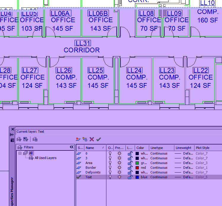
[ATTACH=CONFIG]11459[/ATTACH]
My CAD file is importing just fine using Feature Class to Feature Class, but the Annotation just will not come into ArcMap. I've used every tool and method i can think of to import the CAD annotation. Feature Class to Polygon lets me specify to include labels...that doesn't work. Import CAD Annotation tool doesn't work.
Is there some way to test the CAD data to see if the Text layer is different that expected?
Thanks,
David