- Home
- :
- All Communities
- :
- Products
- :
- Data Management
- :
- Data Management Questions
- :
- Re: Display nDSM Layer with Height Attribute Infor...
- Subscribe to RSS Feed
- Mark Topic as New
- Mark Topic as Read
- Float this Topic for Current User
- Bookmark
- Subscribe
- Mute
- Printer Friendly Page
Display nDSM Layer with Height Attribute Information
- Mark as New
- Bookmark
- Subscribe
- Mute
- Subscribe to RSS Feed
- Permalink
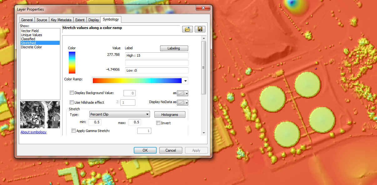
I have created an nDSM layer and I want to use the height of features to display in the Table of Contents. In the Symbology tab I choose the Stretched property and it shows the Value range as between 277.788 and -5. I'm a bit confused as to what this information represents; I think it's the Pixel value. When I use the identify tool I see that there are Height values indicated for each pixel but I don't know how to get that to show up. I'm seeing the same thing occur with the DEM. The datasets were created from an LAS data work flow so perhaps I missed a step or a setting in the workflow?
If anyone has any thoughts I'd appreciate it greatly.
~Natasha
- Mark as New
- Bookmark
- Subscribe
- Mute
- Subscribe to RSS Feed
- Permalink
I did apply the min-max stretch setting and that allows for editing the low - high values but I still don't see how that shows elevation information.
Is the Stretched value the elevation data when revealed in the Identify Window?
Thankyou