- Home
- :
- All Communities
- :
- Products
- :
- Data Management
- :
- Data Management Questions
- :
- Aligning GRTS cells
- Subscribe to RSS Feed
- Mark Topic as New
- Mark Topic as Read
- Float this Topic for Current User
- Bookmark
- Subscribe
- Mute
- Printer Friendly Page
Aligning GRTS cells
- Mark as New
- Bookmark
- Subscribe
- Mute
- Subscribe to RSS Feed
- Permalink
So I have 2 separate GRTS (Generalized Random Tesselation Stratified) for spatial sampling that I want to align but am having trouble even after projecting them to the same coordinate system (Projected: NAD_1983_Albers / Geographic: GCS_North_American_1983).
Any suggestions?
- Mark as New
- Bookmark
- Subscribe
- Mute
- Subscribe to RSS Feed
- Permalink
What were the geographic coordinate bounds for both files, prior to the projection? and what were the projection parameters you used for both
- Mark as New
- Bookmark
- Subscribe
- Mute
- Subscribe to RSS Feed
- Permalink
Both are the custom projection below
NAD_1983_Albers
Authority: Custom
Projection: Albers
False_Easting: 0.0
False_Northing: 0.0
Central_Meridian: -100.0
Standard_Parallel_1: 55.0
Standard_Parallel_2: 65.0
Latitude_Of_Origin: 50.0
Linear Unit: Meter (1.0)
Geographic Coordinate System: GCS_North_American_1983
Angular Unit: Degree (0.0174532925199433)
Prime Meridian: Greenwich (0.0)
Datum: D_North_American_1983
Spheroid: GRS_1980
Semimajor Axis: 6378137.0
Semiminor Axis: 6356752.314140356
Inverse Flattening: 298.257222101
NAD_1983_Albers
Authority: Custom
Projection: Albers
False_Easting: 0.0
False_Northing: 0.0
Central_Meridian: -96.0
Standard_Parallel_1: 29.5
Standard_Parallel_2: 45.5
Latitude_Of_Origin: 23.0
Linear Unit: Meter (1.0)
Geographic Coordinate System: GCS_North_American_1983
Angular Unit: Degree (0.0174532925199433)
Prime Meridian: Greenwich (0.0)
Datum: D_North_American_1983
Spheroid: GRS_1980
Semimajor Axis: 6378137.0
Semiminor Axis: 6356752.314140356
Inverse Flattening: 298.257222101

- Mark as New
- Bookmark
- Subscribe
- Mute
- Subscribe to RSS Feed
- Permalink
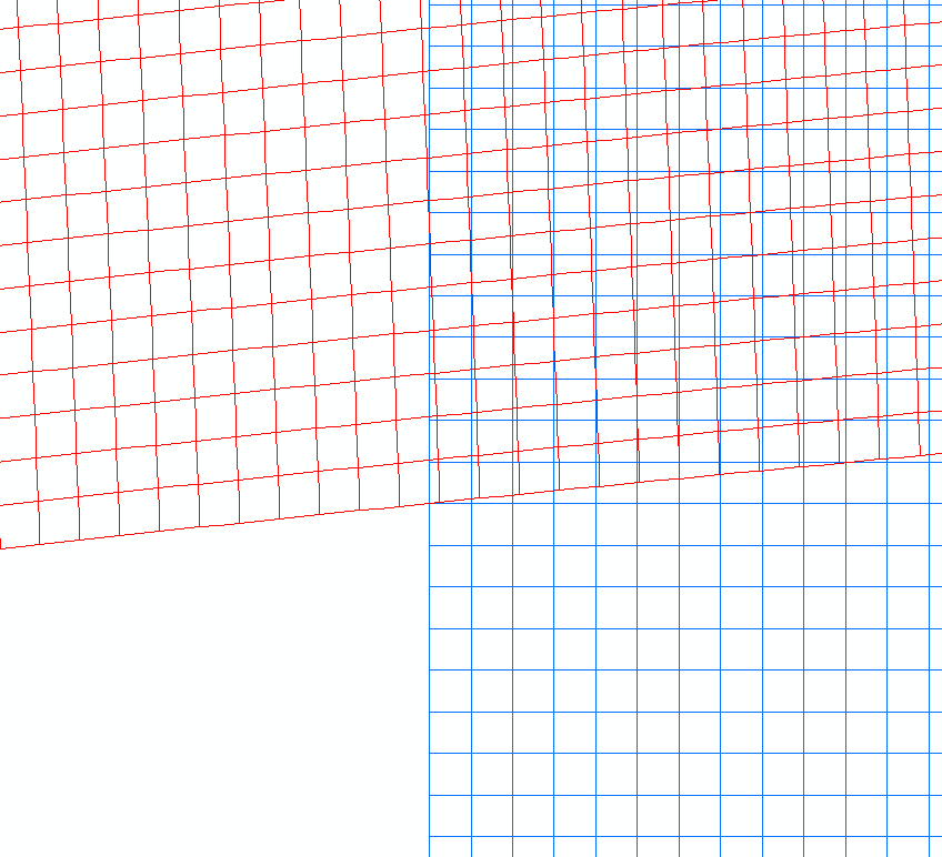
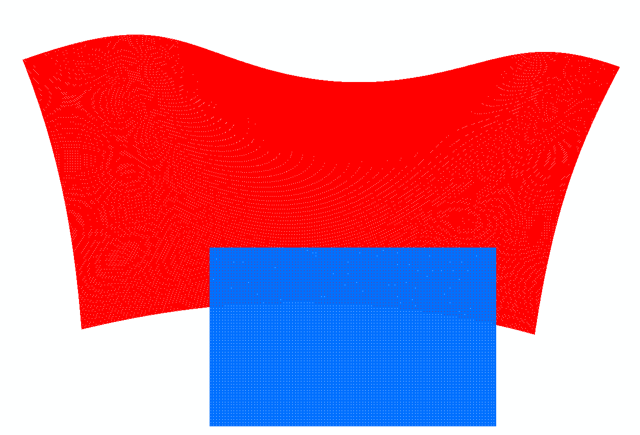
Wow...you central meridians are different and so are your standard parallels, no wonder they look funky. They are definitely not the same ... except for the first 2 lines ... NAD_1983_Albers, Authority: Custom
They are both Custom but that is about it.
- Mark as New
- Bookmark
- Subscribe
- Mute
- Subscribe to RSS Feed
- Permalink
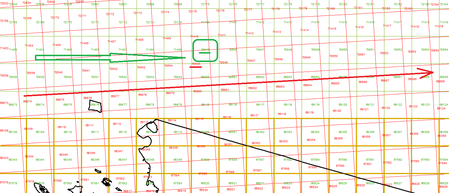
I didn't know if I could correct the Canadian one, I end up redrawing the fishnet, the problem was that I wanted to extract the data from the original one into the new grid draw but since the polygons won't be aligned I wouldn't get matching results. I run into the problem below where the IDs get out of order.
Red is original (skewed)
Green is new grid draw trying Spatial Join to match polygons.