- Home
- :
- All Communities
- :
- User Groups
- :
- Coordinate Reference Systems
- :
- Questions
- :
- Re: Information on the Coordinate Systems desktop ...
- Subscribe to RSS Feed
- Mark Topic as New
- Mark Topic as Read
- Float this Topic for Current User
- Bookmark
- Subscribe
- Mute
- Printer Friendly Page
Information on the Coordinate Systems desktop install?
- Mark as New
- Bookmark
- Subscribe
- Mute
- Subscribe to RSS Feed
- Permalink
Looking for more information about the optional install of coordinate systems. The What's new document for Desktop 10.5 document says this:
ArcGIS Coordinate Systems Data—Contains the data files required for the GEOCON transformation method and vertical transformation files for the United States (VERTCON and GEOID12B) and the world (EGM2008).
but I'm not seeing any discussion in the help documents for 10.5. I'm thinking some of our users may have need for this but I am having trouble finding more information. Is there an article, blog post, Esri UC session, or anything like that available that I can point my users to?
- Mark as New
- Bookmark
- Subscribe
- Mute
- Subscribe to RSS Feed
- Permalink
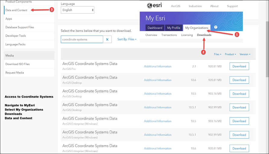
Aaron Padilla, would this graphics help? Please let me know if it does not.
- Mark as New
- Bookmark
- Subscribe
- Mute
- Subscribe to RSS Feed
- Permalink
Yes this helps. I see that I do not have the page for Downloads under the My Organizations tab. Is this something that needs to be setup by the Admin for our ESRI organization?
- Mark as New
- Bookmark
- Subscribe
- Mute
- Subscribe to RSS Feed
- Permalink
I am not sure for certain, but I would start there.
- Mark as New
- Bookmark
- Subscribe
- Mute
- Subscribe to RSS Feed
- Permalink
I see that I do not have the page for Downloads under the My Organizations tab. Is this something that needs to be setup by the Admin for our ESRI organization?
Yes! Your My Esri org admin needs to grant you access or download the data for you.
- « Previous
-
- 1
- 2
- Next »
- « Previous
-
- 1
- 2
- Next »