- Home
- :
- All Communities
- :
- User Groups
- :
- Coordinate Reference Systems
- :
- Questions
- :
- Esri Basemaps
- Subscribe to RSS Feed
- Mark Topic as New
- Mark Topic as Read
- Float this Topic for Current User
- Bookmark
- Subscribe
- Mute
- Printer Friendly Page
Esri Basemaps
- Mark as New
- Bookmark
- Subscribe
- Mute
- Subscribe to RSS Feed
- Permalink
Hello dear fellow GeoNet members,
While using ArcGIS Pro for the development of my MSc dissertation, I noticed that there quite the lag between two available basemaps, World Imagery and World Light Gray Canvas, as you can see in the iimage bellow.f
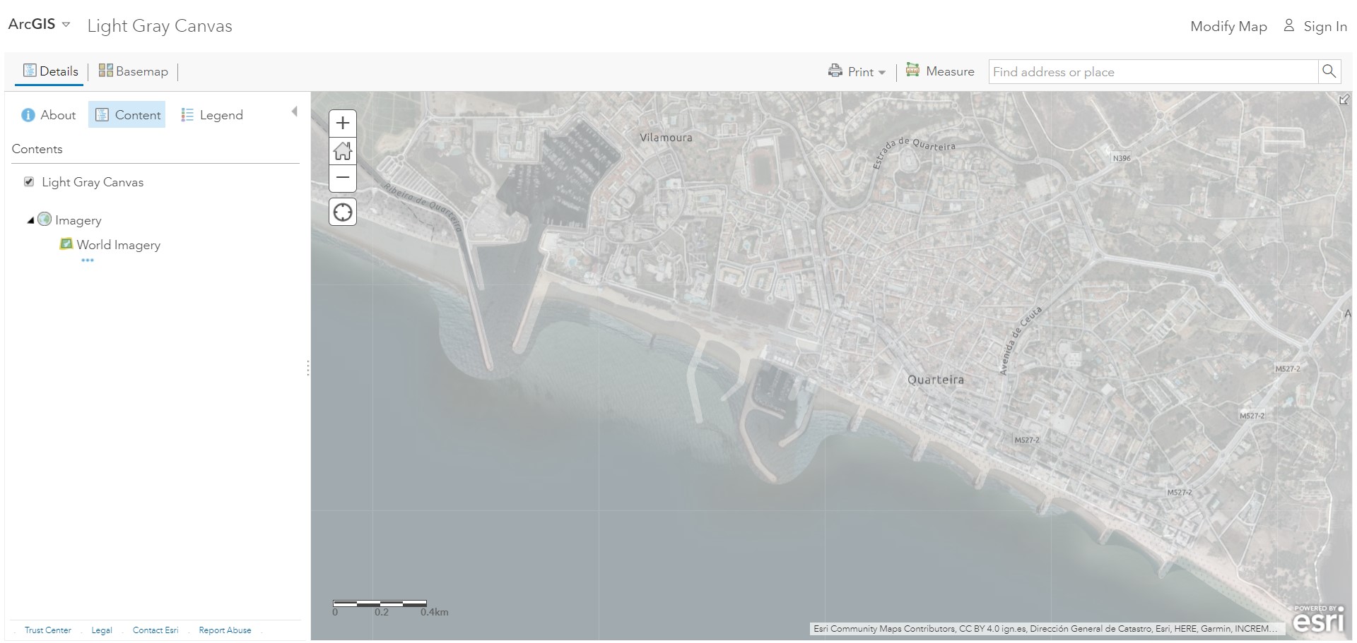
For instance I would like to know what's the reason for this.
The shp and raster files I'm using are in ETRS_1989_Portugal_TM06, and when the Imagery Basemap is selected, the two fit perfectly, but when using the Light Gray Canvas the same issue happens as reported in the image. Did check the details of both basemaps and they are up-to-date.
Does anyone have any thoughts or explanation regarding this issue?
Thank your for your attention.
- Mark as New
- Bookmark
- Subscribe
- Mute
- Subscribe to RSS Feed
- Permalink
Hello MGL RDRGS,
I think the similar issue has been discussed in the following Geonet thread, might be worth looking:
Shift between my published services and ArcGIS Online Base Maps
Additionally, check out the BUG-000085331 : BUG-000085331: A tiled map service published from ArcGIS Pro does n..
Let me know if this addresses the problem. If we might need to dig deeper
Hope it helps!
- Mark as New
- Bookmark
- Subscribe
- Mute
- Subscribe to RSS Feed
- Permalink
Hello Archit Srivastava,
Thank your for your reply!
I then changed to ArcMap, as my initial work started there, and only used Pro to see if the same issue remained, which actually did.
I did read the above-mentioned discussions, but did not find anything helpful indeed.
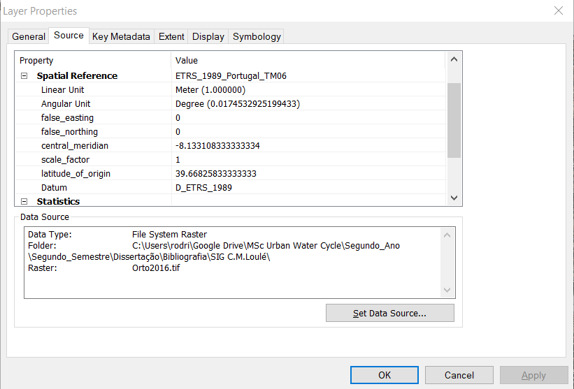
Bellow you can see some of the info of the file I am using:
And the same issue in ArcMap:
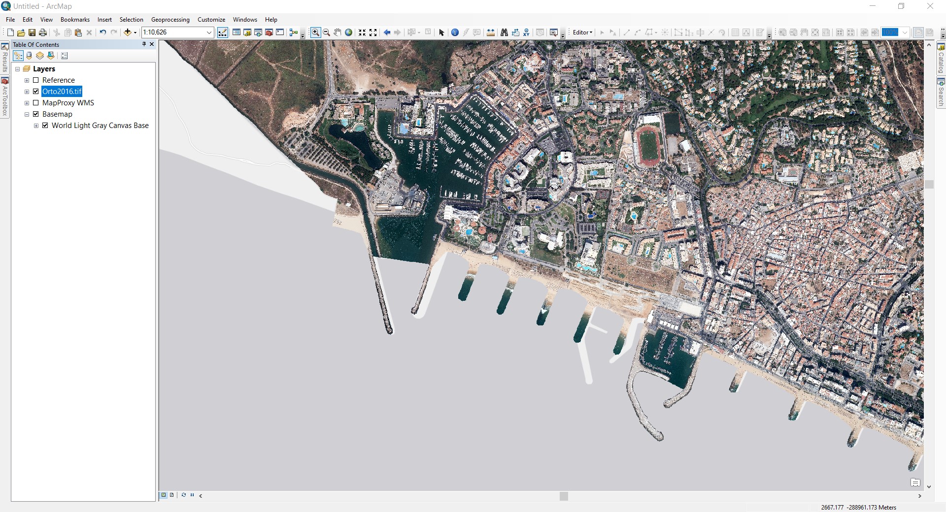
The cut to get the orto2016 was made by using the data form the WMS Server, which covers all the Portuguese country and a shp. file with all the respective municipalities.
Thank you.