JUSTICE: Community GIS, Environmental & Social Justice


I first met Dolores Huerta in the early 70's when I volunteered for the United Farmworkers Union, organizing donated food and supplies and participating in some of the lettuce boycott marches. It closed a huge circle in my life to meet her again at the 2018 Esri User Conference, when she was there with some new young colleagues interested in expanding their GIS capabilities. A recent outcome of the Dolores Huerta Foundation GIS Team is "Redistricting: Mapping for Social Justice". Esri's Sustainable Development Solutions Lead Jen Van Deusen recently covered this project and the new California "Fair Maps" act in detail over on the Esri Blog site: "Maps: The Fight for Fairer Redistricting and Voting Rights".. If you want to get involved with this great team and know a little GIS, the foundation is looking to hire a GIS Intern. If you want to read more about GIS & Social Justice, check out the new "Gis for Equity & Social Justice" geonet group.
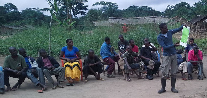
This section covers the many ways that GIS is used in social action, diversity, equity & environmental justice for local, traditional & tribal communities worldwide. It includes ways that Conservation GIS is used to engage, support and collaborate with communities in many kinds of social & conservation efforts. It also includes GIS-based presentations on “PPP” topics, short for “Public Participatory Planning”, as well as material on Citizen Science & Crowdsourcing GIS. Some material here came from the "Environmental Justice & Law" and the "First Nations & Indigenous" pages of the original conservationgis.org site (Photo: TTT Trainer Jean Claude Kalemba of the African Wildlife Foundation conducts participatory village micro-zoning projects at Djolu, DRC)