Select to view content in your preferred language

Underground mapping using drones

797
0
11-12-2018 12:00 PM
BernSzukalski
Esri Frequent Contributor
2 0 797

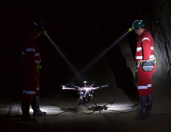
A colleague sent me this interesting article about underground mapping using drones. Check out the images in the article. https://newatlas.com/hovermap-emesent-drones-tunnels-mines/57093/#p544783 

If anyone has any data from something like this, the 3D team would love to have at it!

Tags (2)
About the Author
Esri technical evangelist and product advocate. On a good day I'm making a map. On a great day I'm on one. https://www.linkedin.com/in/bernszukalski/ bszukalski@esri.com